Rain chances will increase this week as a series of disturbances influence the ArkLaMiss closer towards the Easter weekend. This rain will be beneficial considering the severe and extreme drought conditions.
#Rain
Much cooler and very pleasant this weekend, but keep in mind the fire threat will be more elevated due to breezy northerly winds and lower dewpoints. Plenty of burns bans remain in effect. Better chances for rain and t-storms to return later next week.
#Weekend#Fire
Some places will see more clouds than sun today, but still expect it to feel pleasant with temperatures pushing into the mid 70's this afternoon. ULM will host Northwestern State this evening at 6pm. Clouds will break up tonight by the time the final out is called.
#ULM
Mostly pleasant weekend, but it will be getting hot by Sunday as temperatures rise to the upper 80's near 90 degrees. Dry weather will continue through next weekend.
#Weekend
Clouds will linger during the morning hours today, then gradually break apart by this afternoon. Temperatures will be milder in the upper 60's and lower 70's for daytime highs. We will continue to warm up through the weekend.
#warmer
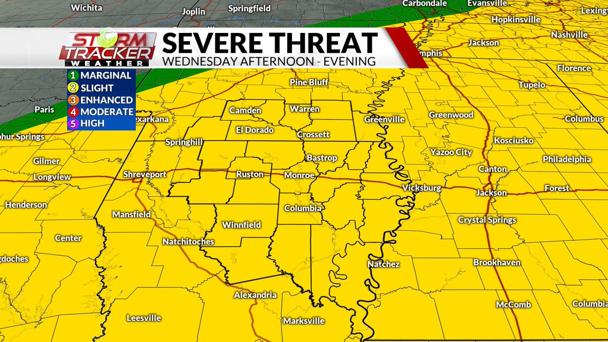
Another threat for severe weather is possible tomorrow afternoon and evening. Tonight, storms will stay mostly along and north of I-30 in Arkansas than push through Wednesday. All threats including an isolated tornado or two will be possible.
#severewx
SEVERE T-STORM WATCH has been issued for most of south Arkansas until 3pm. Severe storms are moving out of Oklahoma into southwest Arkansas this morning posing a damaging wind and hail threat. This threat will continue for the rest of the ArkLaMiss this evening.
#severewx
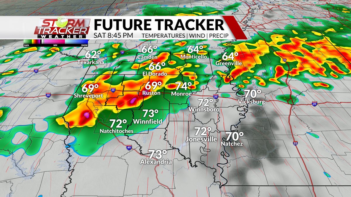
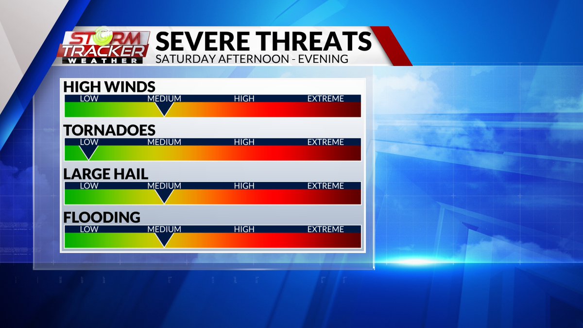
A strong line of t-storms will be moving across the ArkLaMiss later this weekend on Saturday. Severe storms will be capable of producing damaging winds, hail, and flash flooding. An isolated tornado or two cannot be ruled out.
#severewx
The threat of severe weather will remain north of the I-30 corridor for Wednesday night. A few storms could track as far east as Camden and Magnolia that could produce gusty winds. Better chances for rain & storms will be later this weekend.
#Rain
Patchy showers and storms rolled across parts of the ArkLaMiss yesterday, and now areas of fog have developed. Visibility has been reduced to less than a quarter mile between El Dorado and Camden. Conditions will improve and be pleasant today and this weekend.
#Fog
Winds will pick up today and become rather gusty this afternoon. Some gusts could get as high as 25-30 mph. Winds will calm down later tomorrow as scattered showers arrive.
#Windy
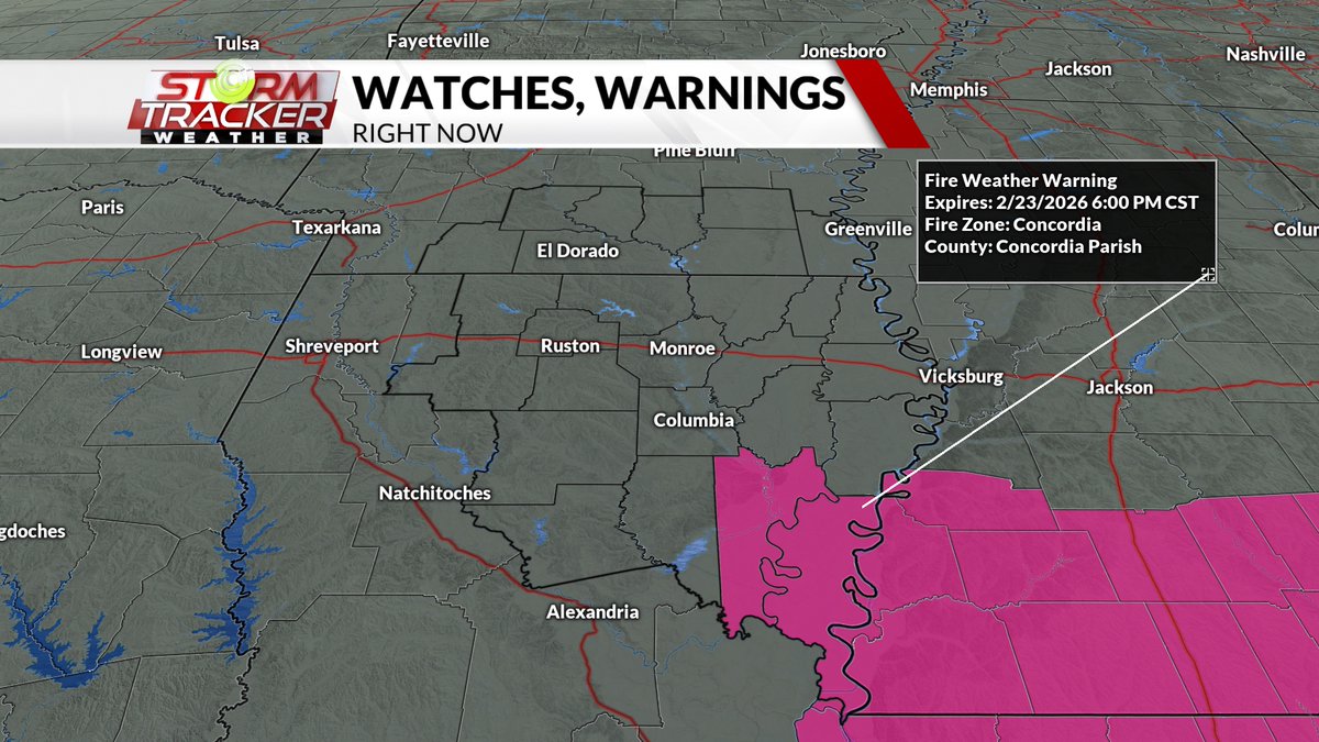
With breezy winds and severe to extreme drought ongoing, this has elevated fire dangers across the ArkLaMiss. Dewpoints have fallen to the teens, and there is a lot of dry kindling from fallen limbs from the recent ice storm.
#fire
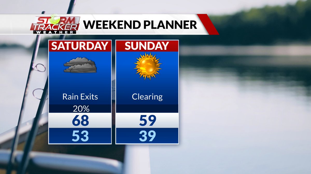
Spotty showers will linger overnight into Saturday along with lingering cloud cover. Temperatures will fall on Sunday getting below freezing Sunday and Monday night.
#weekend
Cloud cover will continue this morning and break up a bit this evening as a front passes today. Spotty shower activity will be possible across NE Louisiana along the front. Winds will also be breezy out of the S/SW.
#breezy#showers