It was ONE year ago that I walked through the doors of ABC30 starting a new role in my career not knowing what the outcome would be. Thank you ALL for welcoming this upstate New Yorker to the central valley with open arms and making Fresno my new second home away from home! ❤️🌞
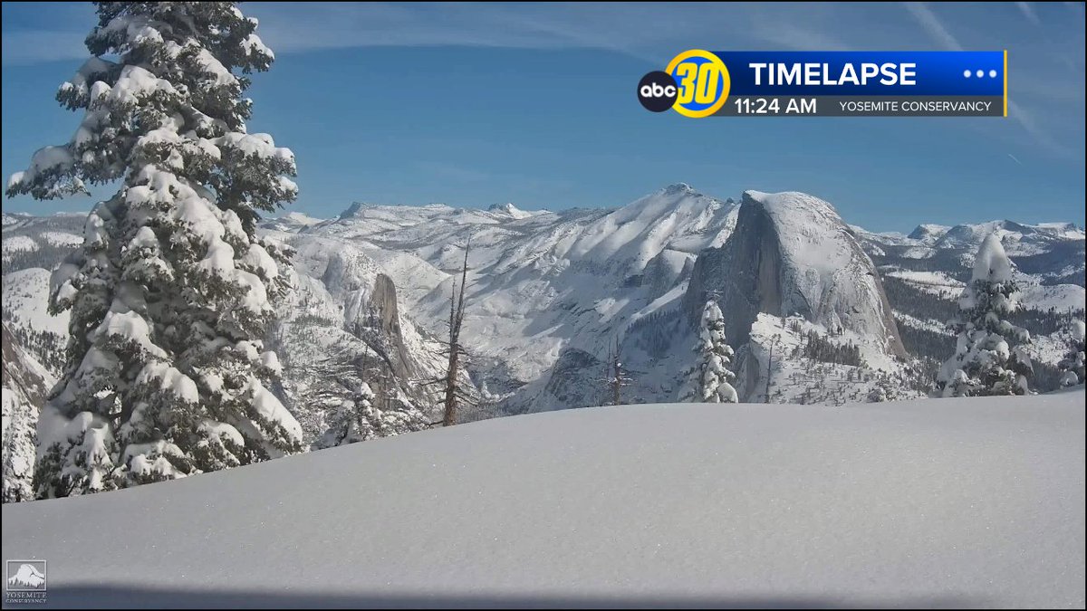
A cooler system dropping south into the western US over the next few days will bring moderate to high probabilities (60-70%) for 0.25" or more over 24 hours for the Sierra Nevada. Snow levels below 8,000 feet has potential for light snow amounts at the highest elevations. #CAwx
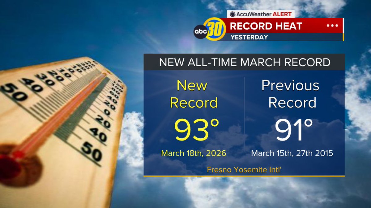
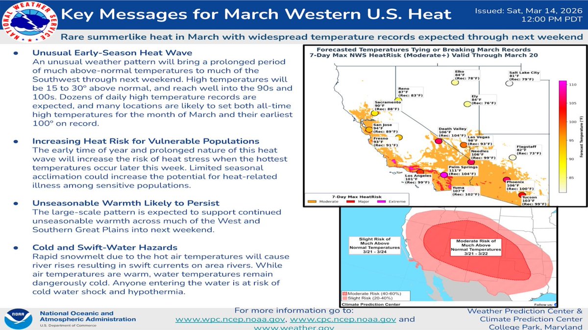
An unusual weather pattern will bring several days of much above-normal temps to CA and much of the SW US. Dozens of new daily high records are likely to occur by early to mid-week, and some locations could reach all-time highs for the month of March. #CAwx
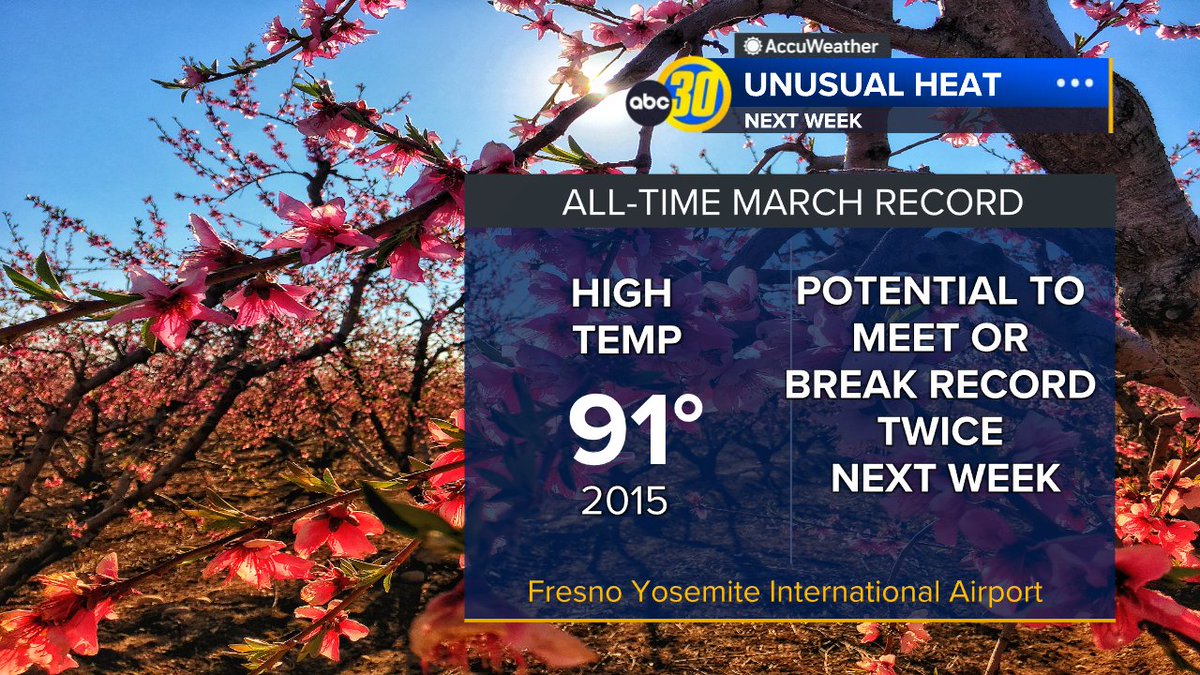
Next week will feature very unusual warmth for March in Central California. The all time record high for March in Fresno is 91 degrees we saw twice in 2015. We could meet or break that record twice next week. If your A/C isn't working, now is a good time to get that ready to go.
How's this for range? One end of California has a Frost Advisory for morning temps in the 30s while the other has Heat Advisories for highs in the 90s. Welcome to spring in California!
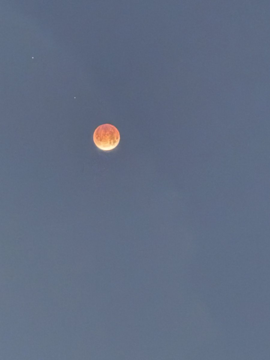
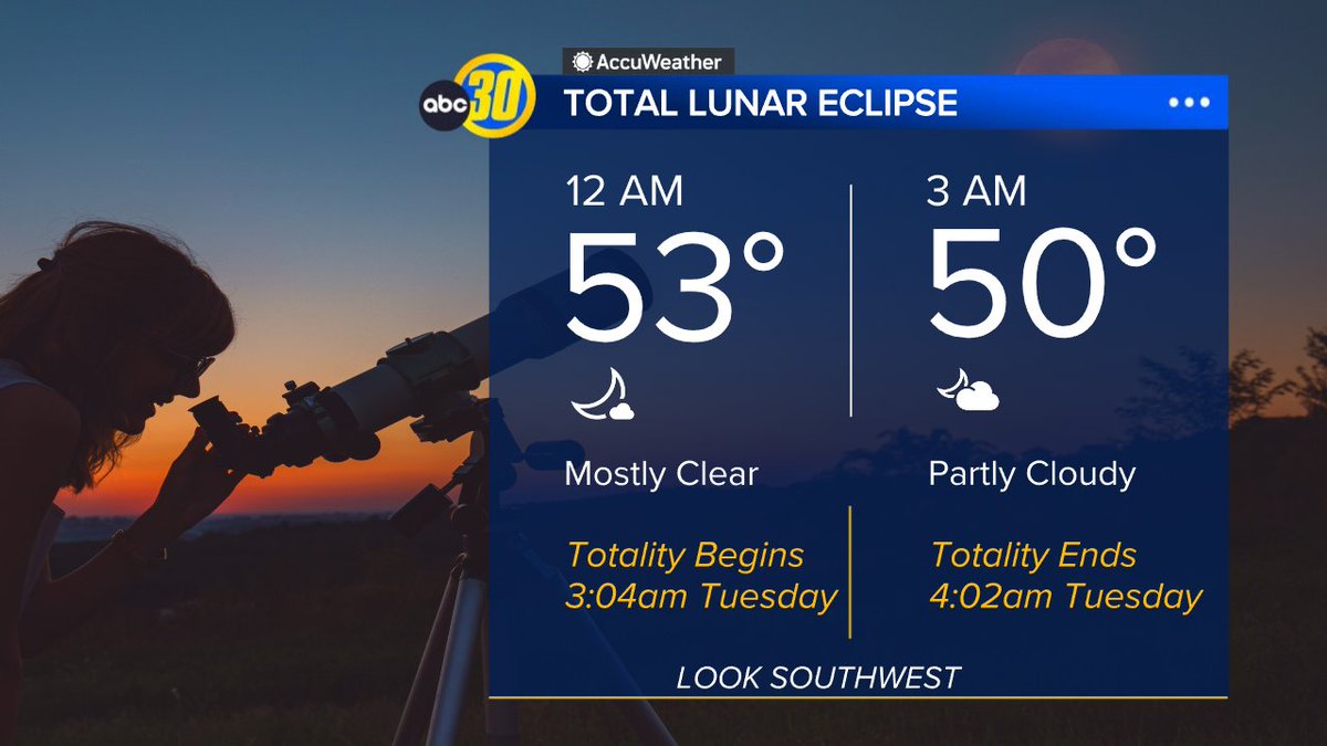
TUESDAY EARLY MORNING If you set your alarms bewteen midnight and 4am you'll catch the TOTAL LUNAR ECLIPSE. Times are PST for Fresno, CA.
Totality begins around 3:04am and lasts around an hour until 4:02am turning the moon a deep copper/reddish color in the southwest sky.
A massive 80-mile crack split the ice on Lake Erie, stretching from Canada to Cleveland on Sunday after strong winds swept across the Great Lakes https://t.co/86SxGLGUP6
🤓Nerd moment...
Micro Climate in action. San Jose in the low 70s and a core of low 80s btwn Santa Cruz and Capitola. All due to winds off the mtns sinking towards the coast and warming.
SW flow across central California will bring some smoky skies due to the #GiffordFire to Kern County for the next few days. This animation provides a model simulation for vertically integrated smoke over the next 36 hours. #CAwx
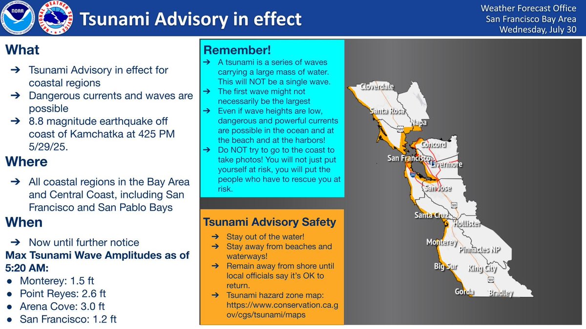
⚠️TSUNAMI ADVISORY remains in effect for the California coast. Initial tsunami waves have reached the coastline and are expected to continue until further notice. Stay away from the water! Stay away from beaches and waterways! Do NOT go to the coast!! #CAwx#Tsunami
Pt. Reyes reporting the highest tidal deviation yet (1.99 ft at 4:00 AM). This is more than 3 hours after the initial tsunami wave arrived. Wait for the all clear, this is far from over. #CAwx
⚠️TSUNAMI ADVISORY in effect for the California coast. Stay away from the water! Stay away from beaches and waterways! Remain away from shore until local officials say that it is OK to return. #KnowYourZone at https://t.co/Dm0UehpMVM. #CAwx#Tsunami
⚠️TSUNAMI WATCH in effect for the California coast. Estimated time of arrival as early as 12:15 AM on July 30. People along the coast: Stand by for further updates. #KnowYourZone at https://t.co/Dm0UehpMVM #CAwx#Tsunami
Be aware that there may be closures or delays on Highway 198 due to an ongoing wildfire near Three Rivers. To avoid this area, we recommend traveling on Highway 180 through the Big Stump entrance of Kings Canyon. For the latest updates, please monitor https://t.co/Tfpj2qz4Qv.
SUMMER SIERRA SHOWERS: Radar snapshot from 9:50am. Chances for a strong storm or two will exist across the far east portion of Mariposa, Madera and Fresno counties, especially toward Yosemite NP.
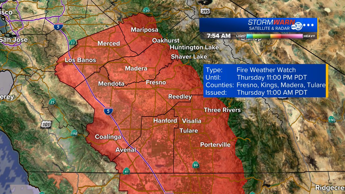
Fire Weather Watches are in effect for Thursday morning-evening across the valley floor into the Sierra foothills. Very low relative humidities, gusty winds and warm conditions are in the forecast, so stay tuned for additional updates as we get closer.