@skyblue_boy Your full Strava history of run/walk/hike activities should sync into CityStrides
If you're still having trouble, get in touch either in the forum
https://t.co/wG6zQe1rGP
or the support form
https://t.co/CjqguJuG9H
@chegaw I was about to joke a bout how it's only an ~8 hour walk, but then looked back & saw your ~11 hour Day 6 ‼️
I've done Ennis -> Doolin & barely managed to shuffle in with the sunset
@SnyderBrowne I usually direct people to make edits in https://t.co/GCSS8b2hiE to correct the tagging
There are a lot of helpful people in the forum if you have questions (or want to ask someone to make the edits for you):
https://t.co/AMLjPhpH7T
For #NationalWalkingDay, get inspired with Mapbox customer @CityStrides! Their app helps you walk every street in your area and build community at the same time: https://t.co/7FX8JxTc2e 👟 👞 👢
As featured in @nytimes: https://t.co/Dahx1edzal
@tohvoigt The automated process was updating cities roughly monthly ... performance started slipping badly, to every ~3 months ... I'm mid/tail end in rewriting that & I'm *hoping* for something closer to weekly
@briankirrane The paid version allows you to filter your view, but that doesn't scope your city progress - just the display.
The paid version also gives access to Challenges, which can have a start/end date - those let you scope/track your efforts.
Here's to setting #goals and challenging yourself in 2023! Running every single street in Zurich is one of my goals for this year. I am at 72% and thanks to @CityStrides it's easy to track progress and find the 590 streets that I am still missing. https://t.co/xax1lP36dw
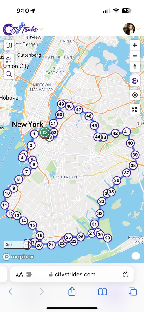
@RunEveryStreet I wanted to know *roughly* how many miles The Dragon is, so I quickly tapped out the outline…
This thing would be at least 55 miles
https://t.co/xdeDD6HF9n
@nathanwpyle My just-completed Run Every Waterfront running project map updated with a rough version of @Nathanwpyle favorite Brooklyn ice-skating dragon.
Wondering if the other 4 Boros have anything better... @ngrybauskas@CityStrides
@pmgpmgpmgpmg Oh! I see - I didn’t expect you would want to share any kind of view of *incomplete* streets with others … that’s why I chose to have the LifeMap portion and the underlying street data separated
@pmgpmgpmgpmg Can you share an example “screenshot of city” so I can better understand that?
I’m thinking that this is the equivalent on the CityStrides side (so please correct me if I’m wrong)
@pmgpmgpmgpmg Thanks for sharing all this!! I’ll have a few replies, to clarify my understanding…
In these photos, the issue looks like my nodes display doesn’t show the available detail of streets - it’s just large dots that need to be zoomed in to figure out what they mean
Yeah?