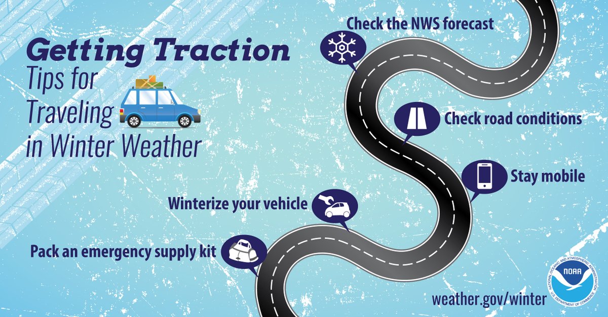
"Tis the season for holiday travel and being weather aware will ensure you and your family arrive at your destination safely. Before you leave, check the forecast as well as current road conditions. Don’t forget the winter emergency kit in your vehicle! #WeatherReady"
people, people, people...
What part of pacing yourself, keeping your hands to yourself and don't damage property did you not understand?
Don't even get me started on being of legal age to drink an adult beverage. Fake IDs are not your friends.
Let's do better today than we did yesterday. Please pace yourself. Keep your hands to yourself. Don't steal or vandalize. Have fun with your friends, eat good food and have an adult beverage only if you are legal to do so. It will make the rest of the day go so much better.
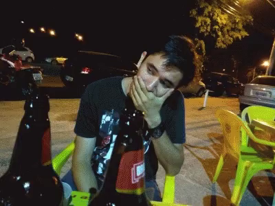
Sad to say, some of you did not take my advice from earlier....
Keep your hands to yourself, don't take other people's things and be kind to each other, damn It.
Stock photo, not actually D-Days but does remind me of it.
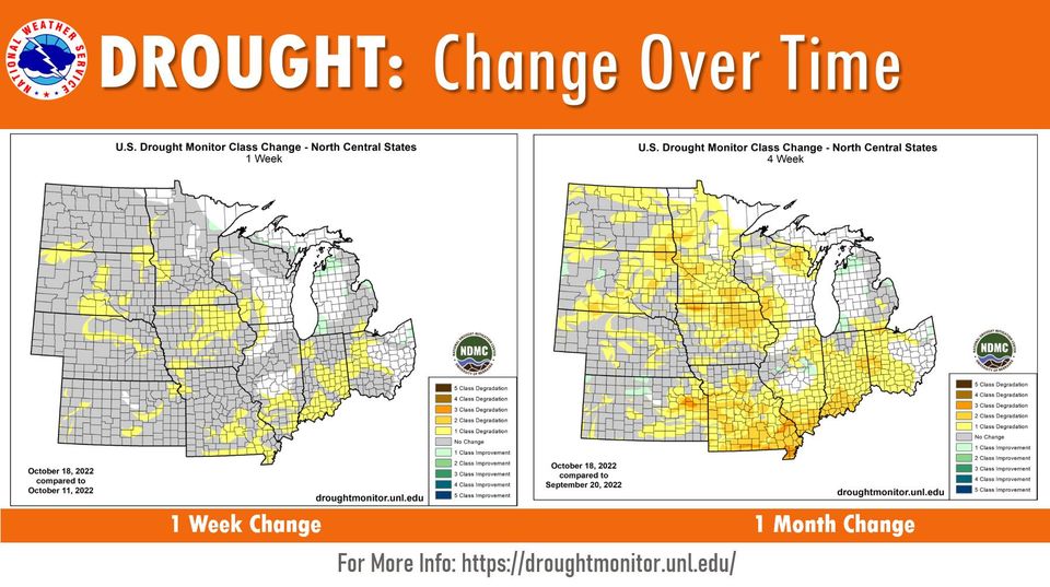
Latest drought information. It is bad out there folks. With D-Days festivities going, please use extreme caution if you are having a fire pit burning at your event.
Happy D-Days to one and all. Have fun this weekend, but be safe, treat others with respect and don't cause damage to other people's property. Make it a weekend filled with memories and not one filled with something that will follow you for years to come.
#DDays2022#GoYotes
We can really use the rain.
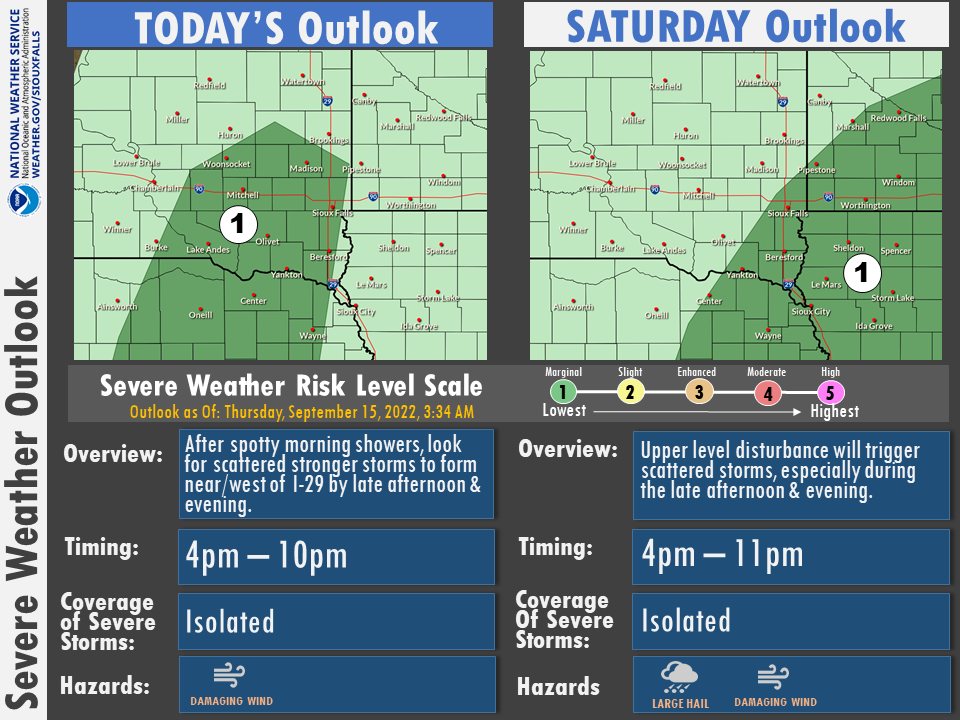
A few stronger storms are possible late this afternoon and evening, with an additional chance for a few severe storms late Saturday. Stay weather aware Clay County
The next couple of days will be busy in Vermillion, Public School starts tomorrow (8/18) and USD Move-In Day is Friday (8/19). Please drive carefully around town as there will be more pedestrians and street closures for the dorm moves.
Stay safe and welcome back students!
This is why we need rain. Clay County is in extreme drought. As school starts, Temps will hopefully be cooler but that does not mean safer. Watch your fires.
Rain? Yes please.
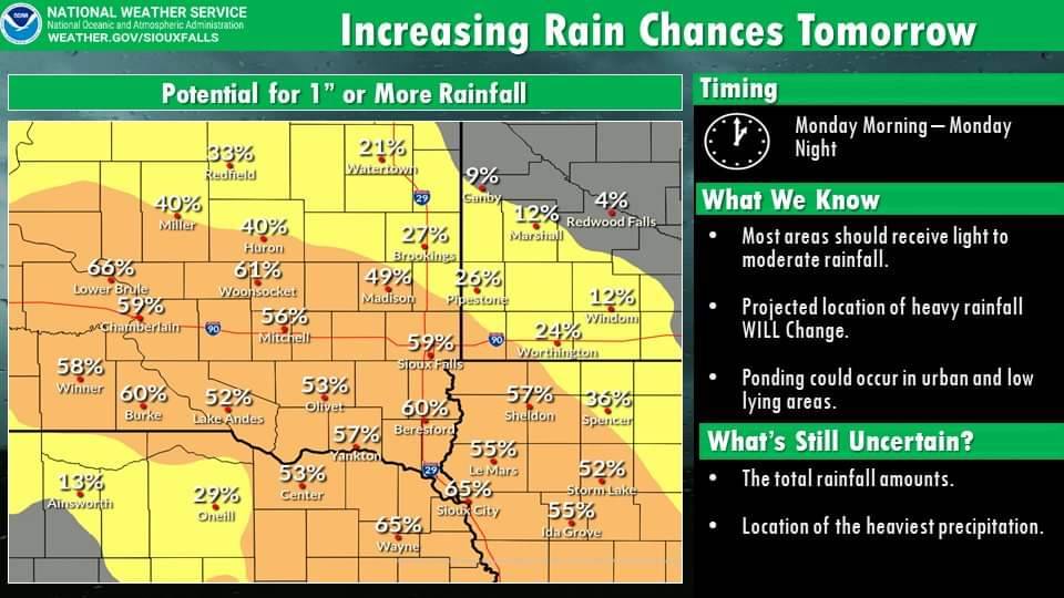
While we don't want to get your hopes too high, scattered showers throughout the day tomorrow could result in some beneficial rainfall. Most areas should receive something, but areas south of Hwy 14 will have the higher chances of getting more than 1". 🌧️
Strong to severe storms will be possible today from central NE into southwest MN.
The main time frame for severe weather is between 2 pm - 10 pm.
Hail up to the size of quarters and damaging winds to 65 mph will be the primary hazards.
Stay weather aware Clay County
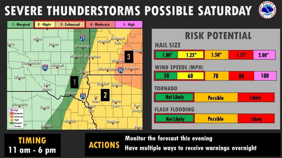
Scattered showers and thunderstorms are expected to develop mostly east of !-29 on Saturday. Some of these storms could become strong to severe. The main hazards with these storms will be large hail and damaging winds. Continue to monitor the forecast for the latest information!
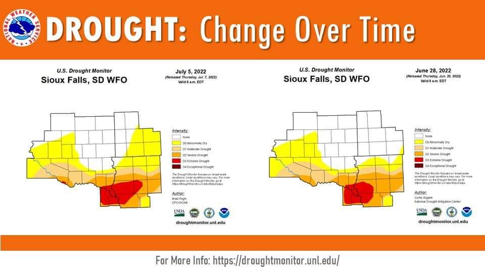
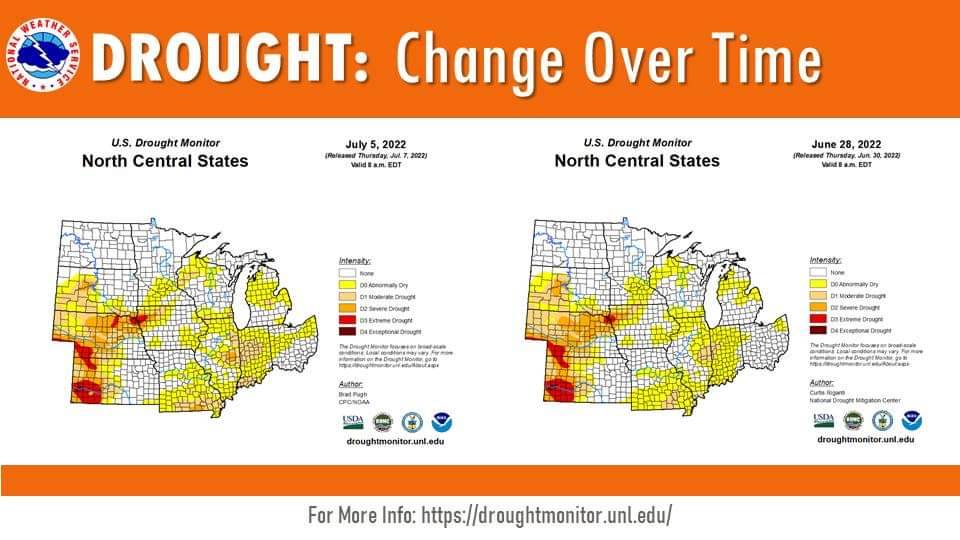
|| Thursday, 7 July 2022: Drought Update ||
Here is a look at the most recently released drought conditions from the U.S. Drought Monitor.
Zoomed in to our local area, you can see some slight worsening in drought conditions despite the recent rains.
THE NATIONAL WEATHER SERVICE HAS ISSUED SEVERE THUNDERSTORM WATCH
437 IN EFFECT UNTIL 7 PM CDT THIS EVENING FOR THE FOLLOWING AREAS including Clay County.
Storm potential has been upgraded to Moderate to our north. If traveling, be aware of conditions at your destination as to not drive into heavy storm conditions.
Stay safe and weather aware Clay County.
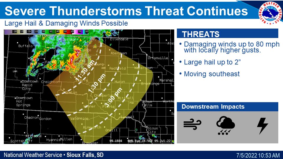
|| Tuesday, 5 July 2022: Storm Timing ||
Updates on storm potential from NWS.
Here is a look at estimated storm arrival times.
Please note: these times can change as the storm evolves.
Stay safe and weather aware Clay County.