📡🌍 Who invented GPS? Discover the contributions of Roger L. Easton, Dr. Ivan Getting, Bradford Parkinson, and Dr. Gladys West in our latest video and article on Geoawesome!🚀
Video: https://t.co/FlJKIeJSzt
Source article: https://t.co/HdjKDjIjhU
#GPS#Innovation#Geoawesome
Live from @EuroGeosciences conference! Our colleague Martina Capponi is presenting the latest advances regarding #gravity applications enabled by quantum sensors, as part of the #FIQUgS project. More info at: https://t.co/PHbYdGV6qj
📸courtesy of @callmeboyk and @DanieleSampiet1
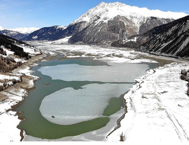
Ottimo articolo sulla #siccità (e spreco) d’acqua in nord Italia. Sto vedendo di recente soldi a pioggia del #PNRR buttati nel … Possibile che non si pensi a un massiccio investimento infrastrutturale in qualcosa che può realmente fare la differenza per gli anni a venire?
I custodi dell’acqua! Le grandi dighe e la lotta alla siccità. Il mio #reportage tra Alto Piemonte, Valtellina e Alto Adige @sole24ore https://t.co/Xt9UTEGdVT
È una scena commovente: si aggrappano a un faro di speranza. Di una vita migliore, vissuta con la possibilità di esprimere se stessi. È un ideale, che a me sembrano un po' sbiaditi dalle nostre parti.
Loro si sorreggono attorno a quella bandiera, noi diamo tutto per scontato.
#Tbilisi
Exciting news from Accra, Ghana! We are participating to the kick-off meeting of the TEMBO project - Horizon Europe programme. We will monitor critical parameters such as dam movements, water levels of lakes and rivers, soil moisture and atmospheric water vapor leveraging on GNSS
This is crazy! 🤯 We used @ASFHyP3 and AutoRIFT, the ITS_LIVE glacier tracking software, to map the displacement from the #turkeyearthquake with incredible fidelity.
Graphic by Alex Gardner, @NASAJPL
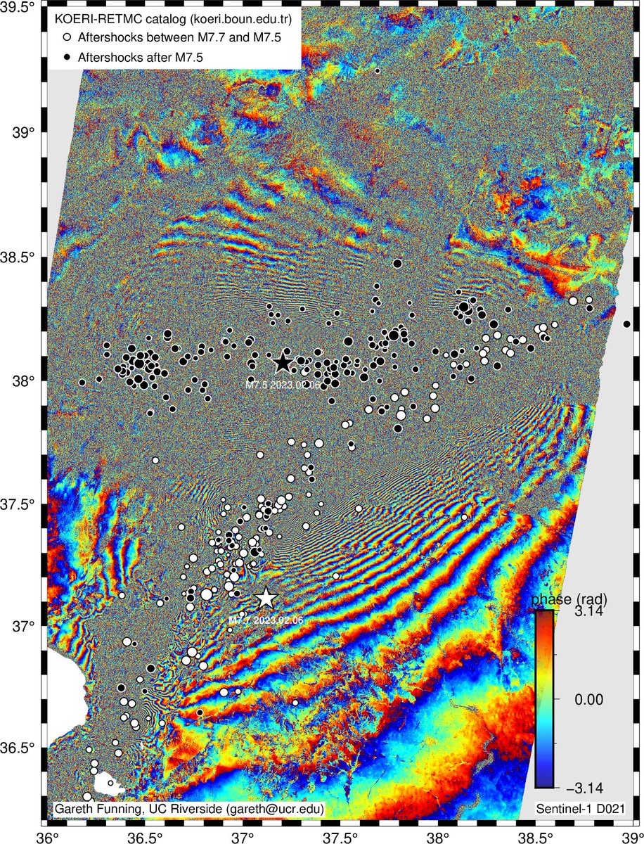
Overnight, California time, Sentinel-1A acquired an image right over the source faults of both of the Turkish-Syrian earthquakes. The interferogram is extremely hard to interpret at Twitter resolution - there are so many fringes, they blur together (and decorrelate in places)...
Pixel offsets for Feb 6, 2023 M7.8 Turkey mainshock and M7.5 aftershock
ALOS-2 path 78, frame 2850, 2860
06/04/2022- 02/08/2023
Imagery courtesy of JAXA and facilitated by NASA
It all started with a fantastic course on #GNSS#reflectometry by @funwithGPS – now we have our software processing various stations in operational near real-time to retrieve water and snow levels! Next step: soil moisture @MAGDA_Project
🛰 Do you know that GNSS can measure water levels? 🌊The plot shows the water level values of Po river obtained by Breva, our GNSS processing software. Data are collected by @GeoGuardGNSS monitoring units. Currently the condition of the Po river is still critical! @ANBI_Nazionale
(Thread) In the first What If? book, I answered a question about cooking a steak by dropping it from space. At one point, I commented—jokingly!—that if anyone put a steak in a hypersonic wind tunnel to gather better data, I’d love to see the video.
Well, I have good news.