Asst. Professor | Coastal Engineering | UNCW
Fanatic of Hurricanes, MATLAB, Rubik's cubes, Dogfish Head beer, Texas BBQ, and a good label maker.
GO SPURS GO
🚨 Latest pub is out related to the REALDUNE/REFLEX experiment!
These are the most highly-resolved field measurements of active dune face erosion DURING storm impact, that I am aware of.
https://t.co/zw1jHE8Cl5
Credit to whole REALDUNE/REFLEX team and collaborators!
🚨SHARE WIDELY🚨 The abstract submission deadline has been EXTENDED for YCSECA 2025, the best conference for young coastal scientists and engineers!!! It will be held in the beautiful coastal city of Wilmington, NC this summer.
https://t.co/6jy5cB2BS8
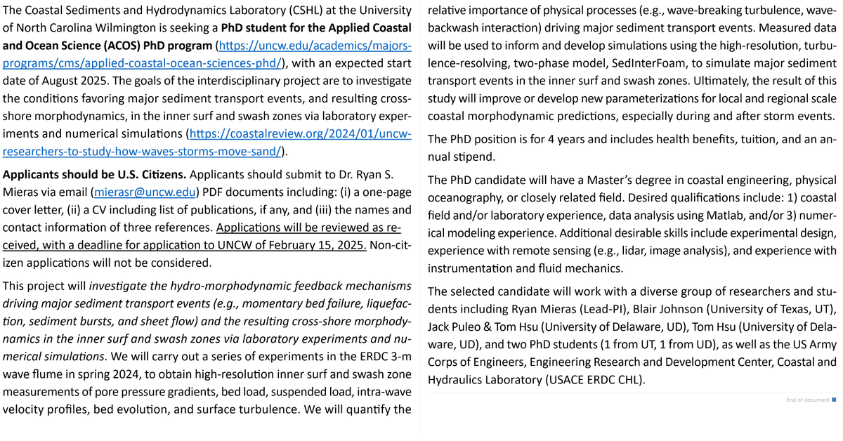
SEEKING Ph.D. STUDENT ASAP!!! Full details in image 🙌
Project summary here: https://t.co/A0k4lXFmwU
Deadline to apply for priority consideration is Febraury 15, 2025.
Reach out to email listed in image for more info.
I am advertising a two-year postdoc related to remote sensing of chronic coastal floods. The position will be jointly at UNC Chapel Hill in the Global Hydrology Lab and in my research group, the Coastal Hazards Lab at North Carolina State University: https://t.co/iI1yobLOHd
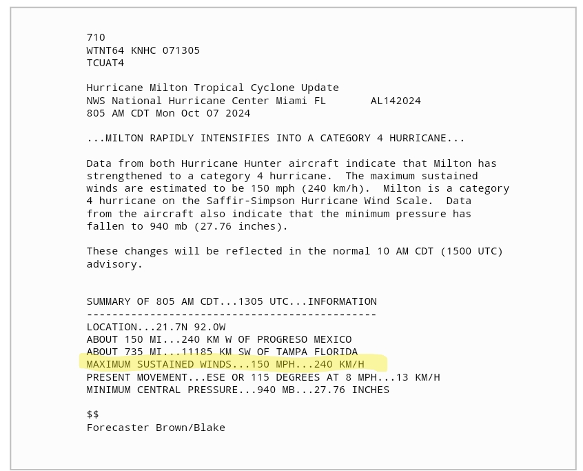
CORRECTION: at 905 am EDT, an update was issued, bumping max sustained winds from 125 mph to 150 mph!
Meaning, a 25 hr increase of... wait for it... 90 mph!
ALMOST 3x THE RAPID INTENSIFICATION REQUIREMENT! #HurricaneMilton 😳😳😳
#HurricaneMilton went from a 'measly' 991 mbar and 60 mph, to 945 mbar and 125 mph, in just 24 hrs--an increase of +65 mph! 😳😳😳
That's nearly double the requirement for "rapid intensification," which is +35 mph in 24 hrs.
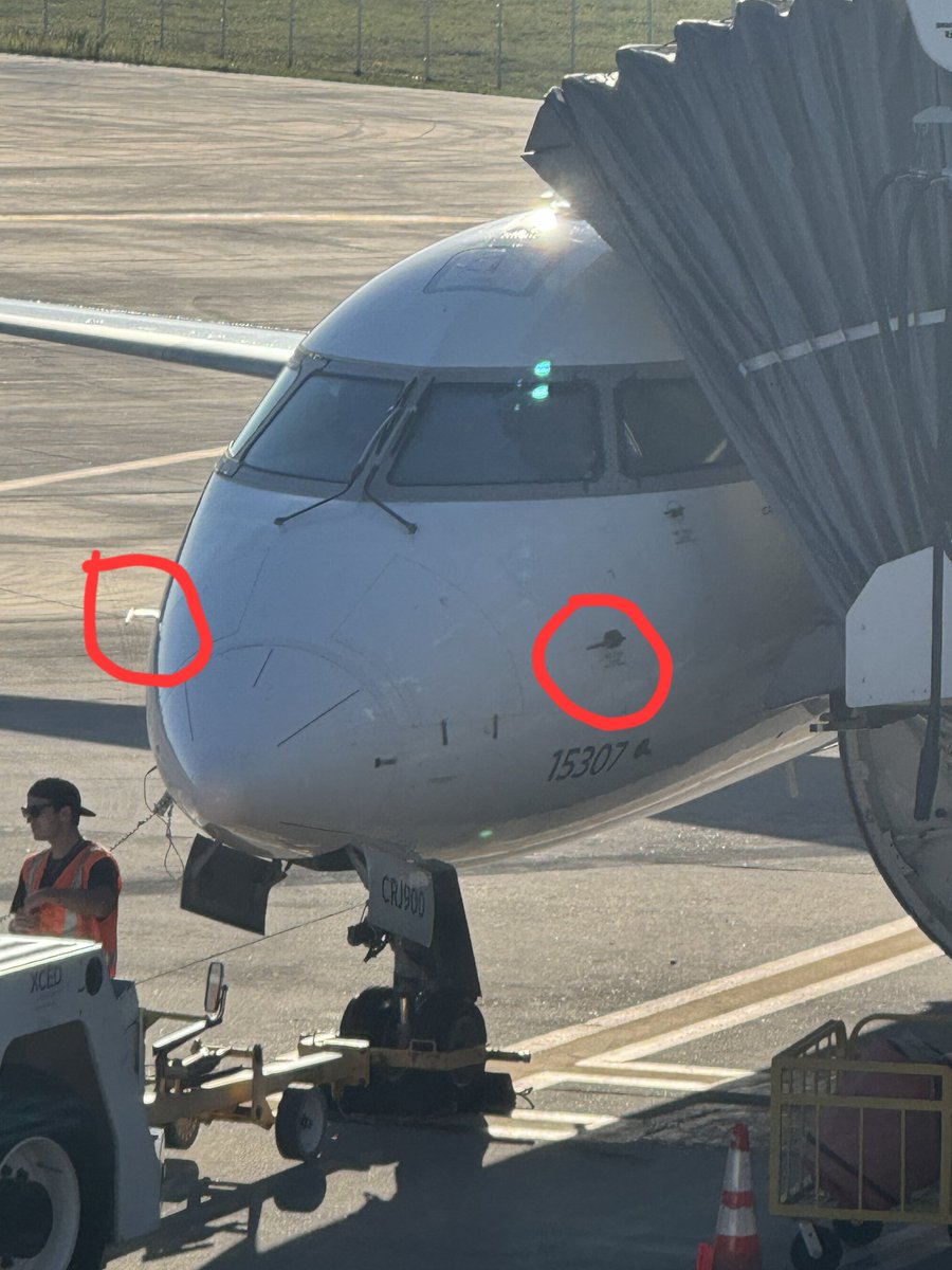
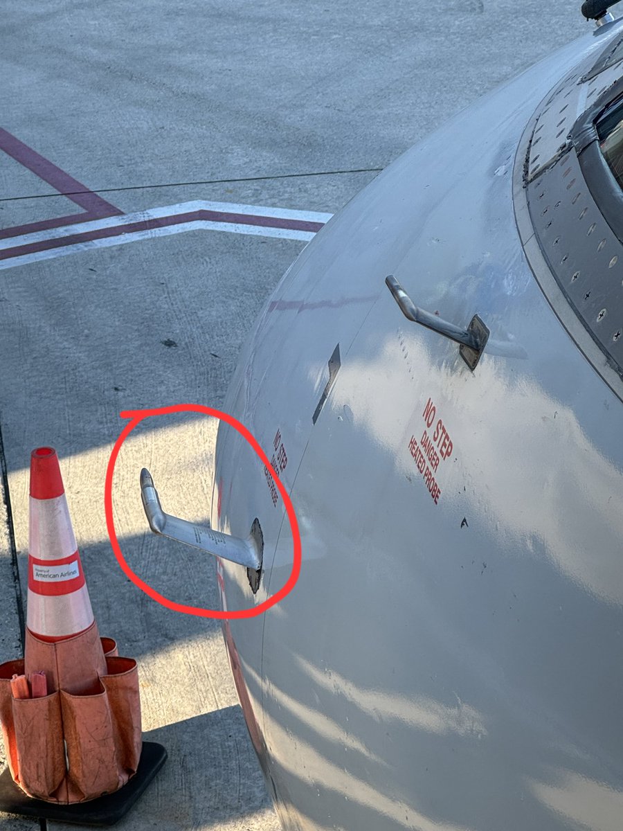
When 2 students from your Fluid Mechanics class are boarding a plane and send you pics of the plane's Pitot tubes, one day after your lecture on the Bernoulli equation, stagnation points, and Pitot tubes! 😇
Celebrate the small teaching wins the most! 🥳
@hurricanetrack Hurricanes like Matthew in NC (and MANY Others, even "only tropical storms") are MOST memorable for their inland flooding.
Remeber the FOUR impacts from tropical systems, and then act #SWIFT
Surge
Wind
Inland Flooding
Tornados
@hurricanetrack Excellent points Mark!
Keep in mind for Florida, a LARGE portion of the west/nature coast experienced RECORD surge on record. Category also doesn't account for "size"
Texans all remember Ike in '08, which had 20+ ft of surge but was "only" a Cat 2 landfall
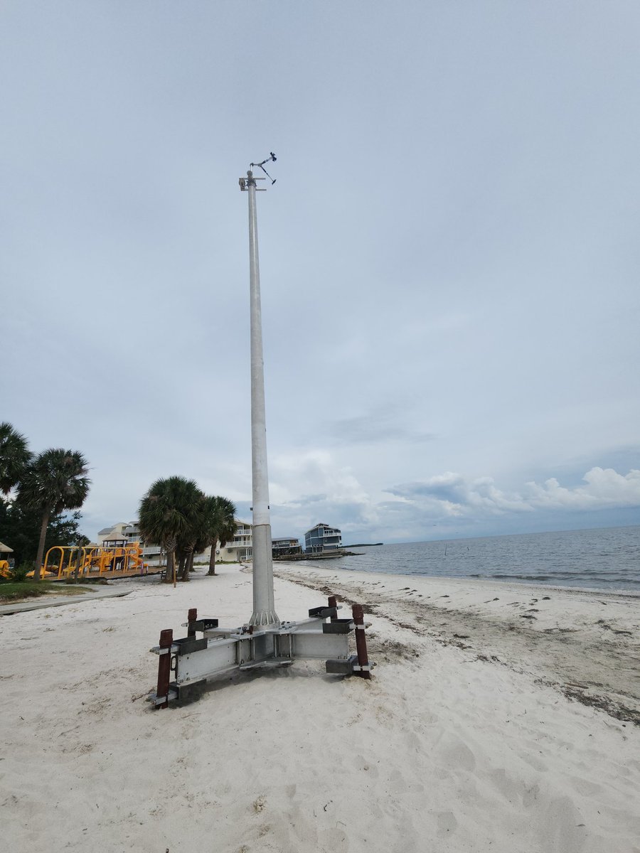
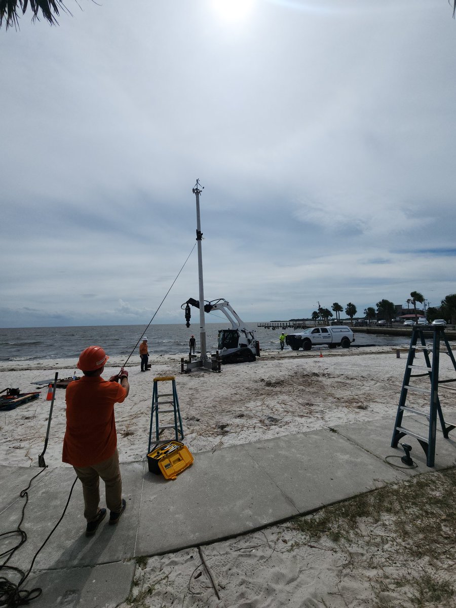
This marks the 1st EVER deployment of a Sentinel tower on a beach (Cedar Key, FL) before a hurricane. HUGE credit to the team at Univ of Florida (& many others across the USA) who put in years of work to make this happen! What a milestone! 👏👏👏
#HurricaneHelene#neer
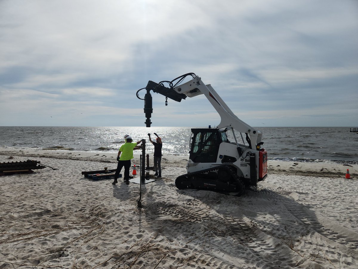
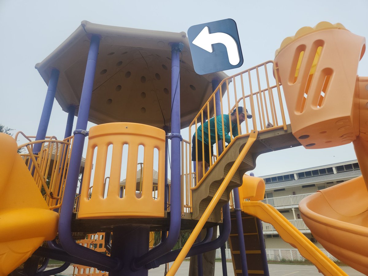
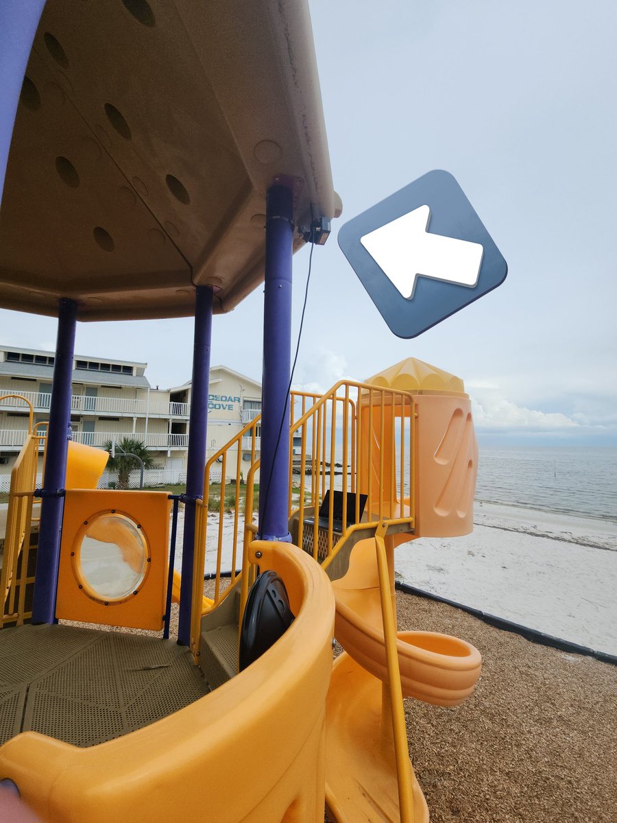
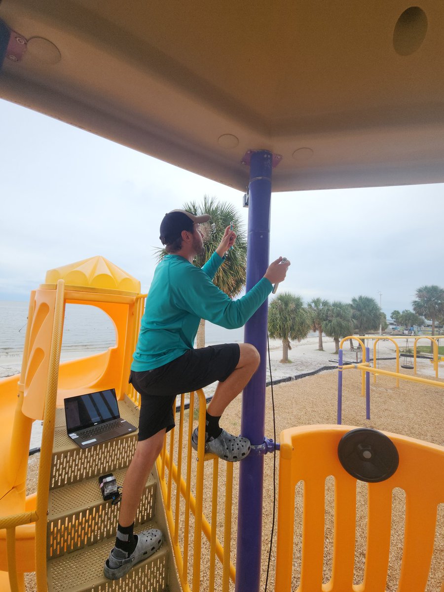
Installing the continuoisly-scanning 3D LIDAR at Cedar Key, FL yesterday.
Ultimately decided to stand down and remove it. This elevation was 20 ft above sea level, which had potential to be under water from surge and waves...wasn't worth the risk. 😔
#HurricaneHelene#NEER
The classic "your route may be affected by Hurricane Warning message" from Google Maps when doing a rapid response coastal deployment #neer#TropicalStormHelene