Hello, and welcome.
We prohibit trolling, attacks, negative or destructive comments, or anything that is deemed not in good nature.
We will delete your post and you will find yourself reported/banned immediately.
Thank you for supporting us and the ARES community.
Might see an oddity today.
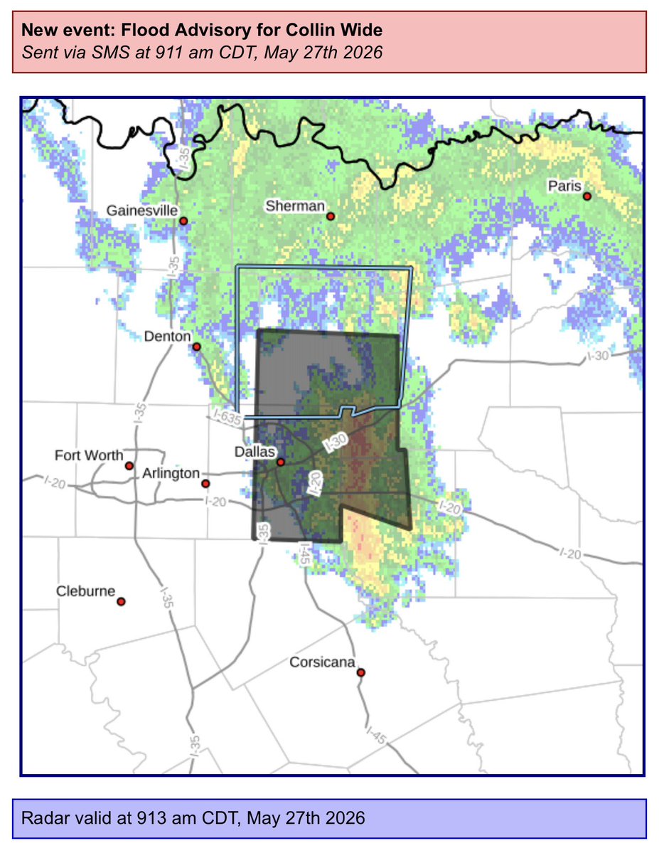
Storms coming in the back door (NE) of Collin.
These often create towering cumulus and sometimes some very heavy rain and some hail.
Keep an eye out after lunch - midafternoon.
6.2.2026
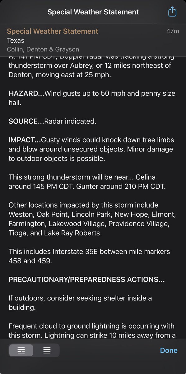
[4:40PM 5/26] - we’re keeping an eye one two areas of storms. One in northeast TX moving towards the ArkLaTex, and another to our west moving east through the Big Country. Some of the stronger storms could produce strong winds, small hail, and heavy rainfall. #dfwwx#ctxwx
FYI: A comms outage is affecting dissemination of KFWS/KRGK radar data, weather radio, & online products.
Our meteorologists are still receiving all radar data to make warning decisions, and we are transmitting all warnings/products via our backup office @NWSShreveport. #txwx
Often, the @NWSFortWorth is asked if/when it will rain and/or impacts. 👀👇🏼
Hourly Forecasts (Click on your location): https://t.co/Ij7BpPz7F5
NWS Fort Worth Hazard Pages: https://t.co/ICBu3iIqYU
National Weather & Hazards Data Viewer: https://t.co/c4We8g2ioL
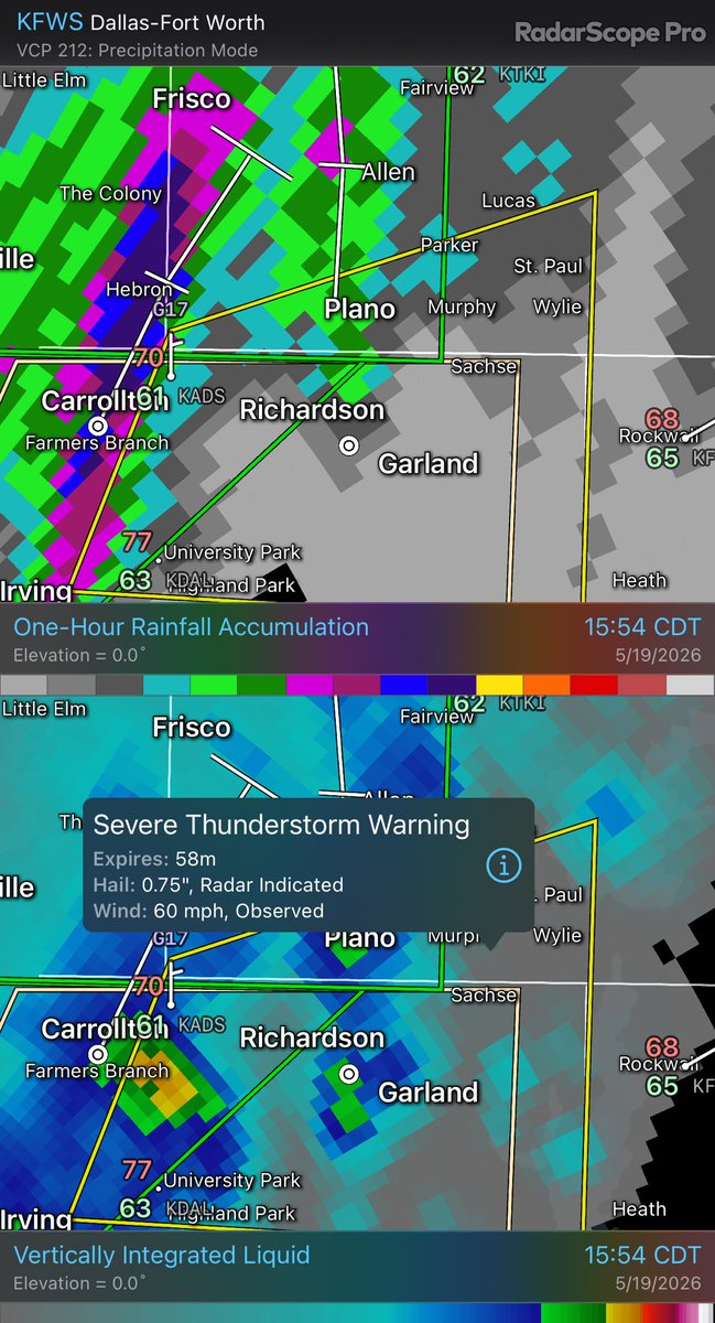
Southern = 50mph .750” hail
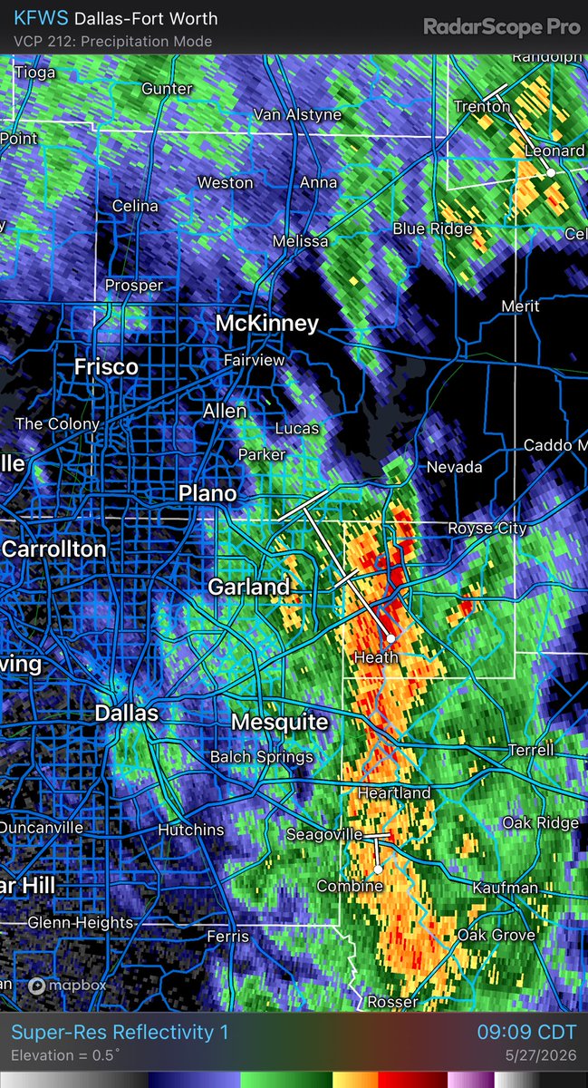
SPSFWD from 5/19/2026 1:57 PM to 2:45 PM CDT for Collin Wide: A strong thunderstorm will impact portions of s... https://t.co/OWTPWkrBbn