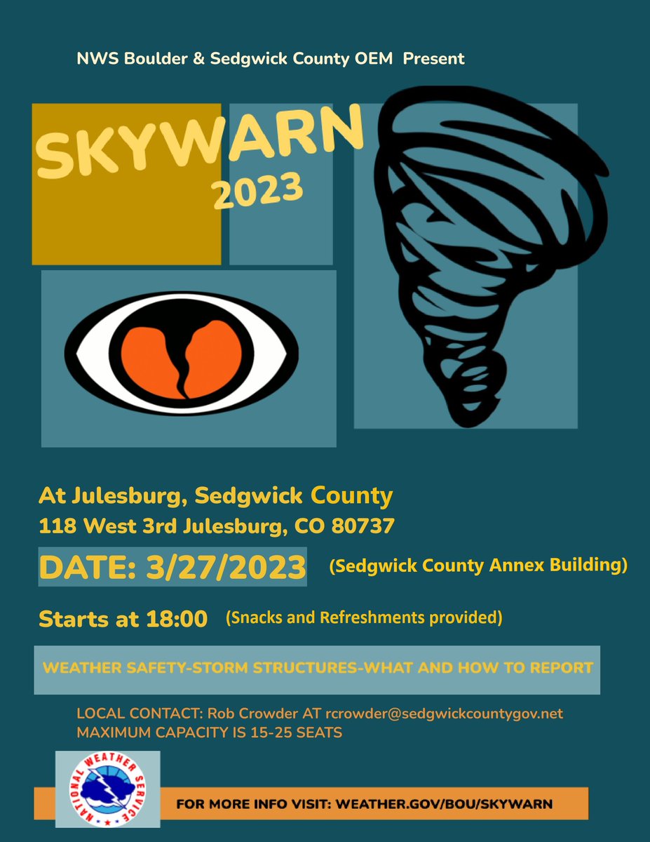
Interested in learning more about the weather? Join us for our annual weather spotter class on Monday, March 27th at the Sedgwick County Annex Building, at 6pm.
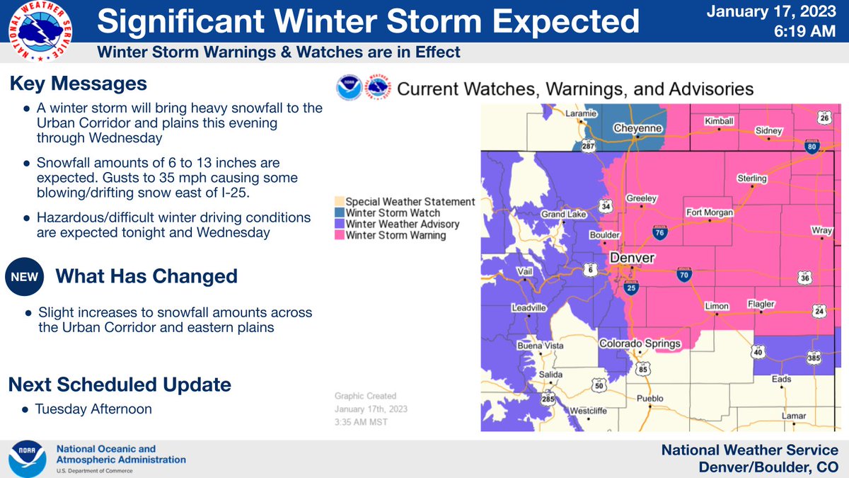
⚠️Significant Winter Storm Arrives Later Today⚠️
Winter Storm Warnings in effect for the I-25 Corridor and all the Plains 5 pm today - 5 pm Wednesday. Significant snowfall & difficult travel conditions develop tonight through Wed. Some blowing snow eastern plains.🧵#COwx
Headline Update! The eastern plains have been upgraded to a Blizzard Warning, in effect from midnight tonight through midnight tomorrow. Travel will become very hazardous in those areas. Avoid travel east and northeast of Denver late tonight through Tuesday! ⚠
#COwx
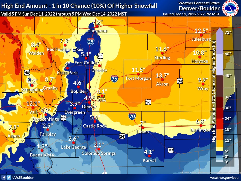
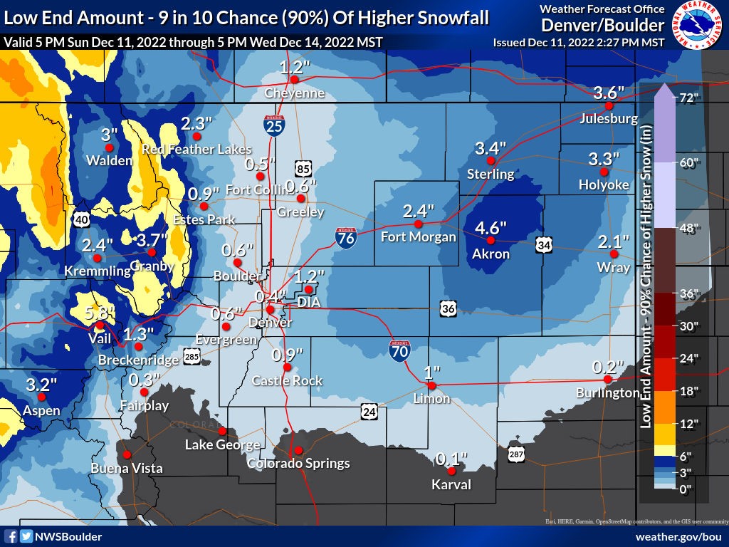
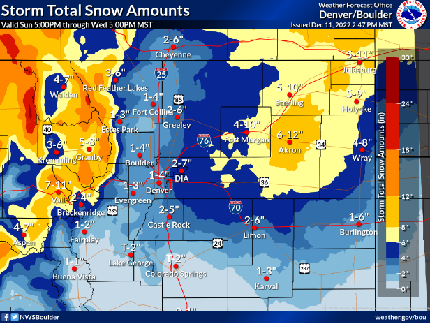
Best estimate snowfall for the upcoming winter storm below, along with low/high end potential amounts.
High confidence: Significant travel impacts for NE plains, mountains. Whiteout/blizzard conditions Tue for parts of the plains.
Low confidence: Snowfall amounts (1/3) #COwx
Those under a fire weather risk...
⚠️ Sign up for local emergency alerts and know how you would be notified, should you have to evacuate!
🔦 Have your emergency go kit ready! https://t.co/hi7DCugLFk
🚗 Know your evacuation routes! https://t.co/w2C3qwq537
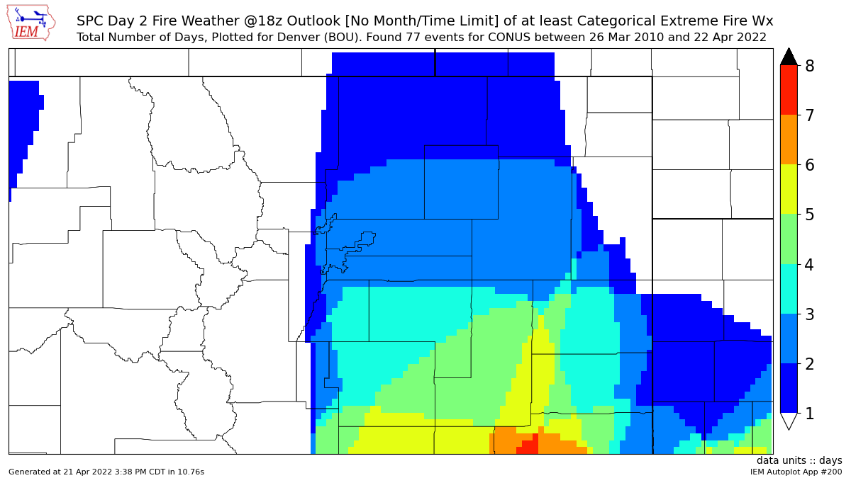
For another perspective on the rarity of this event, @NWSSPC has placed most of our forecast area in a Day 2 Extremely Critical risk. Since 2010, this has only happened 1 other time in the Denver metro and a few times further south. PLEASE avoid ANY sparks tomorrow! #COwx#COFire
Despite the cool and moist start to the day, strong winds and dry conditions will develop during the late morning and afternoon which will create critical fire weather conditions. It will be another day to avoid burning or anything that could create sparks. #COwx
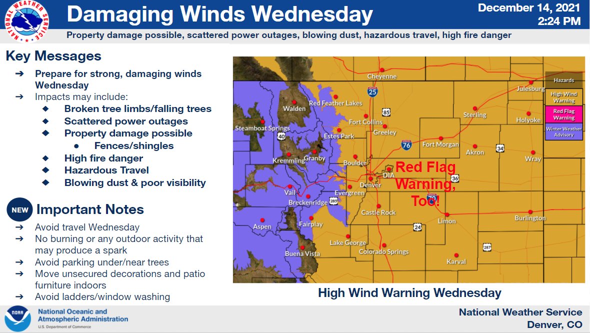
⚠️Latest info on tomorrow's windstorm. Peak gusts revised slightly downward on the plains, but upward in/near the foothills where peak gusts of 80-100 mph expected!⚠️
See...https://t.co/O6vuV93OcK
#COwx
⚠️⚠️Due to crashes and limited services in Wyoming, I-80 and Highway 30 are CLOSED for westbound traffic from Ogallala to the Wyoming border.
Please adjust travel plans accordingly. We will advise when to roadway is open again.
In addition to our monthly tornado testing today at 10:30, we will also be tested IPAWS, a new capability we have. Expect to receive a WEA (wireless emergency alert) on your phone.
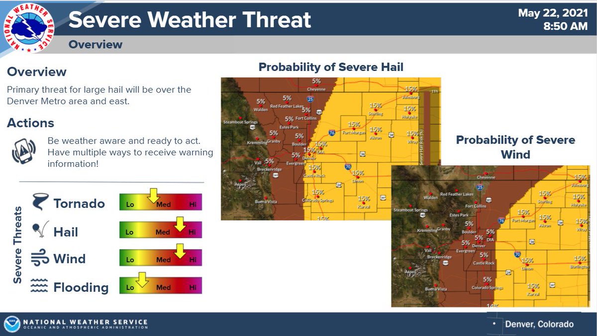
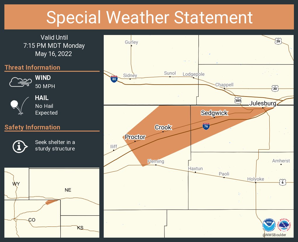
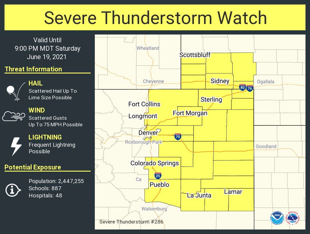
Severe weather is likely this afternoon across far northeast Colorado. The primary threat will be large hail, but tornadoes and damaging wind gusts will also be possible. Storms should fire by the mid-afternoon and track quickly to the east. #cowx
Tornado Watch issued until 8 pm. Forecast update with large hail of 2 inches and severe winds of 60 mph or greater is also possible with these storms. Have a way to receive warnings and be prepared to take shelter. HAVE A PLAN! #cowx