Si vous contribuez à la #CarteCommunautaireduCanada, joignez-vous à notre 5à7 virtuel demain!🍺Ne ratez pas la présentation vedette de Michel Pagé de la Ville d'Amos pour apprendre comment utiliser #ArcGISExperienceBuilder + le fond de carte dans la création d'apps interactives🗺️
If you also want to make a map that has raincloud-patterned water bodies and flower blossom & leaf symbology, you can customize the #CommunityMapofCanada#basemap to your own preferred style w/ the #ArcGIS Vector Tile Style Editor tool:🌞🌱🌧️🌸🌷(2/2) https://t.co/CWz3sJHKWG
'April Showers Bring May Flowers' -- so zoom into the #CommunityMapofCanada April Style of the Month and see the rain & clouds clear up, replaced by flower-patterned parks and sunshine highway symbols. ☔🌧️🌼 (1/2) https://t.co/yMpchoAdiE #Esri#Cartography#MapArt
This #CommunityMapofCanada birthday day cake style even has a candle to blow out.🎂🕯️
Our wish this year? For more Canadian communities to contribute data & more #GIS and #Esri users to use the basemap in their maps, apps & #cartography!🥳🎁See more: https://t.co/qpMpkvVxM9 (3/3)
This 'Birthday Cake' style has a vanilla fun-fetti cake base & Canada's road network piped with frosting! 🎂Don't miss the highway crests symbolized by confetti cannons and balloons.🎉🎈🕯️ Serve yourself a big slice of the #CommunityMap cake here : https://t.co/yMpchozFt6 (2/3)
Happy birthday to the #CommunityMapofCanada! Today we're celebrating the 𝟰𝟬𝟬𝘁𝗵 basemap published & four years of the vector #basemap!🥳 (Our 360+ contributors and communities around the country are also definitely cause for a party.🎉) https://t.co/qpMpkvVxM9 (1/3)
Throwback to last year's #InternationalWomensDay where the #CommunityMapofCanada Style of the Month for March 2022 was designed in celebration of strong women.🗺️♀️ This style & other monthly base #map customizations are here: https://t.co/tQWHo6dTvD
For #InternationalWomensDay and for more context about some of the women included in the Place Names of Canadian Women layer and #map in the @LivingAtlas, more information is included in this interactive #StoryMap created by @NRCan : https://t.co/Q6l0giZi5H
#GNBC
Sharing the Place Names of Canadian Women layer from the @LivingAtlas in celebration of #InternationalWomensDay! ♀️The layer includes ~500 places in Canada named after women from a range of backgrounds and for different inspiring reasons.🗺️https://t.co/joq8sO5tor #EsriCanada
Yesterday's virtual #HappyHour and #networking event welcomed more than 60 GIS experts and #CommunityMapofCanada contributors from coast to coast.🥂Missed yesterday's event? Just reach out for more info about attending upcoming events and webinars! https://t.co/xa3Lj1DV0E… (2/2)
Great to have @CityofMooseJaw present their Capital Project dashboard at #HappyHour#5a7 yesterday. Thank you for sharing how you use the #CommunityMapofCanada in your projects and forward-facing apps!
Want to explore Moose Jaw's app? https://t.co/UJCQUdBHL9 (1/2) #EsriCanada
See you tomorrow at Hart House, @UofT!
✅Arrive by 8 for breakfast and welcoming remarks
✅Come prepared for your workshops & sessions
✅Tweet experieces and photo's to #GISinEd2023
✅Meet new colleagues & connect with old friends
Agenda & more here: https://t.co/LHHNZl2orA
The #CommunityMapofCanada is full of #love for our contributors and communities!❤️It's also full of up-to-date data from Canadian communities, especially place names about #love. Happy #ValentinesDay, from Cuddle Lake to Snug Haven to Hearts Peak!❤️ #Esri https://t.co/Co3QvjZdSg
Trop cool de voir la #cartecommunautaireduCanada dans ce reportage de @RadioCanadaInfo sur l'utilisation d'applications de déneigement au lieu de camions avec des sirènes bruyantes🚨Les données précises + locales sont importantes pour les apps citoyennes❄️https://t.co/Lqfe8QgvLT
Very cool to see the #CommunityMapofCanada featured briefly in this report by @RadioCanadaInfo about using snow removal apps instead of trucks w/ loud sirens! 📢🚨It shows how local community data + an accurate basemap are valuable for citizen-facing apps❄️https://t.co/Lqfe8QgvLT
Using the #Esri Vector Tile Style Editor, land use, water bodies, and parks of the #CommunityMapofCanada are symbolized with different #vanGogh paint textures. Dark paint smudges symbolize cities, trees, and highway numbers.🖌️🌻See more styles at https://t.co/yMpchoAdiE 🗺️ (2/2)
The #vanGogh-inspired Style of the Month for February uses different paint swirling and hatching brushstrokes to make the #CommunityMapofCanada look like it was painted onto a canvas🎨👨🎨View #Canada's 'The Starry Night'-style #basemap and more at https://t.co/yMpchoAdiE🌌✨(1/2)
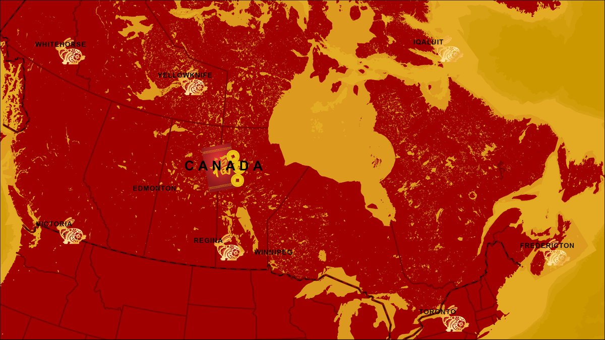
In celebration of #LunarNewYear2023, enjoy this custom #CommunityMapofCanada style for the year of the #rabbit! Wishing all those who celebrate a good new year to come.🐰🧧🥟🏮Check out our style gallery to see more creative #basemap customizations: https://t.co/yMpchoAdiE
A new month means a new #CommunityMapofCanada style! Snowflakes for cities and highways, snowy white buildings, and cool blue streets crystallize the wintery theme for January 2023.❄️More #map styles made with the #Esri Vector Tile Style Editor tool here: https://t.co/4TpwVepLfX
Cities shown by light reflecting off the glassy surface; roads mimic soldering between glass panels; parks and buildings are symbolized by different-coloured glass. So much can be done with the #Esri Vector Tile Style Editor and #CommunityMapofCanada!✨https://t.co/4TpwVeGOhX 2/2