Rotation has broadened on the storm in Jasper county. The Tornado Warning has been downgraded to a base level. However, satellite, radar, lightning, and environment observations all support cycling of the supercell, so a tornado is still possible at anytime. Continue sheltering!
I would expect upgrade from SPC on the new day one outlook. The 0Z cams have PDS soundings for both Tulsa & OKC areas. I would expect a few significant tornados and 4” hail possible. #okwx
The atmosphere will be conducive for thunderstorms and potential severe weather again on Friday. Monitor the forecast as we get closer to the end of the week!
Strong to Severe storms will again be possible through the weekend. Remaining uncertainties on the exact details still exist, so stay up to date on the latest forecast as we get closer to this timeframe.
Strong to severe weather will be possible across portions of the area Thursday night into Friday morning. Remaining uncertainties exist, so stay up to date on the latest forecast. #mowx#kswx
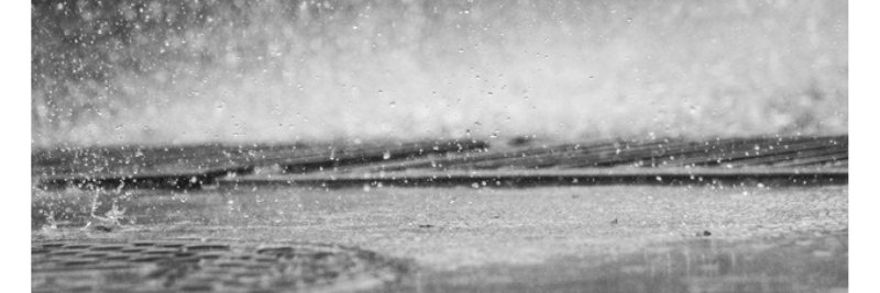
A tornado Watch has been issued for portions of the Missouri Ozarks and far southeastern Kansas, mainly along and west of I-49 through 4am. Hail to the size of golf balls, wind gusts from 60 to 70 mph and isolated tornadoes may all be possible. #mowx#kswx
This is a cautionary tale of why you should stay inside. It is not just the roads, even walking to your car is dangerous with this freezing rain. We are LIVE NOW tracking this major winter storm as it moves across the country. Tune in on YouTube for the latest updates. https://t.co/plZ2pNTJwz
A friend asked me why people buy six loaves of bread, four cartons of eggs, four gallons of milk, and 72 rolls of toilet paper every time it snows. I said I don’t know, but if they consume that all in a 24 hour period they might need all that toilet paper.
The first of two rounds of moderate to heavy snowfall begin tonight, with 8-13" expected by the end of the weekend. Some lingering uncertainty could cause slight adjustments in forecast totals, but the highest amounts will be in areas furthest south. #mowx#kswx
A Winter Storm Warning has been issued for the entire forecast area from 6 p.m. Friday until 6 p.m. Sunday. Significant snowfall of 7-14" is expected along with bitter cold temperatures. Forecast snowfall amounts will continue to be refined with future forecasts. #mowx#kswx