To protect lives and property using and "All Hazards" approach to plan for, respond to, recover from, and mitigate man made and natural emergencies and disaster
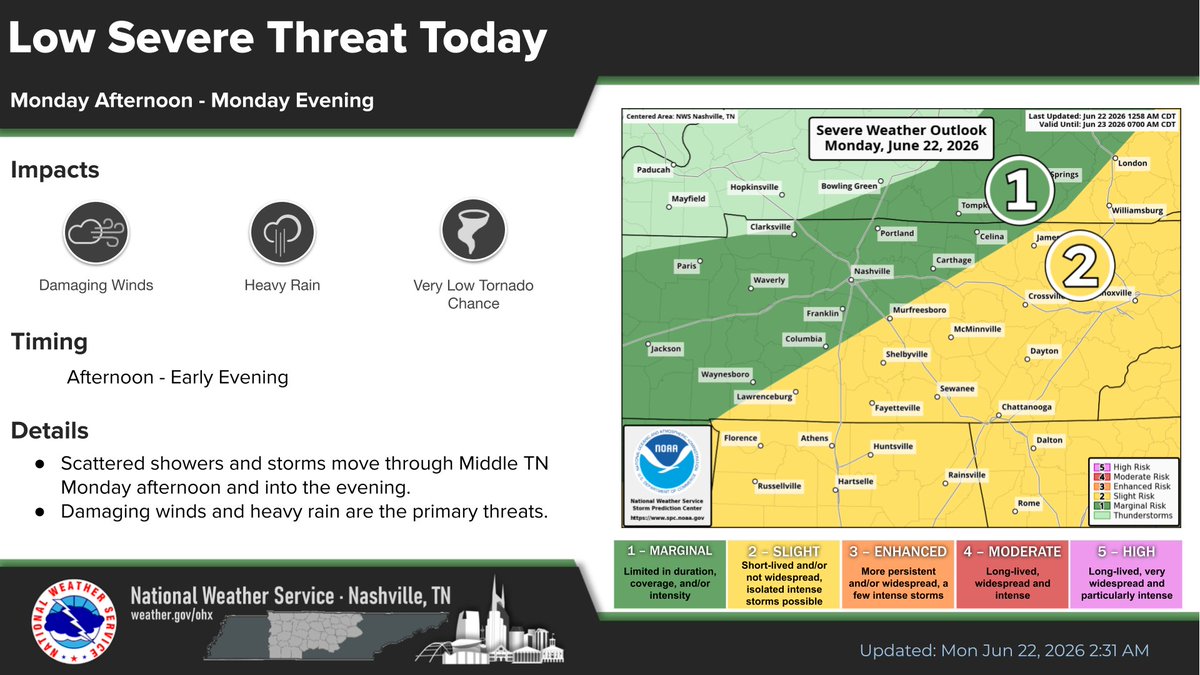
Conditions are setting up for a few storms btw noon and 8 pm today. Not everyone will see one. Those who do? They will all carry a damaging wind risk. If you have outdoor plans, please remain weather aware. Also, if you have outdoor plans today, stay hydrated! The heat continues!
Emergency personnel from multiple agencies will be participating in an emergency exercise July 1 at Stone Memorial High School in Crossville. There will be a heavy presence of emergency personnel and equipment on site and in the area. There is no emergency or threat to the public
Look for gradually warming temperatures the next couple of days with rain and storms moving through Thursday and into Friday. The forecast for Saturday looks to be splendid.
...A TORNADO WARNING IN EFFECT UNTIL 515 PM CDT FOR NORTHWESTERN CUMBERLAND AND SOUTHEASTERN PUTNAM... At 450 PM CDT, a severe thunderstorm capable of producing a tornado was located near Monterey moving northeast at 35 mph. This includes I-40 between mile markers 300 and 314.
Tornado Warning for...
Northwestern Cumberland County in Middle Tennessee...
Central White County in Middle Tennessee...
Southeastern Putnam County in Middle Tennessee...
* Until 515 PM CDT.
Some relief from the drought is coming our way. We will see on and off chances for showers and scattered thunderstorms through the Memorial Day Weekend. There will be dry times, but each day will bring a high chance for some rainfall. 2 to 3 inches of rainfall expected.
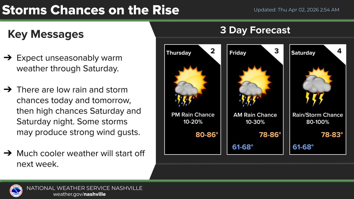
There are low rain and storm chances tonight and early Friday, but the main event is going to be a cold front that sweeps across Middle Tennessee Saturday afternoon and evening. This is going to be the main period for active weather. Fortunately, the severe weather risk is low.
Begin the day with a friendly voice. It's going to be a terrific Tuesday temperatures not deviating from the norm. So it's not a far cry from the weather we thought we'd inherit this time of year. (And high pressure means ceiling unlimited for you aviators out there.)
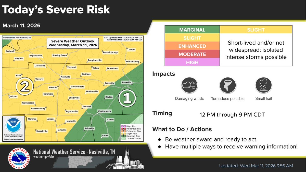
Let's talk today's severe threat. Some things have changed, but most have stayed the same.
The entirety of Middle Tennessee is still in a slight risk (level 2 out of 5) for severe weather today. Main hazards are still...
💨 Damaging Winds
🌪️ Tornadoes
🧊 Small Hail
Very nice weather in store for Friday. Rain returns this weekend, but no severe weather is expected. 1-2" of rain looks likely areawide through Sunday. Above-normal temperatures return next week with the 70s making a comeback.