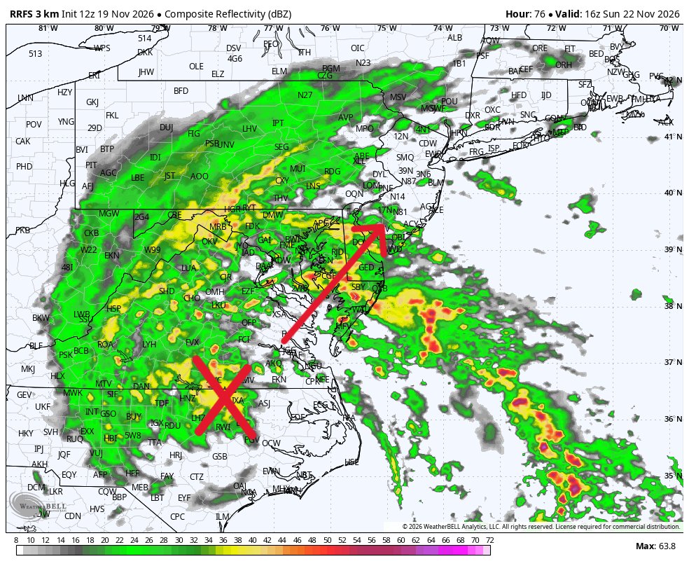
Latest run (12z) of the RRFS brings the weekend Hybrid Howler inland and gets Baltimore into the rain on Sunday. 👇 More and more likely the AI modeling is going to be correct on this one. Something to keep in mind for longer range forecasting in the winter months. Stay tuned...
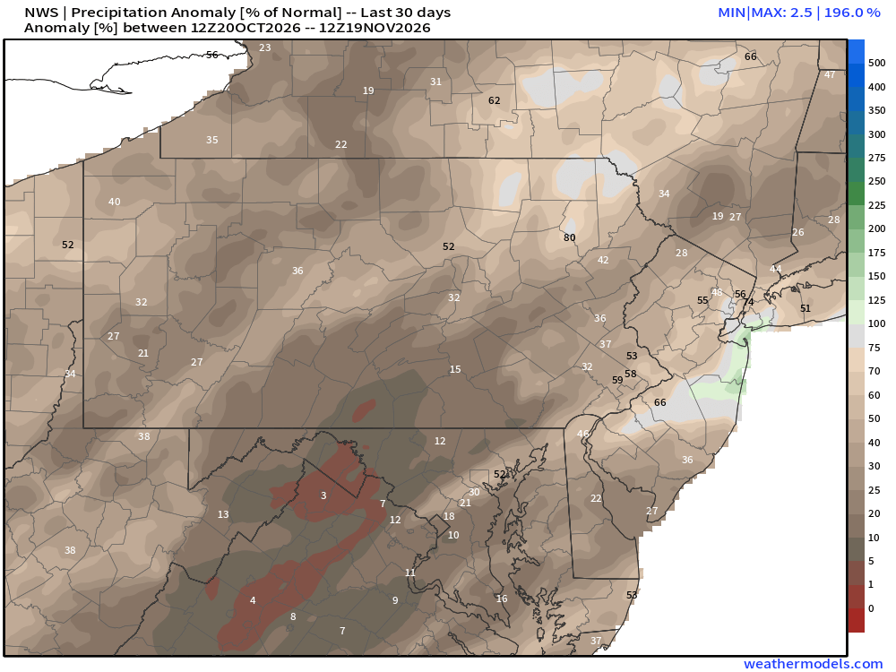
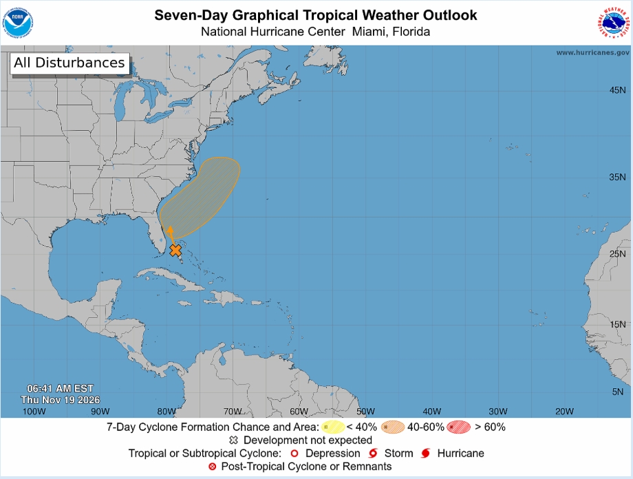
In the modern satellite era (60 years) there have only been two hurricane seasons with 2 or fewer hurricanes in the Atlantic basin: 1982 (2) & 2013 (2). Only one so far in 2026. And let's just assume the coastal low this weekend does not become a hurricane. 👇 Both following winters were snowy for Baltimore: 1982 (35.6"), 2013 (39"). If 2026 ends up in the same category, does that mean a snowy winter? Well, correlation is not always causation. But sometimes it is. 😁 Stay tuned...❄️🚂
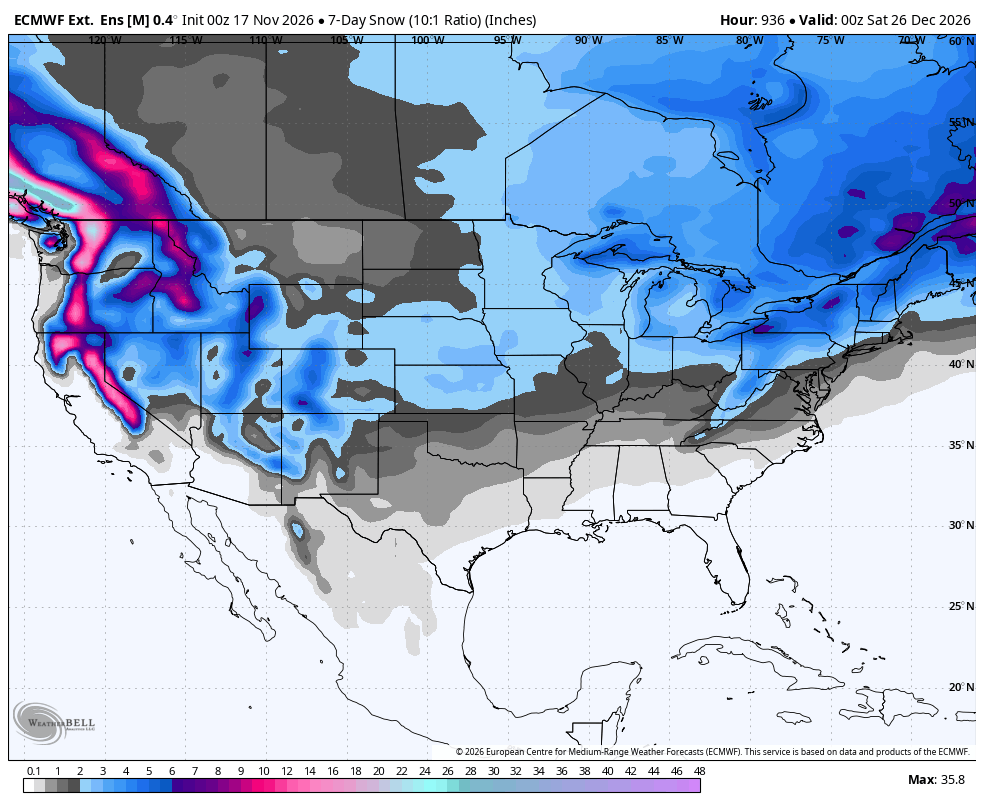
The new November snowfall forecast for Winter 2026/2027 shows more snow across a large part of the United States, from the West and the Plains to the Mid-Atlantic and the Northeast, compared to the last forecast.
Most of Europe still looks low on snow this winter, except in the far north and northeast, and at higher elevations with lower temperatures.
The latest data also gives a first look at Christmas week, showing where fresh snow is most likely across Europe, the U.S., and Canada. It’s very early, so we use it as a first trend look.
https://t.co/xt5C9vINdm
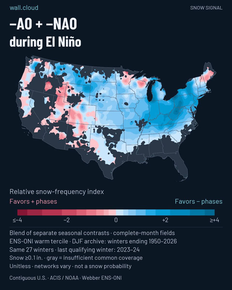
If you take into account the ENSO, AAM, AO, etc… we start to see 2002 creep up to the top of our list for the start of December. Not a particularly large sample size, but an elevated global wind state and a strong El Nino keeps the list small.
Focus on the track here, not the specific inches / anomaly. At the very least, this will be our first potential for flakes in my opinion. Why is the EPO not being plotted here? Right now we are favoring it to average out closer to zero but will need to monitor.
For those forecasting for the weekend, I think the Euro operational model is "out to lunch". 😁 It's doing some strange "fujiwara" thing. The Euro AI, GFS AI and the Google Deep Mind have Baltimore in the rain Sunday. Stay the course...
Pattern Turning Much More Active !!
(1) Multiple coastal systems possible through Thanksgiving weekend. Storm 1 is this weekend which I just touched on (see prior post).
(2) A shot of cold air will push into the northeastern US by Tuesday of next week. A strong system is possible for Wednesday into Thanksgiving day. Some of this cold air may result in wintry precip for inland areas, but the system looks generally to warm for anything substantial as of right now with no 50/50 low locking in the cold air.
(3) A third system for Saturday into Sunday of Thanksgiving weekend. This system looks to be primarily rain as well. The cold air will try to build in behind this system with increased snow potential for the first two weeks of December.
#EcWx
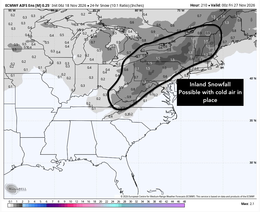
**Long Range Speculation: I would watch 1st week of Dec for first east coast winter threat**
If we get a storm system Thanksgiving weekend (pic1) that helps usher in the first real cold of season (pic2). If block stays in place that cold can lock ahead of potential powerful southern stream energy ejecting towards Northeast.
Will be watching this closely and be commenting more if It gains more merit
Chilly through the weekend but another warm up is expected next week here in the DC region. Middle to upper 60s expected later next week through next weekend as well.
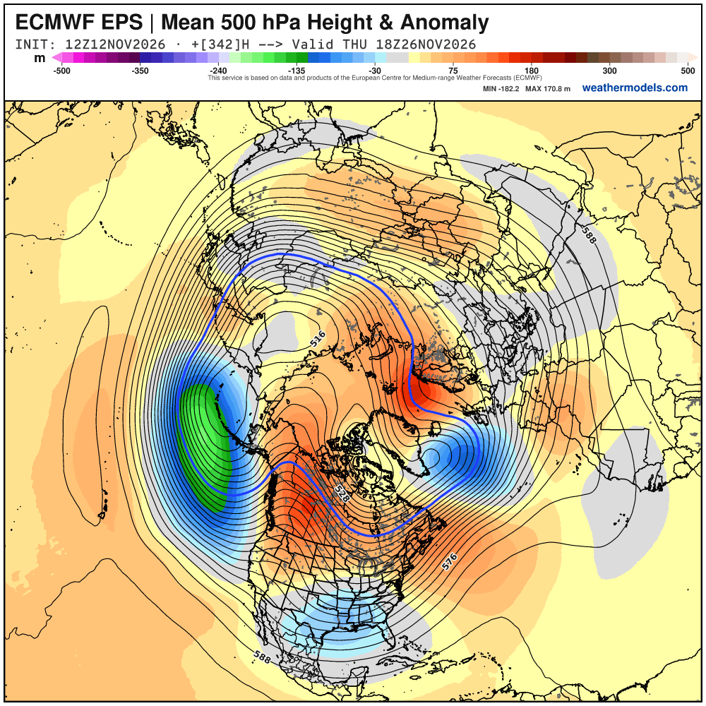
Next stronger cold outbreak then continues to look like right around Thanksgiving. What's too hard to say at this stage is...
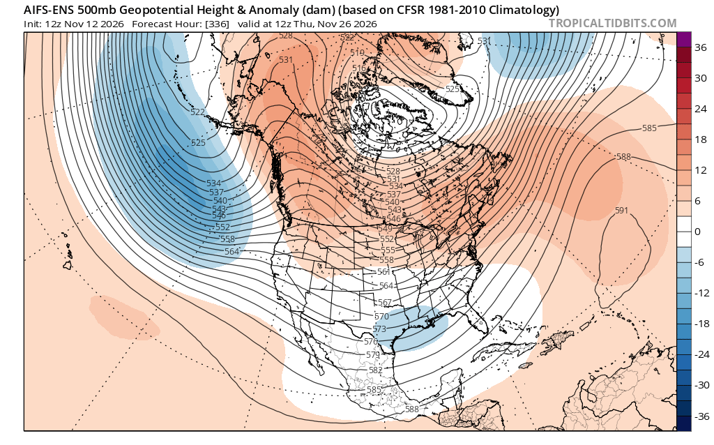
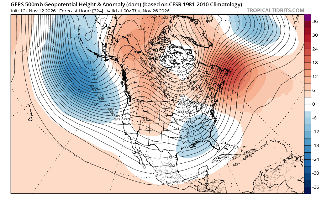
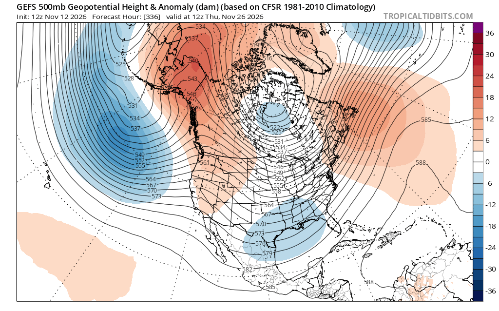
(1) - Intensity. Details on the strength, location, and duration of the Alaska/Canada ridge spike matter here, as well as if there is any Pacific-North American (+PNA) component.
(2) - Duration. Most models agree on cold but the polar vortex is forecast to start regaining strength around this time as well. You can see the TPV mostly locked up to the polar latitudes, as least out of the AIFS. Still a strong Pacific jet signal as well, which would continue to flood the Lower 48 with "milder" (still cool to chilly, just maritime air mass compared to sustained, land/ice driven polar cold) air from time to time suggesting stronger cold pushes may be hard to sustain for too long. (see tweet 2 below)
(3) - Strom. Certainly a storm signal on the AIFS (as least for interior/northern areas) and I would suspect that just about every stronger cold push this season come with a storm threat, so expecting a busy season in that regard. But who gets snow and who gets rain will have to be worked out. We're talking an 11-15 day pattern here. As we saw with the storm this week, upper-level features will still shift, and surface features will follow suit as we get closer. Don't buy surface storm tracks shown at this range, though I'll show this run below for context. (see tweet 3 below)
Now... looking more long range:
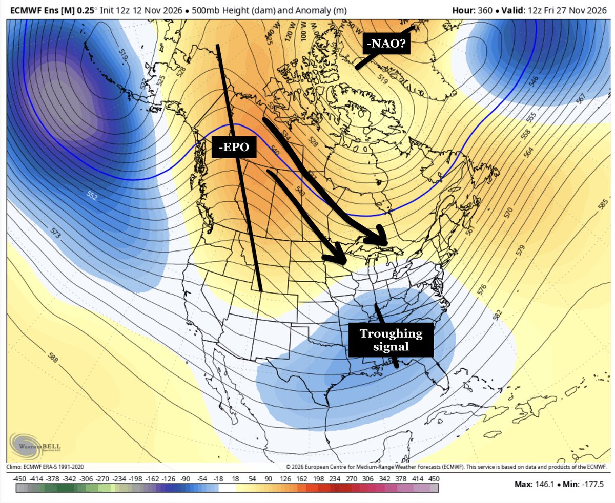
(1) A warmup is expected with above average temperatures with a strong ridge for the end of the upcoming week. A southwest flow will lead to positive height anomalies over the eastern US.
(2) The pattern will likely change Thanksgiving week as a -EPO develops, pushing colder air south.
(3) A troughing signal develops over the southern US. We'll have to wait & see if this is able to interact with the cold air pushed southward from the Alaskan ridge.
(4) I'm watching for a 2 week opportunity (Nov 28-Dec 12) for a potential impactful snow event somewhere across the Great Lakes/Mid-Atlantic/Northeast US.
#EcWx
The U.S. looks poised to get a real taste of stormy, El Niño-fueled weather into December.
The Madden-Julian Oscillation, a pulse of tropical thunderstorms that travels around the globe, will move across the Pacific and reinforce the already active pattern.
Did someone order Turkey on ice? The models are in agreement on a an interesting pattern for Thanksgiving that is favorable for an East Coast snowstorm. I admit more what if than a real risk for now but I'd be excited to this pattern in a month! Consistent with influence of #SSW
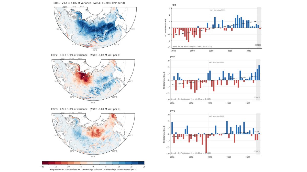
@HamoudaMosti & I computed the patterns of October Eurasian #snow cover extent. The dominant one is a continent wide snow cover that is increasing. The second is a dipole with more snow in East Asia but less snow in West Asia, that is getting stronger with 2026 the highest value.
This El Niño winter may feature more than twice the normal amount of strong East Coast storms, with 19 forecast compared to a normal of 9 by ECMWF.
That's going to leave a mark, with more frequent risks for coastal and freshwater flooding, strong winds and inland snow.
Weather models are run 6-weeks into the future with "ensembles" solutions tend to smooth/average out in space and time. You get a "best guess" of the snowfall at every location (the ensemble mean is not a solution).
Through Christmas -- I see great things for us all!
The Winter storm of December 2009!
I imagine this storm is a locked in core memory for many people.
This Winter storm rolled in the weekend before Christmas. Kids were just let out for Christmas break. You got a massive snowstorm moving in. I imagine the vibes were absolutely beautiful. This is a dream scenario for me. Many got to live it out almost 17 years ago!