Here is a look at the wind gusts expected outside of thunderstorms over the next 36 hours. Gusty winds are still expected into the day on Thu after the initial line of t-storms move through. A Wind Advisory has been issued for E. Tucker County for 46 to 50 mph winds expected.
Numerous showers and non-severe thunderstorms are moving from eastern OH into Western PA late this evening. As a strong low pressure approaches and the core of the low level jet nears, expect sustained winds and wind gusts to increase through the night. #pawx#ohwx
Allegheny Center. 700 Arch Street - The Aviary. Caller said that two dudes are standing around and staring at people. PD found two Tai Chi students practicing holding poses.
@BillNavari This is McConway & Torley LLC foundry in the Lower Lawrenceville neighborhood is the last steel manufacturer operating within the Pittsburgh city limits
NEW: According to PennDOT, the message boards on the Parkway East are offline due to "theft and vandalism" of the fiber optic cable. https://t.co/pqgdGOI9g9
Right now, there is a 60% chance of a severe thunderstorm watch being issued for our area. As the ingredients continue to come together, I would expect some gusty thunderstorms. The cumulus clouds are already starting to tower, so make sure you are aware of your weather surrounding this afternoon!
It's no wonder that so many young Americans have learned to hate their country. They were taught that we don't have a shared story and that America is divided. Our churches and social clubs have emptied out. Social media, which was advertised as a tool to bring us together, did the exact opposite. And they're soaking in hostile propaganda 8 hours a day from the phones in their pockets.
Our kids are going to search for belonging no matter what we do. And there are plenty of voices out there offering a finished identity: 'THIS is what you believe. THIS is who YOU are.' So, what are we offering instead?
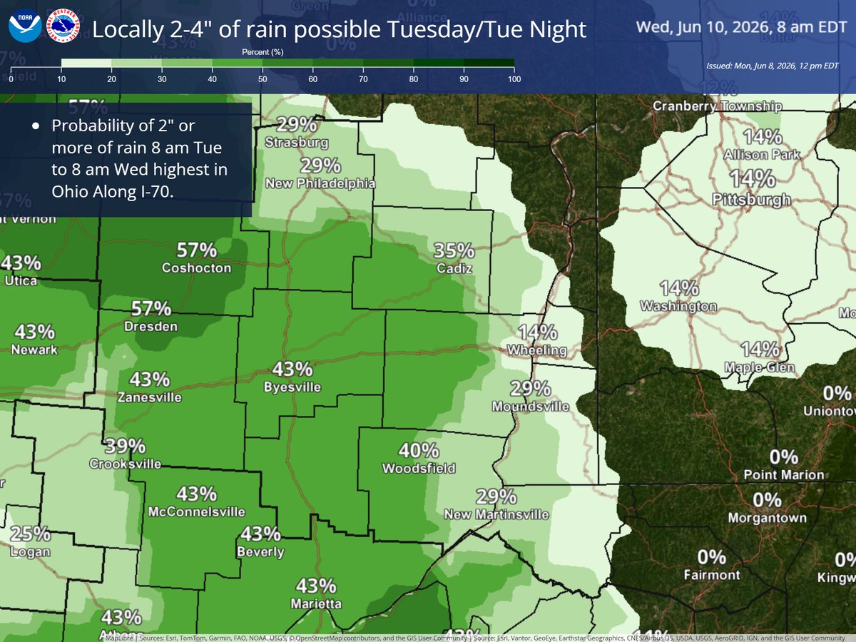
A warm and humid airmass moving into the upper Ohio River Valley Tuesday and Tuesday night has potential to produce spotty very heavy rainfall in a short period of time.
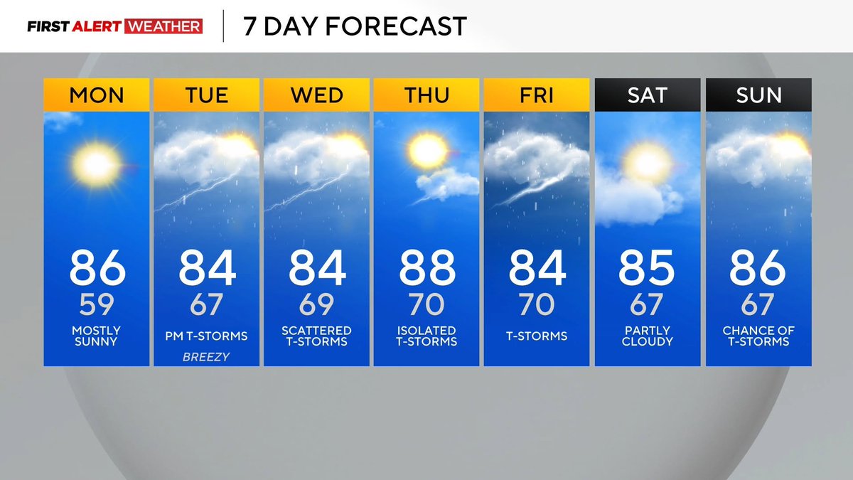
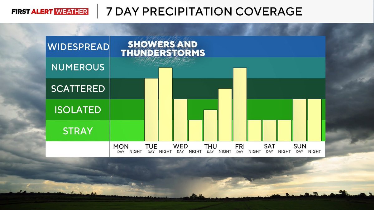
06-07-2026 PM WEATHER
#pawx#wvwx#ohwx
-Dry and warm start to the week.
-Humid air returns Tuesday with afternoon/evening rain & t-storms.
-Slightly lower rain chances Wednesday and Thursday.
-Stronger system arrives Friday.
-Unsettled/stormy pattern likely into mid-June.
If yinz have outdoor plans, be weather aware this afternoon. There is a line of showers and storms moving our direction. What can you expect:
🌩️
🌧️
Remember if you see a flash take a dash! Get to shelter immediately.
Don't let a quick passing shower dampen your Saturday plans, the ☀️ will come out for a short period midday. Stay weather aware this afternoon and early evening for ⛈️.
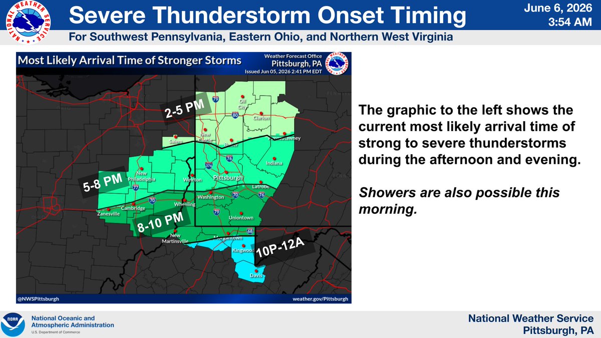
Little change in the forecast for strong to severe storms this afternoon/evening. The primary threat is damaging wind & large hail. An isolated tornado cannot be ruled out. There is still some uncertainty in the exact timing at specific locations as 1-2 rounds move through.


![Trey_KDKAWx's tweet photo. PBZ issues Tornado Warning [tornado: RADAR INDICATED, hail: <1.00 IN] for Beaver [PA] till 5:45 PM EDT https://t.co/oCmxG46ixf https://t.co/lFr8cEX3TS](https://pbs.twimg.com/media/HKze-b0XcAAZx1y.png)