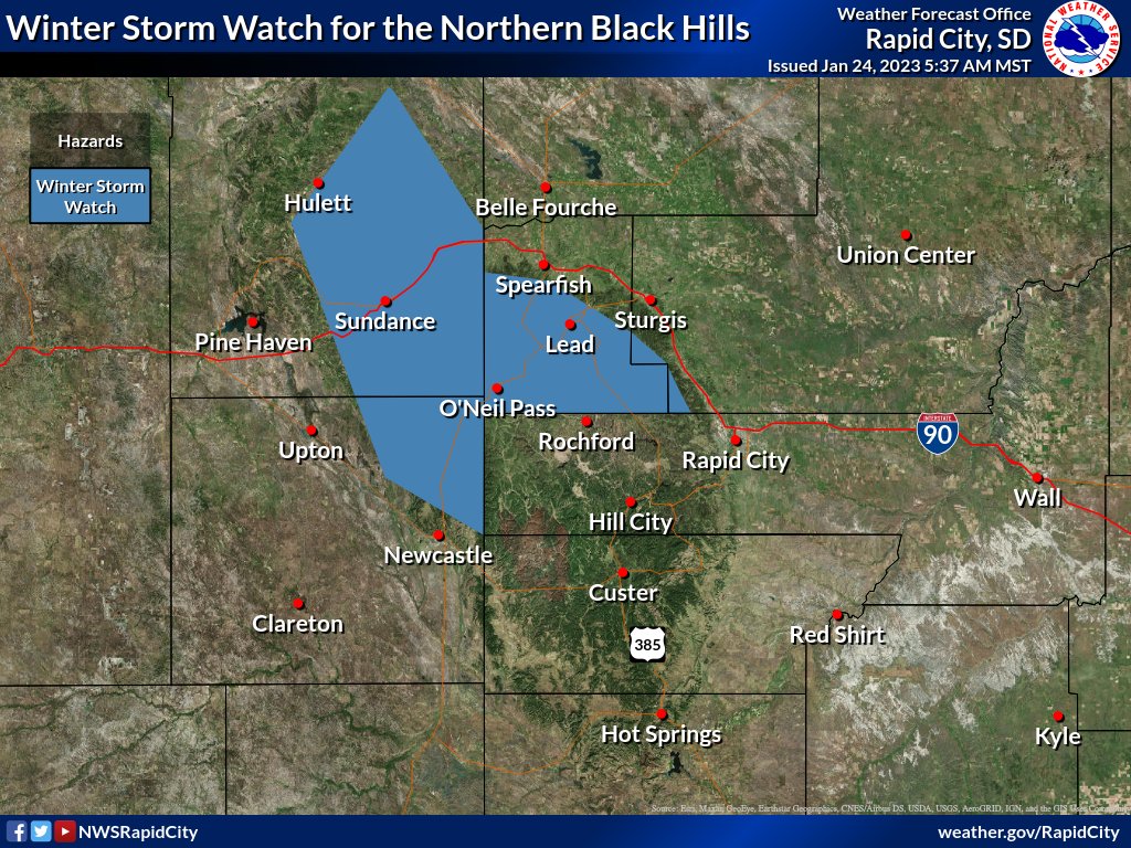
Long duration snow event still on track through this weekend. A Winter Storm Watch has been issued for the northern BH and the Bear Lodge Mtns tonight through Wednesday where 6+" of snow can be expected. Total snow through Sunday could be 1-2 ft in the northern BH. #sdwx#wywx
We're happy to present our 5th Annual Shareholders Report, Rain or Shine 2022. See what we've been up to the past year! https://t.co/CkRvoUw43r #sdwx#wywx
Yet another example of how real this blizzard was for folks. After 4 days, their horses were found and they had to walk bags of hay to them. Photo courtesy of Kelly Hunter near Swett, SD, taken atop a 10 foot snow drift. #sdwx
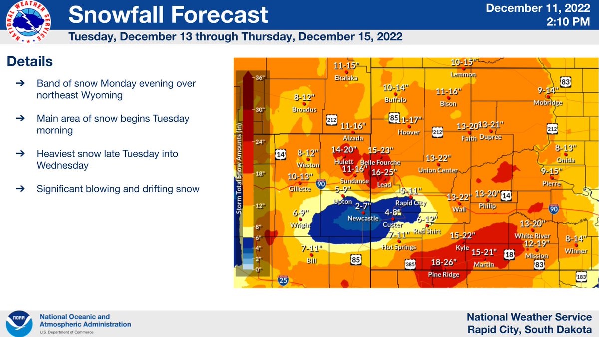
Winter storm could arrive as early as Mon evening, however the heavier snowfall should be on Tues and Weds. Some areas of west and central SD could see precipitation start out as freezing drizzle. Travel could become hazardous to impossible especially Tues-Thurs. #sdwx#wywx
Cold Air funnels captured just South of Rapid City, SD Thursday morning around 9:30 AM by Frank and Carol Foster of Hot Springs. Happy December 1st! @NWSRapidCity#sdwx
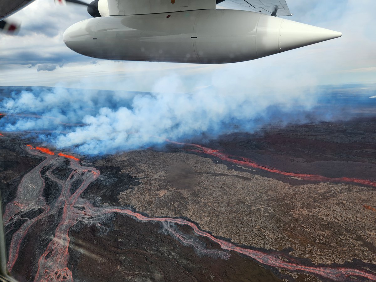
You probably heard the Mauna Loa volcano is erupting, but you may not have heard that we have a NOAA Mauna Loa Observatory located on the north side of the volcano!!!
Lava has crossed the access road & power lines, cutting off access to the site. All NOAA staff are safe! (1/2)
11/18/2022: Record low shattered at the Rapid City Regional Airport. The temperature dropped to -9F this morning, which breaks the old record of -2F set in 2014. #SDwx#RapidCity#Cold#Brrr#Record
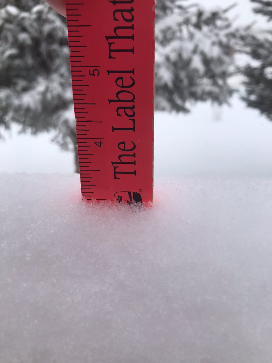
11/15/2022 5pm: 6.7" of cotton candy snow for the day at the NWS office in Rapid City. 0.18" liquid equivalent. 37:1 ratio! The snow depth was 6", but will likely quickly settle overnight into Wednesday. #SDwx#RapidCity
11/14/2022 445 PM MT Road Conditions: Slick roads noted over the higher terrain of the Black Hills. If you encounter slick roads, take it easy. Slow down. #SDwx#WYwx Images courtesy @SouthDakotaDOT @WYDOT_Northeast