Happy to be opening our #GISDay event at @UBishops. Thank you to everyone who has come out to learn more about the importance of Geography and the innovative geospatial solutions we are sharing.
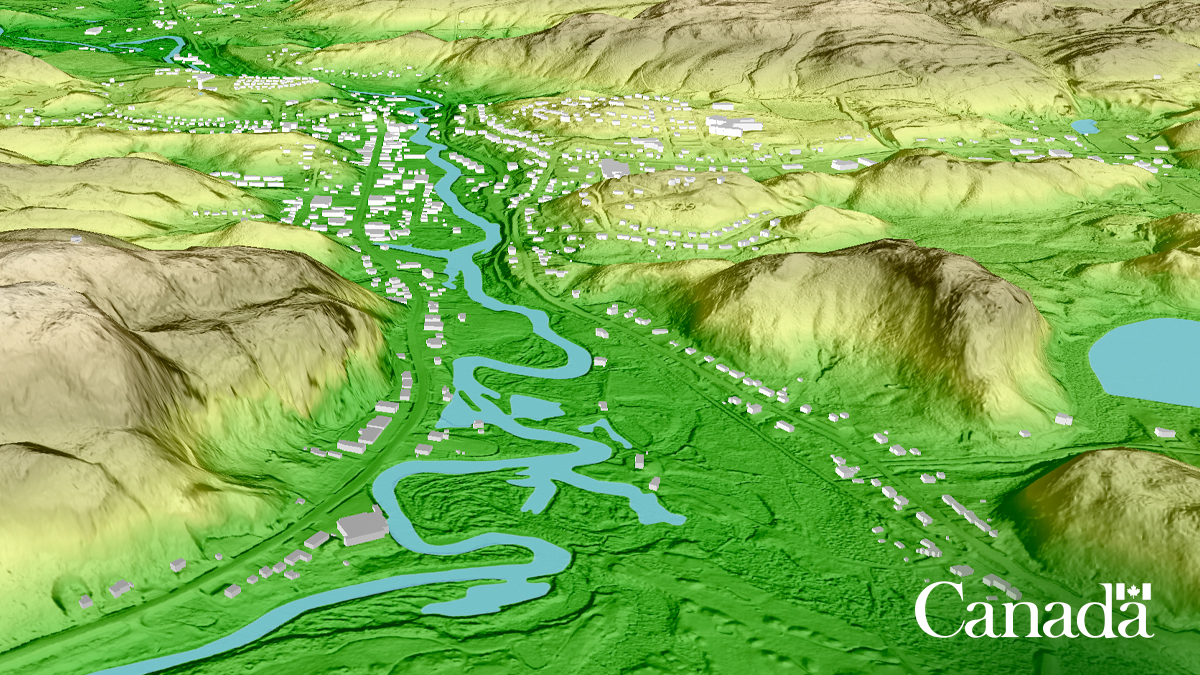
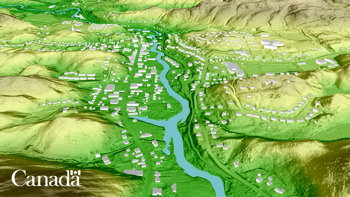
I am very proud of the work of the National Elevation Data Strategy which has enabled the integration of more than 1M km2 of LiDAR data into elevation products. Thank you to all partners!
We’ve achieved a sky-high milestone!
New LiDAR-derived elevation datasets have been updated, covering over a million square kilometres. This area covers 36.6M Canadians – that’s 92% of the population!
Learn more: https://t.co/xsxD0CsNsw
#OpenData
Happy to announce that you can now use OpenTopography tools to compute topographic change on overlapping datasets in the USGS #3DEP & NOAA Coastal Lidar collections. Dynamically compute landscape change for ~20% of CONUS w/ publicly available #lidar in OT: https://t.co/IyAVmdWCEN
Happy to be participating @UNGGIMAmericas. Yesterday I presented on #AI-based On-demand #Mapping: A Future for Collaboration 🇨🇦🇺🇳 @NRCan
Heureux de participer! Hier, j'ai fait une présentation sur la #cartographie à la demande basée sur #IA:Un avenir pour la collaboration🇨🇦🇺🇳
#LiDARHD | De nouvelles données classées sont accessibles en #Opendata. Elles couvrent une partie des régions PACA, Occitanie, Auvergne Rhône-Alpes, Bourgogne Franche-Comté, Corse, Grand-Est.
#FTAP#FranceRelance
🌐Découvrez-les sur https://t.co/sqbiM8v1Df
Dernières images satellite Sentinel disponibles pour des feux au Québec
Last available Sentinel images of fires in Quebec
⬇️⬇️⬇️ 03/06/2023 Sentinel-3
🧵 for more detailed images of the three zones
Everyone meet Charlotte! She is one of the many women working in #CCMEO supporting science.
Read this thread to learn about the great work her and the Data Cube team in the Geobase Division are doing.
#WomenInSTEM#GeospatialJobs#NRCan
Rencontrez Charlotte ! Elle est l'une des nombreuses femmes qui travaillent au sein du #CCCOT pour soutenir la science.
Lisez ce fil de discussion pour en apprendre davantage sur l'excellent travail qu'elle et l'équipe Data Cube de la division Geobase réalisent.
Je vous invite à vous connecter sur la plateforme SEAO du Gouvernement du Québec pour consulter l'avis d'intérêt de la province pour 2023, incluant des levés #lidar aéroporté topographique et topo-bathymétrique.
Lien vers SEAO: https://t.co/KXyw3YPeq6
I invite you to connect to the Government of Quebec's SEAO platform to consult the province's notice of interest for 2023, including airborne topographic and topo-bathymetric lidar surveys.
Link for SEAO: https://t.co/KXyw3YPeq6
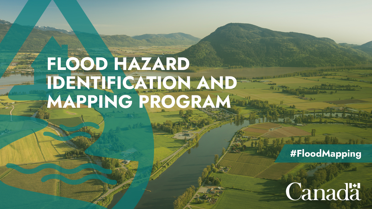
Vous voulez en savoir plus sur l’aide qu’apporte le Programme d’identification et de cartographie des aléas d’inondation aux collectivités pour qu’elles se préparent mieux aux risques d’inondation?
Want to learn how our Flood Hazard Identification and Mapping Program is helping communities better plan and prepare for future flood risks?
Register for our #FloodMapping program webinar on March 15 at 1pm ET to find out: https://t.co/0mJGev9lrB
@CWRA_Flows
Le chargé de projet au #CCCOT Charles
@PapasodoroRNCan était à Denver pour présenter la Stratégie nationale des données d'élévation lors de la conférence Geo Week, dans une session avec l'@USGS. (Article disponible uniquement en anglais) https://t.co/2cNbozZFxI
#CCMEO Project Lead Charles Papasodoro @PapasodoroRNCan was in Denver this week to present National Elevation Data Strategy at the Geo Week conference in a joint session with the
@USGS. More info here: https://t.co/D3AjdVOf4k
L'équipe SGU du #CCCOT a utilisé l'imagerie #RADARSAT-2 pour évaluer les déplacements causés par le #séisme en Turquie et en Syrie. La carte montre un déplacement de plus de 3m le long de la ligne de faille. https://t.co/abvBZLhOkz. Suivez @csa_asc et @DisastersChart.
#CCMEO’s EGS team used #RADARSAT-2 imagery to assess displacement as a result of the #earthquake in Turkey and Syria. The map shows more than 3m displacement along the fault line. https://t.co/abvBZLhOkz. Follow @csa_asc and @DisastersChart for updates.
New #forestry e-lecture series from @CIF_IFC launching next Wed Feb 15, with a focus on @NRCan's 2 Billion Trees program. Come hear from our colleagues and collaborators on this massive national #TreePlanting🌲 effort: https://t.co/PL3IVriZ2P