Radar shown relevant up to 2:30 PM CDT Friday. For current radar trends, please use the Interactive Radar in the KCBD Weather app. Zoom where you want, and you can add alerts - tap on any you see for specific details for that alert. Heavy rain is likely with SOME of the storms.
24-hour rain totals (inches) as of 9 PM CDT Thu:
2.73 Denver City
1.78 Seagraves
1.56 Lesley
1.20 Welch
1.17 Friona
0.69 Post
0.68 Lubbock Air
0.64 Amherst
0.57 Earth
0.51 Tahoka
Full list on my Fb page "Steve Divine KCBD"
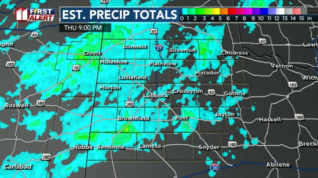
📷 Doppler est. 24 hour rainfall as of 9 PM CDT Thu
Rain Totals (in inches) for Tuesday afternoon through Wednesday morning (June 2 - 3):
2.29 Brownfield
1.64 White River Lake
1.29 Happy
1.27 Gail
1.23 Welch
1.22 Hart
1.13 Lamesa
1.10 Lubbock SW
The full list, too long for X, is on my Fb (Steve Divine KCBD)
The number of TT Mesonet stations has grown so large that the manual process to post a meaningful list is now very time-consuming. I may experiment with AI to see it the process can be automated or significantly shortened.
Here are the sources I use for rain reports.
Lubbock Daily Almanac:
https://t.co/kae5lQXnPv
24 hour Mesonet totals:
https://t.co/FPN8D5zKdd
96 hour Mesonet totals:
https://t.co/qtpjpaBLlX
Few strong storms in the Lubbock area, some may become severe.
SEVERE THUNDERSTORM WARNING UNTIL 615 PM WESTERN DICKENS & EASTERN CROSBY COUNTIES. At 557 PM a severe storm was 7 miles NE of White River Lake, nearly stationary.
HAZARD...70 mph wind gusts and quarter size hail.
A hot and dry weekend with very little chance of a cooling shower. Very little chance. Here's a look at the weekend heat and our next significant chance of rain.
9:15 PM CDT UPDATE: The SEVERE THUNDERSTORM WATCH remains in effect for just two KCBD/FOX34 counties: Briscoe and Hall counties in the northeastern viewing area.
The SEVERE THUNDERSTORM WATCH is canceled for the KCBD/FOX34 viewing area, except for Briscoe and Hall counties (northeastern viewing area) and Dawson, Borden, and Scurry counties (the southeastern viewing area).
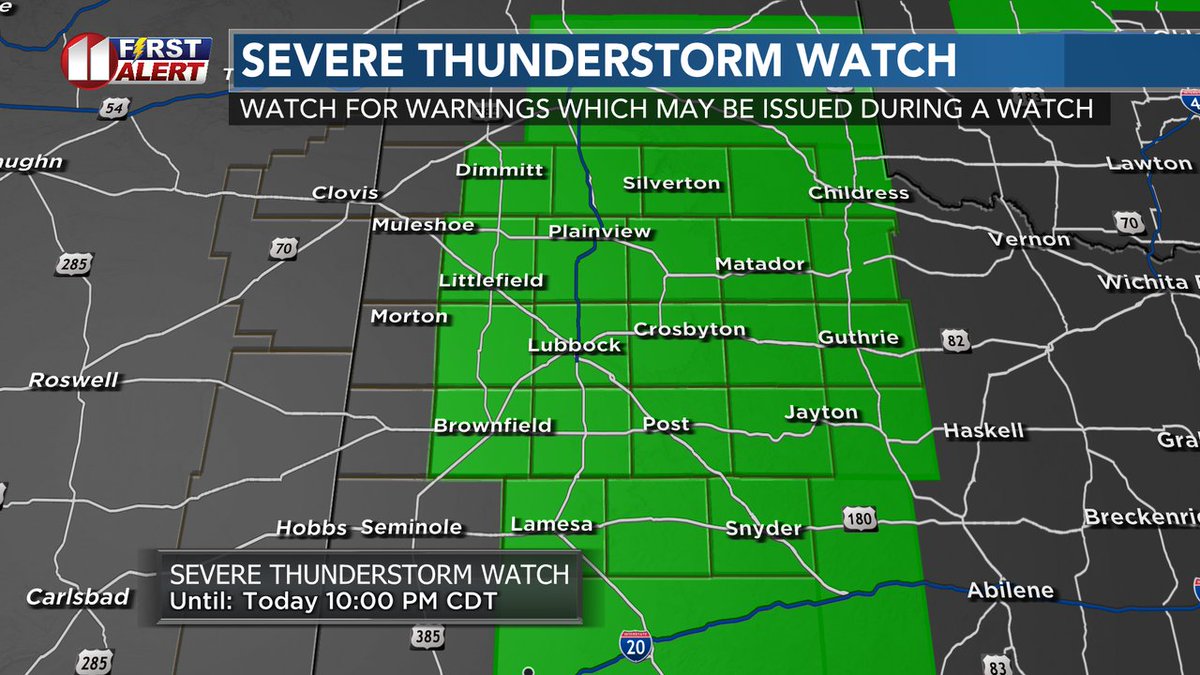
A SEVERE THUNDERSTORM WATCH is in effect for all but the western KCBD/FOX34 viewing area until 10 PM CDT. Watch/listen for warnings which may be issued. The main threat is damaging very large hail and damaging wind gusts.
Strong outflow boundary speeding toward the Portales and Clovis areas. Estimated arrival times indicated in the box. Again, those are estimates. Gusts near 50 mph and blowing dust possible.
A few strong storms could bring limited heavy rain, hail, and gusty winds to parts of the KCBD/FOX34 viewing area this evening. The threat drops off significantly until late Friday, when another chance of storms arrives.
Reminder: You can track any storm or shower with the Interactive Radar in the free KCBD Weather app! You have control over the view, move it anywhere and zoom in (or our) - just like you do with pictures.
Warmer and drier - with a slim chance of a late afternoon or evening thundershower - Wednesday and Thursday. An uptick in rain chances is expected Friday.