Speaking of flash drought risk, @NOAA's @NWSCPC has issued a Rapid Onset Drought Risk along the Central/Lower Mississippi River Basin for August 22-28.
Major winter storm hitting Central Plains today! High-impact snow (8+ inches) expected near Joplin/Springfield, with freezing rain down south. Storm marching east toward Mid-Atlantic & Norfolk area bracing for heavy snow tomorrow. Travel disruptions likely across multiple states.
Expected snowfall totals have increased slightly, with highest amounts still expected along the Arkansas/Missouri border within narrow snow bands. Keep an eye on road conditions and be mindful if travelling! #mowx#kswx#ozarkswx
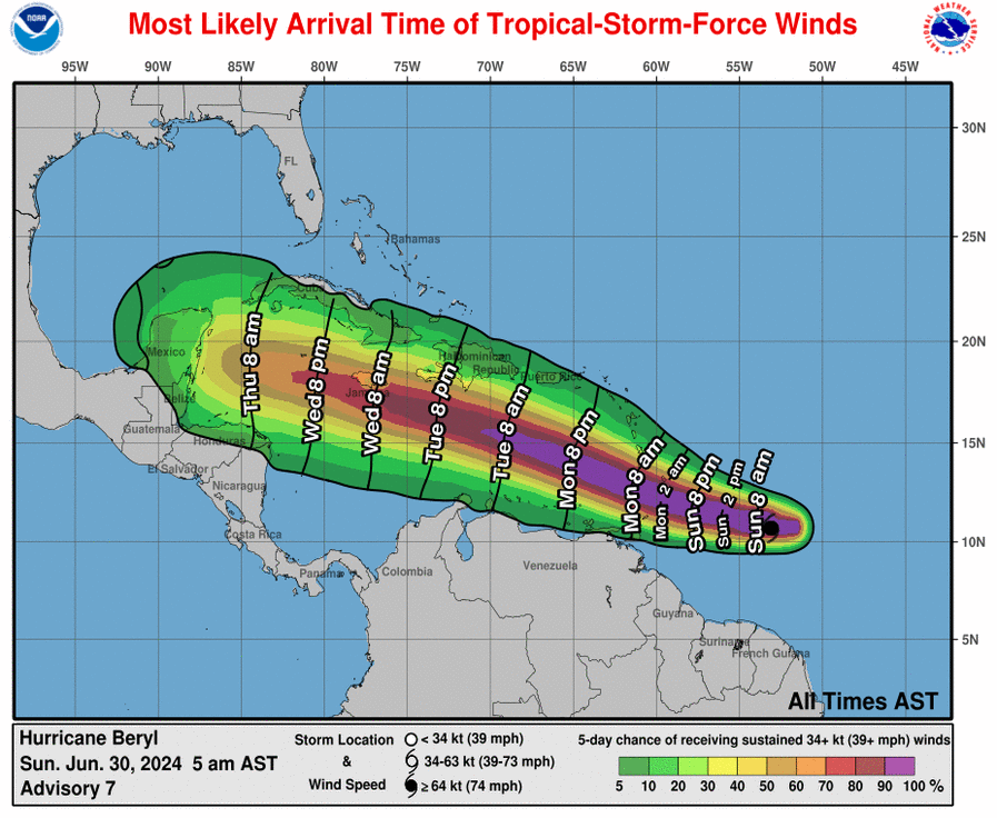
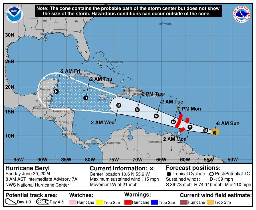
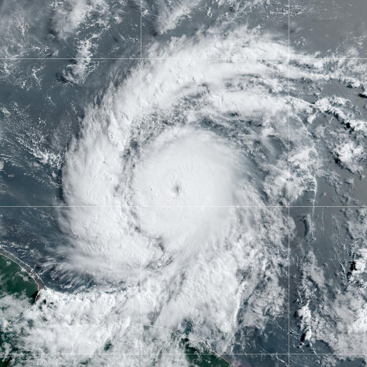
Hurricane #Beryl continues to quickly strengthen this Sunday morning. The storm is now a very dangerous category 3 hurricane with maximum sustained winds of 115 mph. Life-threatening winds and storm surge are expected in portions of the Windward Islands by early Monday. Latest at https://t.co/Wq6ZtKgfeH
⚠️Outbreak of significant severe weather is likely late this afternoon over the Plains!
Strong Tornadoes, giant Hail, and extreme damaging winds possible! Timing is uncertain but the greatest risk mostly after 4 pm and into the late evening. See https://t.co/QMmU4tCxt1 for info.