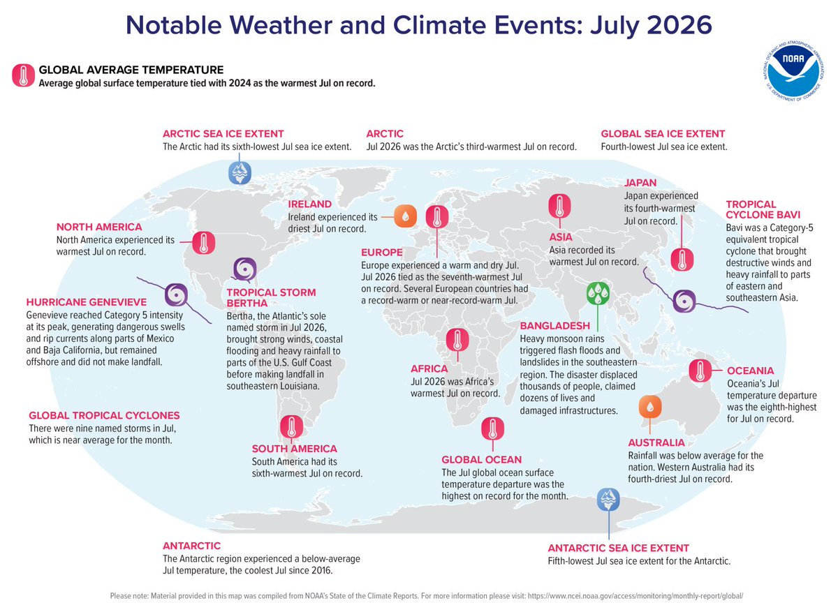
The past month was the joint warmest July on record – tying with July 2024 – according to @NOAA. From record-high temperatures to drought to monsoons and hurricanes, this map illustrates recent weather and climate events around the world.
Read more: https://t.co/HwhJqOvpU2
Sat, Aug. 8 UPDATE: We are now following the potential development of 2 systems in the tropical Atlantic during the upcoming week. The development window is tight due to strong upper-level winds nearby, and the chance for tropical cyclone formation is currently low for both systems.
Continue to monitor trends with us at https://t.co/Wq6ZtKfHp9.
So far, the 2026 Atlantic hurricane season has produced two named storms—Arthur and Bertha—and no hurricanes. Arthur was the season’s first named storm, with both Arthur and Bertha forming over the warm waters of the Gulf of America.
June 3 8AM PDT- The first tropical storm of the Eastern Pacific Hurricane Season has formed #Amanda. Strengthening is expected over the next couple of days, before a weakening trend this weekend.
5/28: GOES-E shows that Saharan dust is reaching the eastern Caribbean Sea. Saharan Air Layer activity usually ramps up in mid-June, peaks from late June to mid-August and begins to rapidly subside after mid-August.
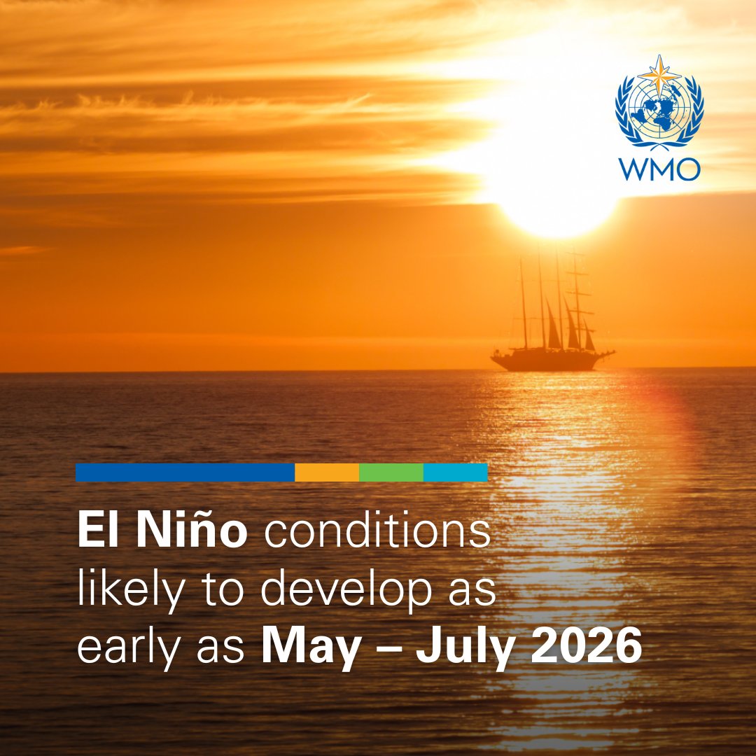
An El Niño will likely arrive later in the year, according to sea level data from Sentinel-6 Michael Freilich. The satellite—which measures the height of the entire ocean every 10 days—captured a swell of warm water hundreds of miles wide in the Pacific Ocean off the coast of South America.
NOAA predicts above-normal eastern and central Pacific hurricane seasons. For more detailed information, visit https://t.co/CTiqpJ64II
For preparedness info, visit https://t.co/JlW83jaVML
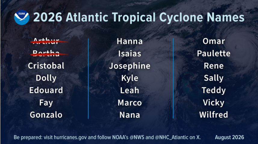
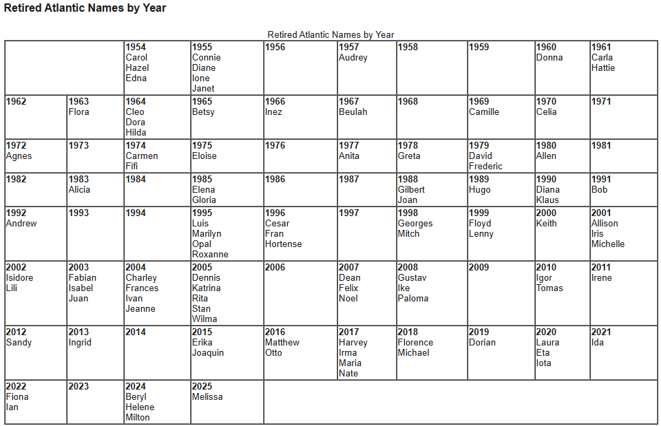
Since 1953, Atlantic tropical storms had been named from lists originated by the National Hurricane Center. They are now maintained and updated by an international committee of the World Meteorological Organization. Here is the full list of names https://t.co/70SCdX7FIB The image below shows the retired names with Melissa recently retired in 2025.
Remember, even if the Atlantic hurricane season ends up being below to near normal, it only takes one storm in your community to make it a bad hurricane season for you. Prepare this year like you would any other!
Rainfall IDF Curves explain how extreme rainfall behaves by predicting:
🌧 How heavy rainfall can be
⏱ How long it may last
📊 How often these events might occur
These insights guide safer, more resilient infrastructure design.
https://t.co/dESke9e4BD
@CaribBank
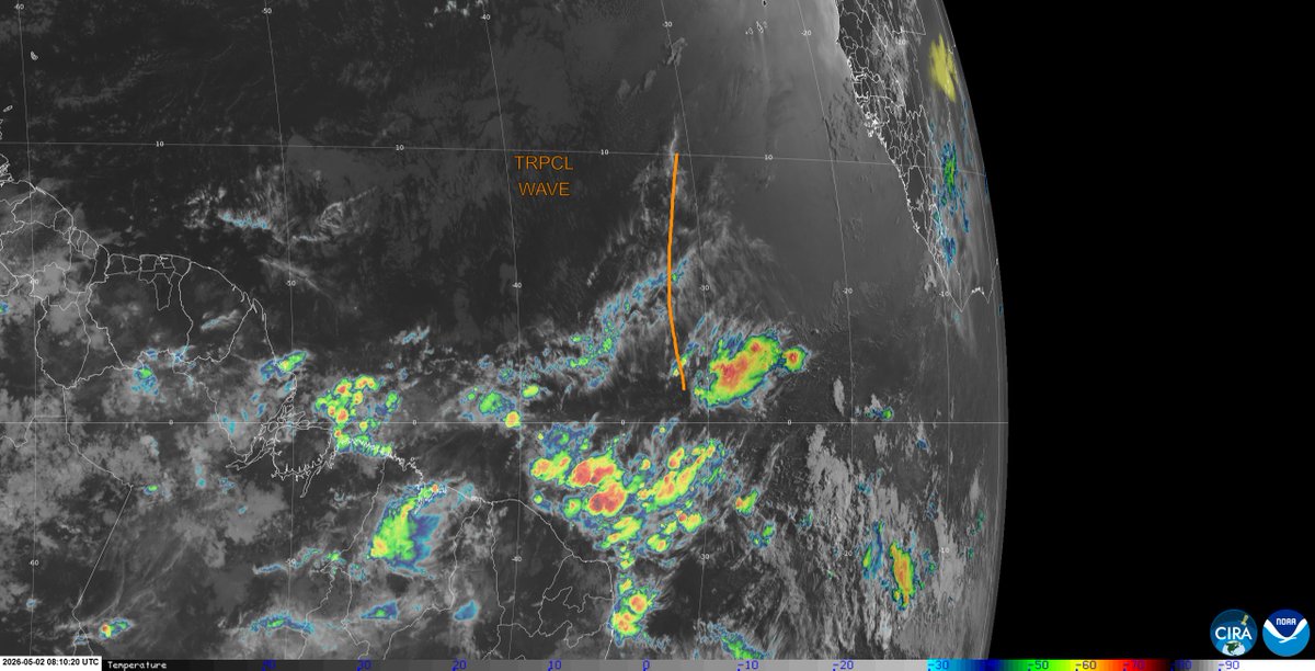
May 2: The 1st tropical wave of the Atlantic hurricane season is along 30°W and moving W at around 20 kt. The wave is embedded within a robust Saharan Air Layer, bringing dry air and a generally hostile environment for development. As a result, deep convection remains limited.
May is the transition period from the Dry Season to the Wet Season. The Wet Season usually runs from June to December, and the Atlantic Hurricane Season begins on June 1 and ends on November 30. #TrinidadandTobago#GetWeatherReady
For the May-June-July season, above-normal land surface temperatures are expected nearly everywhere, esp. over southern North & Central America, the Caribbean, Europe & Northern Africa. Rainfall predictions show strong regional variations.
To the update➡️https://t.co/NYupOnDpRO
CariCOF Dry Spells Outlook for April to June 2026
Expect:
🔥 Frequent short dry spells
⚠️ Increased wildfire risk early in the season
🌧️ Gradual shift to wetter conditions by June
💧 Ongoing drought may intensify in some areas
Read the full outlook 👇
https://t.co/zPzkOJmUVe
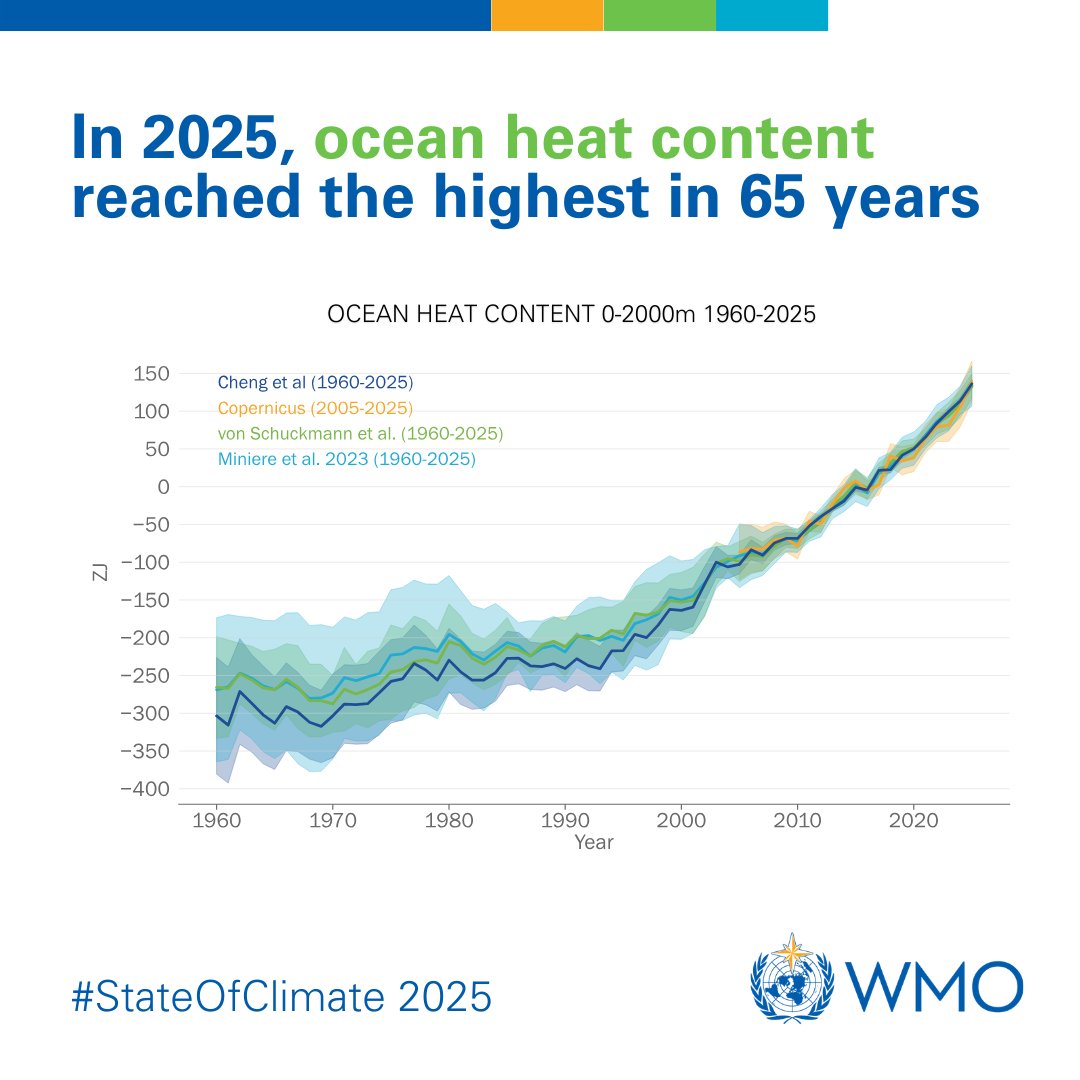
The ocean continued to warm in 2025, reaching record high levels.
It is expected that the ocean will continue to warm well into the future – a change which is irreversible for hundreds to thousands of years.
Check out the #StateOfClimate 2025: https://t.co/THJBFJmvww
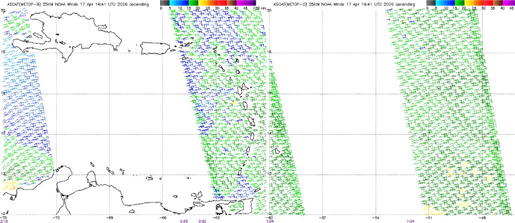
At the surface, the leading edge of a trade-wind #surge, in the form of moderate (green) to fresh (yellow) #winds has reached the eastern Caribbean Sea. These convergent winds are creating instability in the area.