Track Tropical Storm Arthur using the Earth Scan Lab Hurricane Activity Dashboard:
https://t.co/FOW3dMmuxQ
Our Tropical Outlook and Forecast graphics incorporate Water Vapor satellite imagery to give more context on the storm and its environment.
@LSU_CCE@LSU#Arthur
The new Earth Scan Lab website is now live!
Explore Hurricane tracking, Gulf sea surface temperatures, river flood-water monitoring, satellite imagery, and interactive tools showcasing oceanic and atmospheric conditions across the Gulf and beyond.
🌎 https://t.co/gweey2Oure
Join us in congratulating Dr. Walker on her well-deserved retirement. Thanks to @LSU_CCE for the celebration. Her leadership at the Earth Scan Lab and work with @GCOOS1 leaves a lasting impact. We’re proud to carry forward her legacy at ESL.
One year ago today, skies cleared across Louisiana and the Gulf Coast, allowing ESL’s MODIS true-color product to capture the aftermath of a rare and historic winter snowfall across the region. @LSU_CCE#MODIS#LouisanaSnow
“GOES-19 water vapor composite (bands 8, 9, 10) showing Tropical Storm Imelda (AL09) and Hurricane Humberto (AL08). Forecast tracks from the NHC as of Sept 29, 2025. #FLwx#SCwx#NCwx#Hurricane
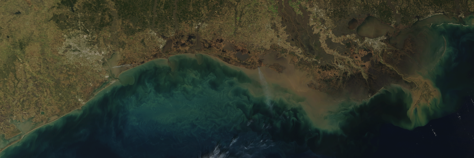
ESL produces true-color satellite images of the entire Gulf of Mexico coastline daily, including southern Louisiana. Check them out here below https://t.co/7L9418GbpY
On January 21, 2025, Louisiana experienced a rare prolonged snowfall event with blizzards and extreme cold temperatures.. This MODIS true-color satellite image was produced at the LSU Earth Scan Laboratory (ESL) from measurements obtained January 22 (10:10 CDT).
Today’s eclipse, as seen from space; specifically the GOES-16 geostationary satellite. It scans this hemisphere view every 10 minutes (!). Here, 3 channels are combined to reproduce RGB color over about 5 hours.
One of the drivers for hurricane intensification in the #GulfofMexico is the Loop Current. The #EarthScanLaboratory at @LSU_Boon captured great satellite images of the current drawing warm Caribbean water into the northern Gulf. Learn more https://t.co/jxRTVr5xdB
“Satellite Sensors Highlight New Loop Current Eddy Detachment” - visit the LSU Earth Scan Laboratory (https://t.co/xoFa75lbIY) for details, images and animations showing the formation of Eddy Zodiac as it detached from the Gulf of Mexico Loop Current.
GOES-16 image shows winter storm "Maya" blanketing the eastern United States with snow, ice, and rain. Forecasters are already talking about "Nadia" (out of view) approaching the west coast, expected to bring more wintery weather. @LSU_CCE@LSUResearch
https://t.co/hlZ6YpvXIc
This CONUS loop from GOES-16 updates every five minutes. At the time of this post, it shows #HurricaneMichael having made landfall.
https://t.co/QNxY10NFaZ
#hurricanemichael2018