🚨 BREAKING: The Strategic Petroleum Reserve has just fallen to its lowest level since August 1983- 340.3mb. That's a 42 yr low. No matter where you stand politically, it's a remarkable statistic: America's emergency oil stockpile hasn't been this depleted since the Reagan era.
⚡️@NWSGrandRapids has recorded 27 thunderstorm days for 2026 through June 14.
That's the most number of thunderstorm days year to date since daily thunderstorm records began in 1903 - over 120 years!
In second place was 2024 with 22 thunderstorm days.
#wmiwx#miwx
Michigan's tornado count is up to 20 after this week.
Usually, Michigan sees only 13-16 in an entire year. Last year was also active with 33 tornadoes in the state.
https://t.co/OZhsOer425
A Tornado Watch is expected to be issued within the hour for much of West Michigan. (June 11, 2026)
_________
This means conditions will be favorable for damaging wind gusts and spin-up tornadoes.
https://t.co/rdAoMz9zt9
A retiring American Airlines pilot received the ceremonial aviation tradition - a water cannon salute this evening at @FlyGRFord 🫡
Video credit: Richard Bennett
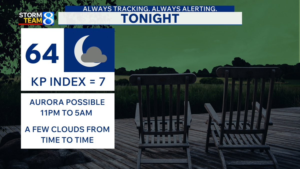
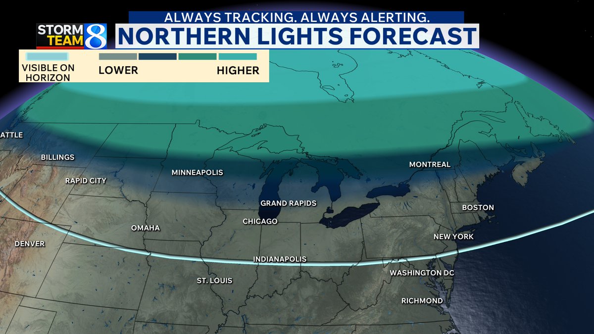
There is an increased chance of seeing the northern lights tonight.
• Best chance is away from city lights
• Astronomical dark = between 11 pm and 5 am
• Be patient! Auroras are rarely on time.
The lack of morning weather balloons launched across the western and central U.S. is having a real, tangible impact on degrading forecast quality.
We can't look at weather balloon data that doesn't exist. We can't pump nonexistent data into models. We can't rely as heavily on models that don't "know" what's happening above our heads.
Today's severe weather forecast is less certain because we don't have weather balloon data to confirm the strength of jet stream winds aloft.
This is extremely frustrating, and is the result of logistical, organizational, political and budgetary decisions.
Anyone ever seen interstate-induced clouds before? Low level CU developed perfectly along major interstates around Houston this morning. Kind of shocking to see such perfectly lined up clouds. #txwx
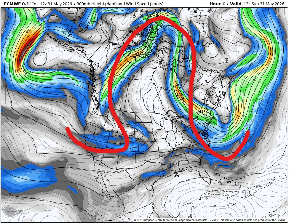
Exceptionally quiet across the contiguous U.S. again today due to an Omega Block. Ω
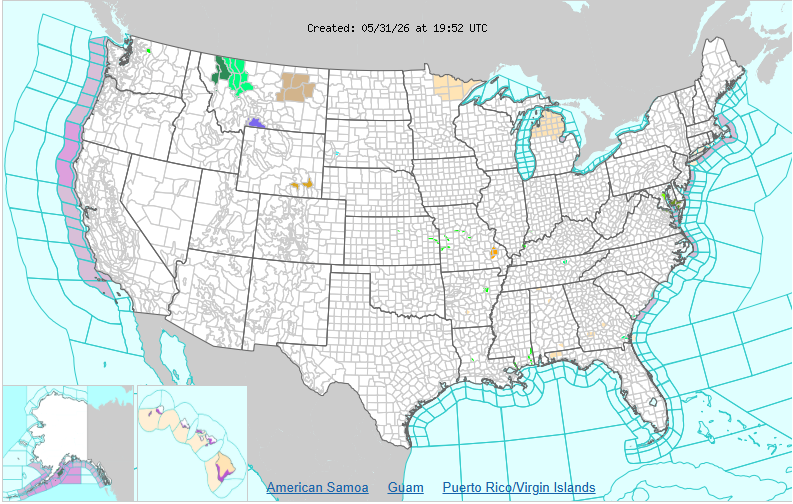
1. Winter Weather Advisory over Beartooth Pass
2. Severe thunderstorm in SW Missouri
3. Wind Warning in two elevated parts of Wyoming
It was a historic winter in the Upper Peninsula of Michigan
🌬️ Ranked as “Extreme” in winter severity index in north-central zones.
❄️ 300”+ snow across Marquette, Houghton, Baraga, Ontonagan, & Keewana Counties.
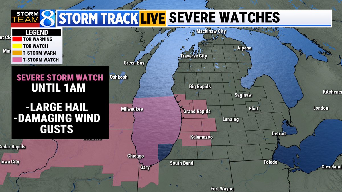
A Severe Thunderstorm Watch has been issued until 1 am for portions of West Michigan.
Threats include the potential for scattered large hail with isolated very large hail (as large as 3 inches). Isolated damaging wind gusts are also possible.
https://t.co/4pwKVWH73d @WOODTV