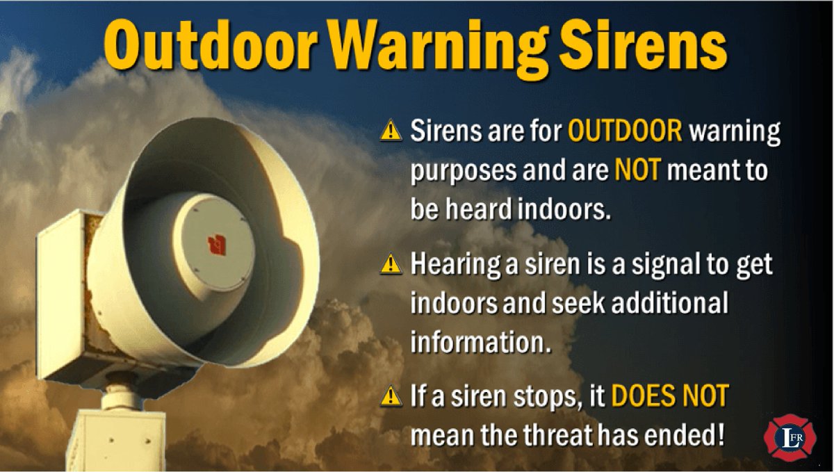
Reminder: Monthly Outdoor Warning Siren Test at Noon Today
The outdoor warning sirens will be activated today, May 2nd, at 12 PM (noon) for the monthly siren test.
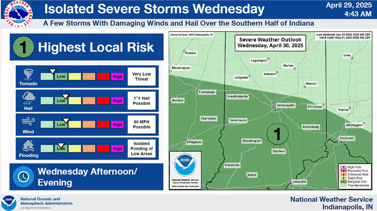
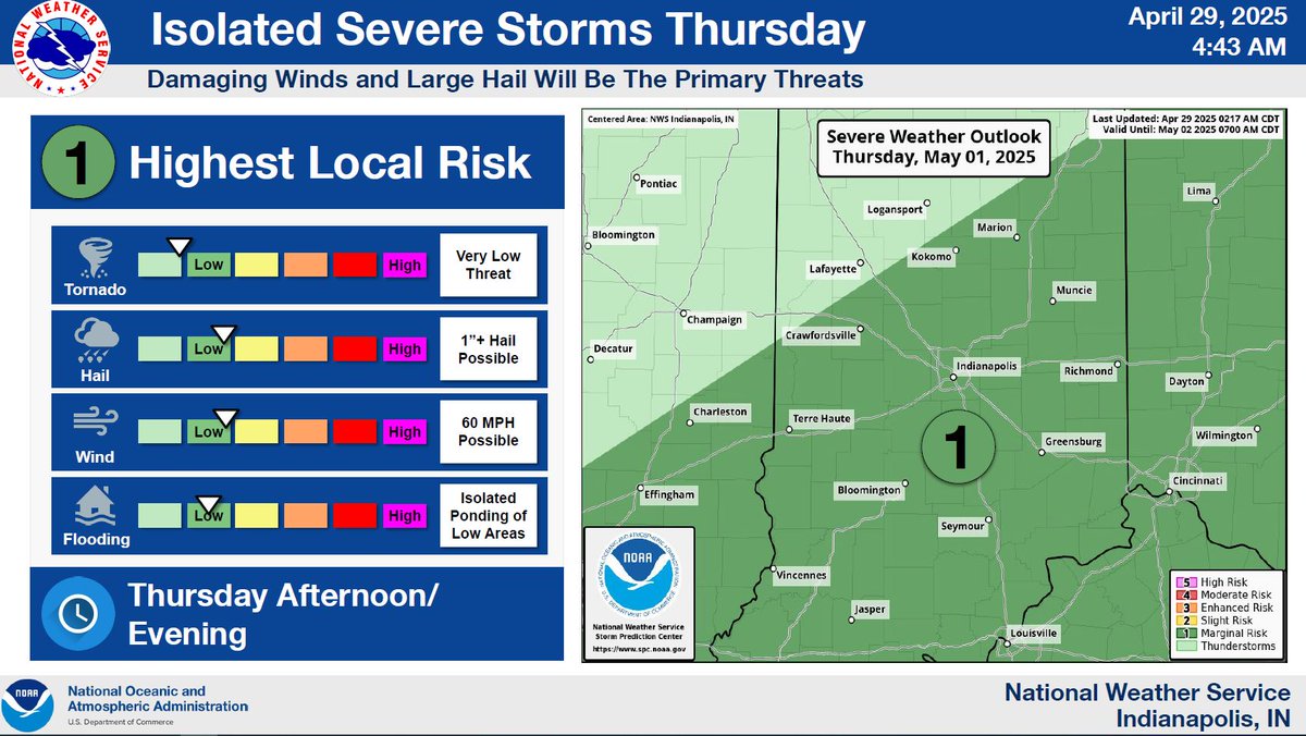
Storms Possible Today and Thursday
The National Weather Service is forecasting scattered strong to severe thunderstorms late this afternoon and evening as well as Thursday afternoon and evening.
Hazards: Damaging winds, hail, and isolated tornadoes are all possible
Today, 4/29: A couple of rounds of storms are possible through this evening. Scattered severe storms may be possible this afternoon through early evening.
Wednesday and Thursday could have some storms that produce damaging winds and hail during the afternoon and evening.
Important Notice from the National Weather Services:
NOAA Weather Radios will be down due to a mandatory system upgrade from Monday, April 28th, through at least Wednesday, April 30.
Have several ways to receive weather alerts!
#MCEMA
From the National Weather Service:
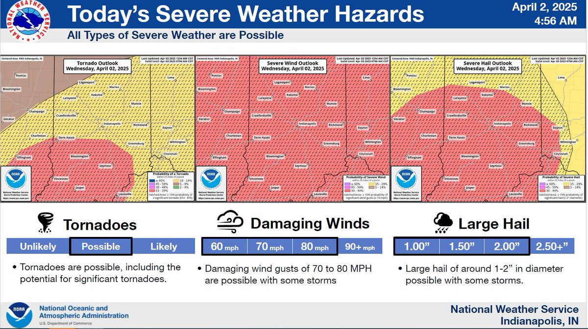
Monroe County is now under a Moderate risk for severe weather for this afternoon and evening (April 2).
Potential Hazards:
- Damaging winds
- Heavy rainfall
- Hail
- All other severe weather hazards, including tornadoes
#MoCoEMA
A Burn Ban has been issued for all of Monroe County due to extreme dry conditions and elevated risk of fire danger.
The ban will go into effect at 2:00 PM on Tuesday, September 17, 2024, and will remain in effect until Tuesday, September 24, 2024.
Monthly Outdoor Warning Siren Test Reminder
Friday, Sept. 6, will be our monthly test of the outdoor warning system.
The outdoor warning sirens will go off at Noon (12 PM) on Friday.
The 7 PM test has been cancelled. In the event of severe weather, the test will be cancelled.
Thunderstorms are possible Tuesday and Wednesday
Monroe County will be under a Marginal risk for severe weather on both Tuesday and Wednesday.
A few storms may become severe. Stay weather-alert.
Our office will provide updates as more information becomes available.
#MoCoEMA
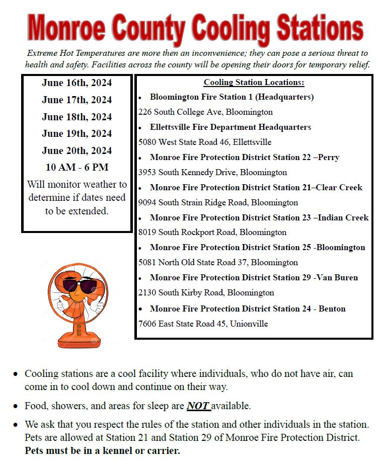
Monroe Cooling Stations Opening
Dates Open: Sunday, June 16h to Thursday, June 20th
Time: 10:00 AM to 6:00 PM each day
Map of Cooling Stations:
https://t.co/HqzCRv0UNF
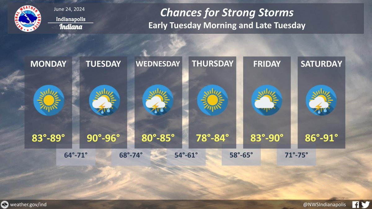
Thunderstorms Possible Late Thursday
A warm-up is coming starting on Thursday with temperatures near 90 degrees.
It will be hot and humid all next week.
Per the National Weather Service, there is high confidence in hot and humid weather for next week.
Are you interested in serving your community during times of need?
Join Monroe County CERT!
Monroe County is hosting a Basic Academy on June 27.
This academy is limited to the first 20 participants who sign up.
More academies are to come in the near future, so stay tuned.
Monthly Outdoor Warning Siren Test Reminder
Tomorrow, Friday, June 7 will be our monthly test of the countywide outdoor warning system.
The countywide Outdoor Warning Sirens will go off at Noon (12 PM) and at 7:00 PM tomorrow.
Severe Weather update:
Monroe County is now under a Marginal risk for severe weather today.
Isolated severe thunderstorms are possible.
Stay weather-alert!
Additional isolated to scattered storms will develop this afternoon and continue into this evening. A few of the storms could become severe late today, especially across southeastern portions of central #inwx. Damaging winds and locally heavy rain are the primary threats.
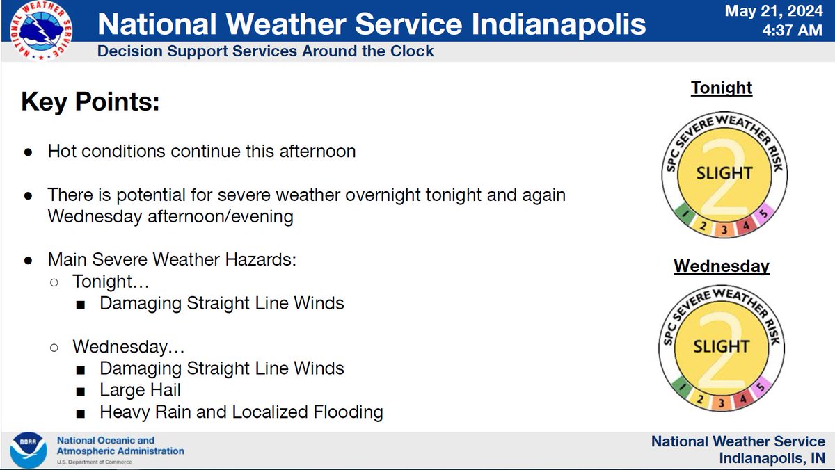
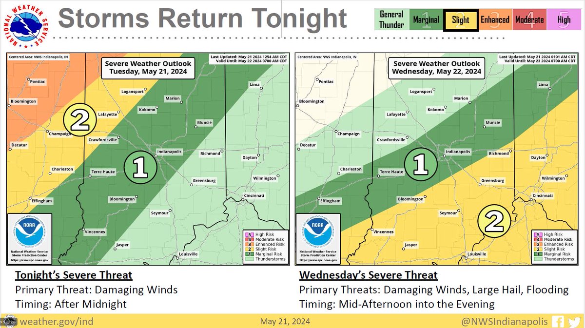
Severe Thunderstorms Possible Tonight and Wednesday
The primary threat for tonight is damaging winds.
Timing for tonight's weather threat is after midnight.
For Wednesday, the primary threats will be damaging winds, hail, and flooding.
Timing: Mid-afternoon into the evening.
Severe Thunderstorms Possible Late Tuesday Night through Wednesday
The National Weather Service has placed Monroe County under a Slight risk for severe weather starting late Tuesday (May 21) evening through Wednesday evening (May 22).
Timing: Tuesday night through Wednesday
Safety Reminder:
Never drive or walk in flood waters. Flood waters can contain contaminants that could become dangerous.
If you can't see the pavement, the best thing to do is to turn around and go a different route.
Showers are possible through the morning, becoming less widespread by the afternoon.
Fog may be possible tonight.
Rain and thunderstorm chances will return late Thursday into Saturday periodically.
Heavy rain will be possible through the overnight with widespread 1-2 inches of rain expected. Locally higher amounts of 3-4 inches could lead to flash flooding where training storms occur. Confidence in the exact location of these higher amounts is low. #inwx