Together with my CNN Climate & Weather colleagues, I'm writing a newsletter (again!), this time a weekly on extreme weather and climate. It's free, and you can sign up here: https://t.co/9L0Cqmsvjw
6 AM Sun: Light precip is spreading into the region. Mainly rain at the onset from around I-78 and south, then precip will become heavier and transition to snow starting late morning and into the afternoon. Snow for most areas by evening. Latest briefing: https://t.co/JiD09By93X
NEW: A significant gap in weather balloon coverage in western Alaska, caused by Trump admin cuts to NOAA/NWS, may have hurt the forecast accuracy for the deadly storm there over the weekend. https://t.co/YpJlfx0VG5
How about *only* hurricane pairings in the Atlantic and for the entire period of record (since 1851). What are the closest two hurricanes have ever been recorded? Humberto and Imelda right at the top. The nearest reliable contender was Easy and Fox back in 1951.
#Humberto has a meso sector on it now. As a strong Category 4, it has a nice, cleared out stadium effect eye. You can even see the low level clouds spinning around in the eye! Always love the views like this
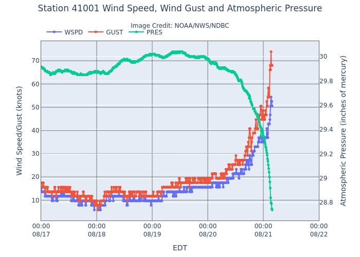
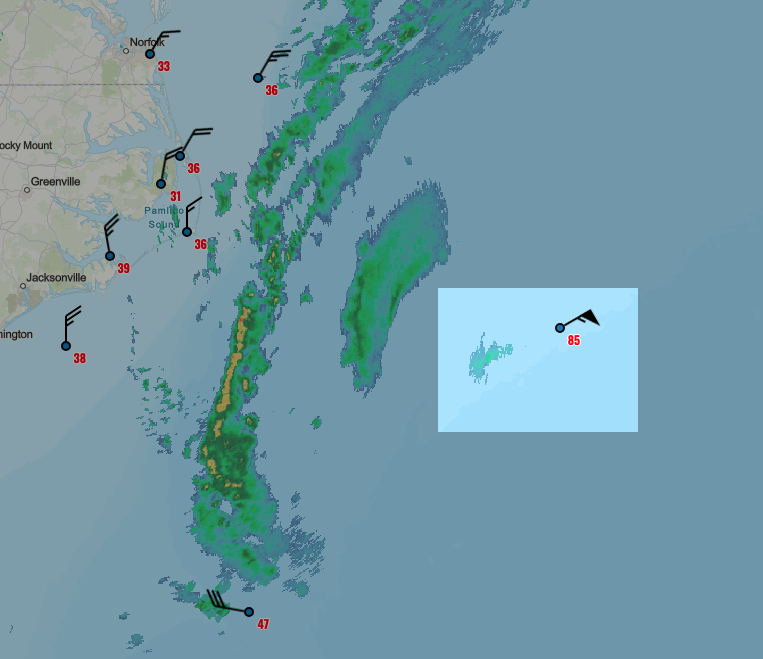
NOAA buoy 41001 (~170 mi. E of Hatteras, NC) is in teeth of #Erin.
So far, peak gust to 85 mph, with significant wave height of 39.7 feet. With max wave heights usually 2x sig. wave heights, that could mean 80-foot peak waves!
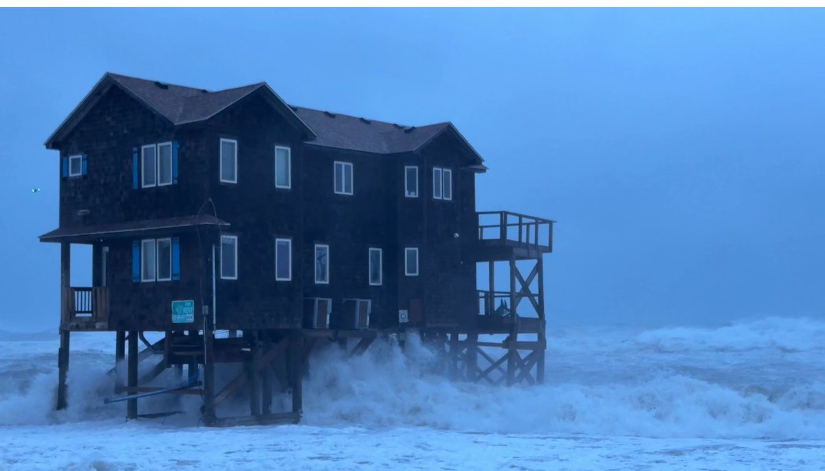
Can't wait to see cam photos after sunrise. 🍿
No two #hurricanes, or their impacts, are exactly alike.
But I feel some deja vu seeing the #Erin forecast with Earl almost 15 years ago.
Earl was closer to the OBX than Erin's current forecast. But Erin is already larger than Earl was at its closest pass.