A large area may experience severe storms tomorrow across Europe. It's a pretty complex setup as well, so make sure you read the text about the uncertainties and different scenarios at https://t.co/brDSjrqkOF
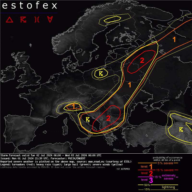
On Tuesday, severe weather shifts further E with the main threat being very heavy rainfall. Large hail and some downbursts will be likely as well. Read more at https://t.co/brDSjrpMZ7
An outbreak of severe storms is expected over N Russia with strong tornadoes and swaths of severe to extremely severe winds possible. Read more at https://t.co/brDSjrpMZ7
Severe weather continues across parts of S/SE and E Europe on Tuesday. The highest risk are is across S Serbia/SW Romania/NW Bulgaria, where severe to extremely severe wind gusts and very large hail will be possible. Situation over Russia is uncertain, see https://t.co/brDSjrpMZ7
Reminder about likely severe weather outbreak across parts of Europe! Southern Lvl 3 (NW Italy) will feature especially destructive hail, while the Northern Lvl 3 (France to Germany) will feature a transition to damaging wind gusts. Read more at https://t.co/brDSjrpMZ7
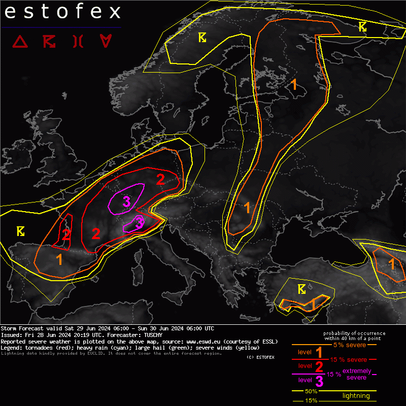
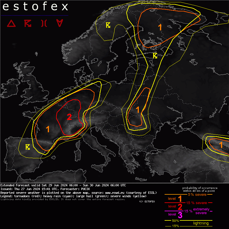
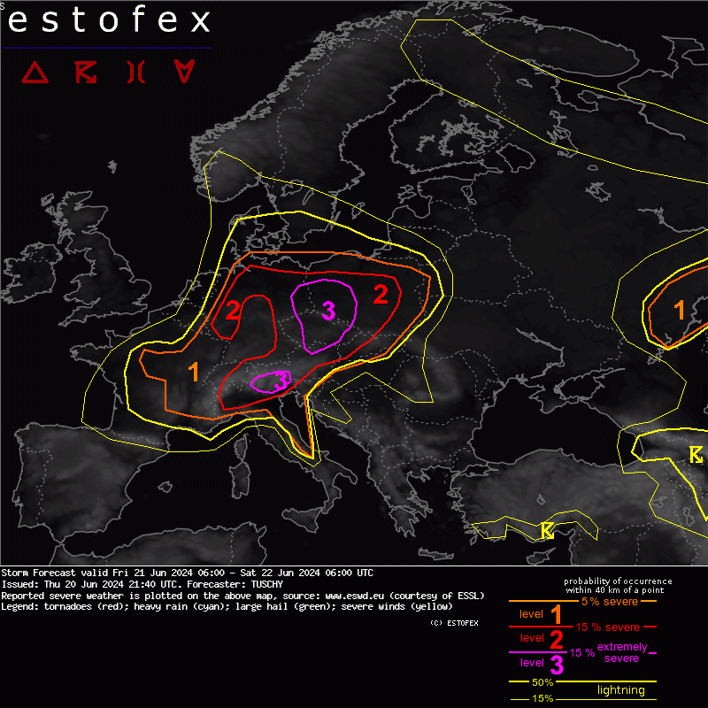
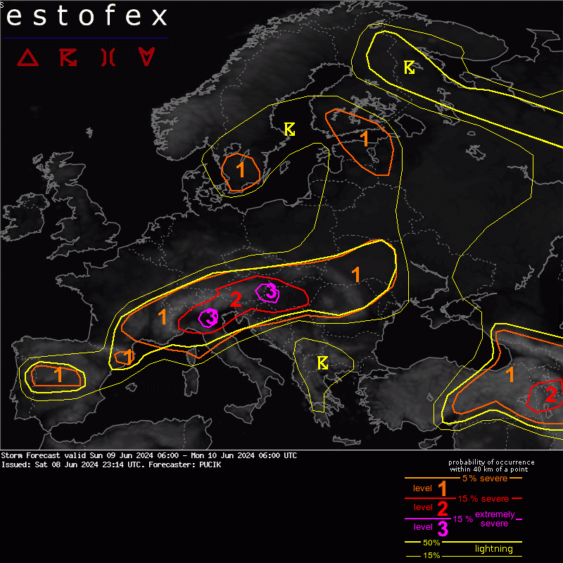
Severe weather continues throughout the weekend! Today, the highest risk will be in a belt from Bosnia through Serbia, Hungary, and Romania into E Slovakia and SE Poland. However, N Italy is also not out of the woods yet. Read more at https://t.co/brDSjrpMZ7
Active severe weather pattern continues across Europe. The highest risk of severe storms is forecast across the flank of N Alps with threats of very large hail and severe wind gusts. Read more at https://t.co/brDSjrqkOF
Severe weather threat expected in a very large area. The highest risk will exist across E Lithuania, E Latvia, N Belarus and W Russia, where storms will be capable of extremely severe wind gusts and tornadoes, some of which can be strong.
Active severe weather pattern continues over Europe! The highest severe weather risk is forecast in a belt from Serbia through S Romania and N Bulgaria with risks of very large hail and extremely severe wind gusts. Read more at https://t.co/brDSjrpMZ7
Severe weather outbreak likely on Sunday from N Italy through Austria into W Hungary. The highest risk of destructive hail will be in N Italy, while the highest risk of damaging wind gusts and tornadoes in E Austria/extreme W Hungary. Read more at https://t.co/brDSjrpMZ7
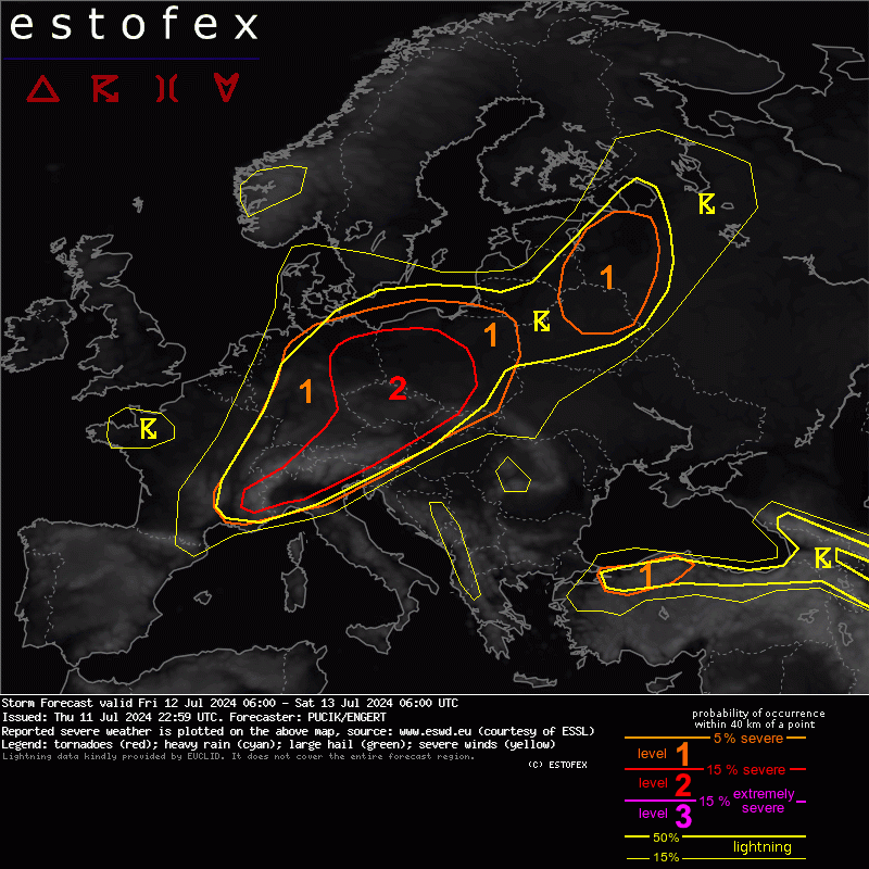
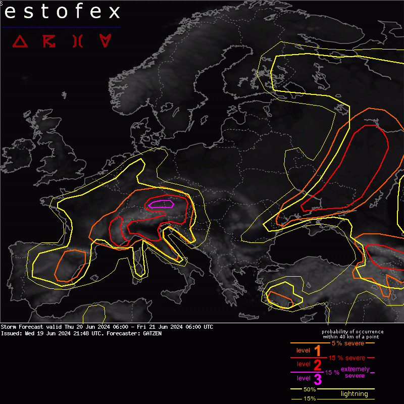
Severe weather outbreak possible tomorrow across parts of SE Europe. There are some uncertainties though, so make sure to read the full text at https://t.co/brDSjrpMZ7
Due to the kinematically very impressive environment, a level 2 was issued across N Germany and NW Poland mainly for (strong) tornadoes and damaging wind gusts
Read more here: https://t.co/jlZK2M7KzA
An active severe weather situation is expected on Thursday with tornadoes and severe wind gust being the primary threats. Read more here: https://t.co/XtX2GvS8vO
Numerous areas with potential for severe weather are forecast on Sunday. There are a number of uncertainties in many areas, including the effects of the dust on the solar insolation. Read more here: https://t.co/n8fHTNdGfD
Lvl 2 has been issued for damaging wind gusts and tornadoes across NW France and BENELUX. Read more at https://t.co/brDSjrqkOF Please also note that ESTOFEX covers the contribution of convective storms to severe weather.
A late-season severe weather outbreak is forecast across the E Aegean Sea, W and S Turkey and possibly also over Cyprus. Numerous rounds of storms are forecast with multiple different hazards. Read more here: https://t.co/4msqdd1Zyf