We verify and #geolocate images and videos of natural disasters from around the globe in real-time to provide reliable info for news and relief efforts. Tag us!
One of the uses of the geolocation data I've been producing is being able to visualize the extent of the #Earthquake in #Turkey and #Syria. Here we see it overlayed on a USGS map of the earthquake intensity.
Check the link below for an interactive map!
https://t.co/8wLRH3qRBf
False color Sentinel imagery allows us to see the large area burned by wildfires early this week near Valparaiso, #Chile (dark areas in the center of image)
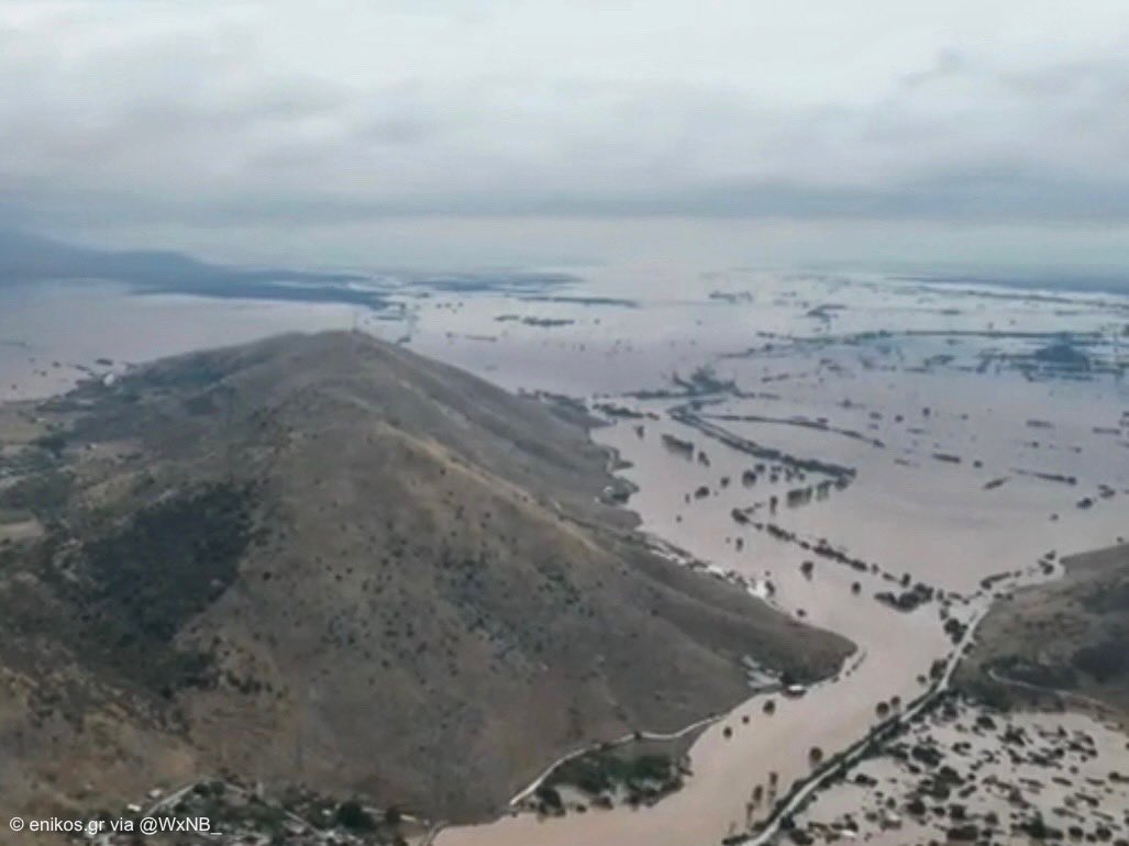
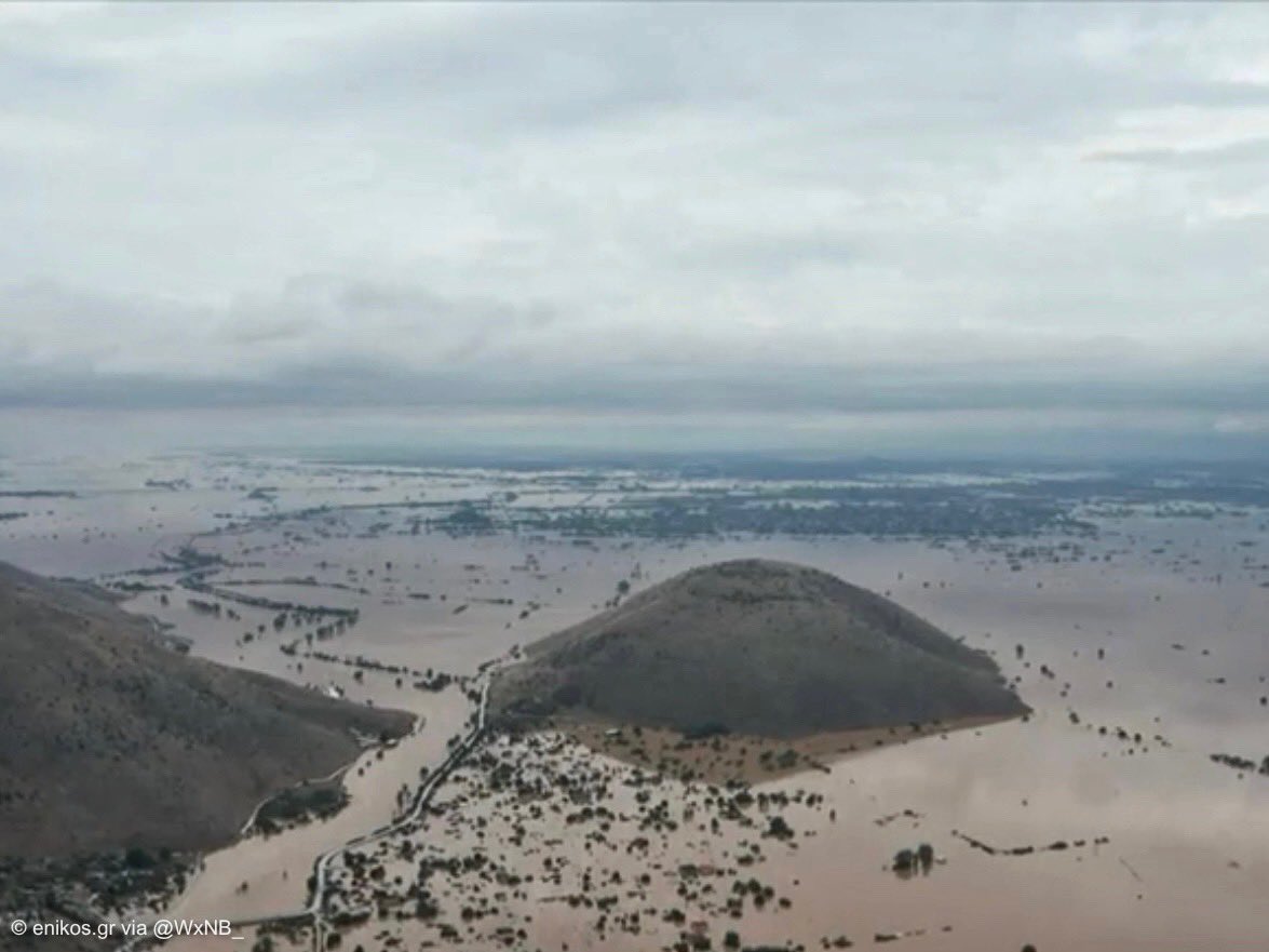
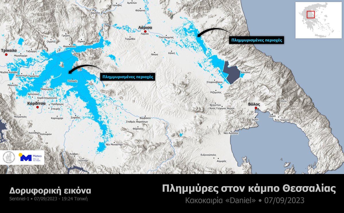
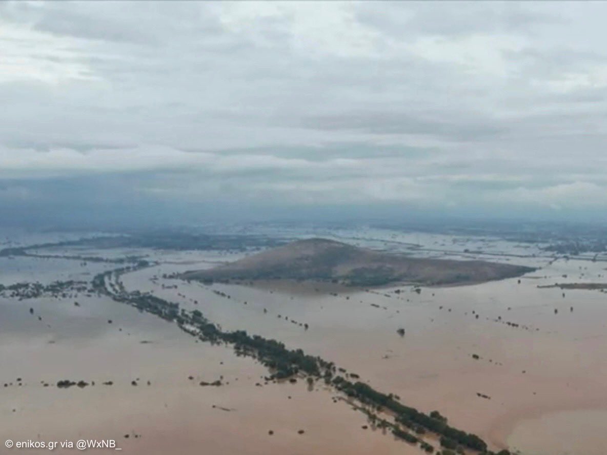
Tremendous flooding has been ongoing in the Thessalian plain of central Greece from storm #Daniel. These drone photos are from the town of Vlochos, near 39.520928, 22.091169
@geoconfirmed#geoconfirmedworld
I’ve seen a few posts regarding Salton Sea flooding this weekend. Here’s a map of the drainage basin with the Day 2 excessive rainfall forecast for Hurricane Hilary. This basin has no outlet and will likely see severe flooding as several inches of rain falls in the area.
#cawx
This video is indeed from Santa Rosalía, specifically 27.334168, -112.272827. Likely many more scenes like this to come from Hurricane Hilary across Baja and Southern California
@GeoConfirmed#geoconfirmedworld
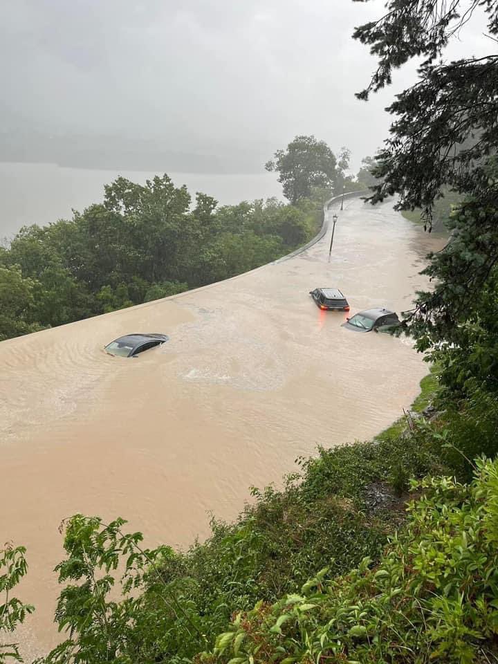
Current scene in West Point, New York / #HudsonValley 🌊
The radar estimates that over 10 inches of rain fell today, nearly the amount that typically falls over an entire summer!
⚠️ There’s more rain to come…
📸 Megan Cardone via a resident of West Point, NY
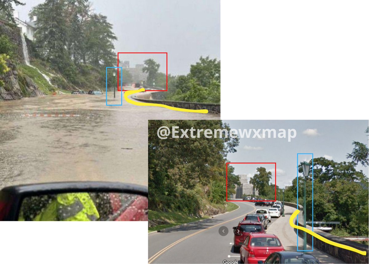
You’ve likely seen these dramatic photos of road flooding in New York. Photos 2 and 3 in this post geolocate to 41.385046, -73.956785 in West Point, New York. @geoconfirmed#geoconfirmedworld
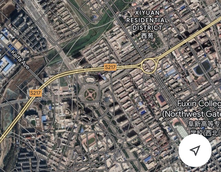
As a side note: @googlemaps road overlays are all offset by nearly half a kilometer throughout parts of China. This makes the overlays unusable, surely this can be fixed easily?
This strong tornado geolocates to 41.998698, 121.617977 in southern #Fuxin, #Liaoning province China. Have yet to geolocate other images and videos of this event
Another video of the Fuxing, #Liaoning Province tornado in #China. Check out this cylinder shape & the darkening given the debris. And take note of the power flash as well.
Credits are on the video but in Chinese.
#severewx
It is not possible to geolocate this image, but videos like this predate the earthquake and show a Falcon 9 rocket maneuvering in orbit. I was able to find other very similar videos from 2018, but couldn't find a safe site to link
See this fact-check: https://t.co/3dF9UuwR2d
@GeoConfirmed any way to get a locate on this? I have questions. A C-17 flew over and hit severe turbulence right about the same time that 7.8 EQ struck, and between the dust and atmospheric shockwave, I'm wanting to call BS on this. The light source has me puzzled, though.
Yesterday we had a great online meeting with Joseph from @ExtremeWXMap to discuss about location of pics & videos Joseph is a volunteer, making this time consuming process just to help We discussed about methods and possible application for earthquake. Fascinating! Thanks Joseph!
I was able to geolocate this massive fissure from the #earthquake to just outside Tepehan, Altınözü/Hatay province #Turkey at 36.159372, 36.222598. 1st image is a *rough* outline of the fissure as seen in the images. @LastQuake
https://t.co/SdZ4yuQOcC