Thks @FE_Kenton and crew for fixing me up with some @farmers_edge VR Fung maps and sending them to the canplug in my sprayer so I cud load them up right quickly
#wheat seeded April 28th predicted by @farmers_edge to begin flower today. The FHB risk model shows low risk across this farm, flag leaf showing some leaf disease so grower will apply fungicide. Use data from your field to enhance decisions #AgData#crop19
It’s hail season in Alberta🤕 using our satellite imagery we can trace the path of a hail cell through the field. This means an accurate representation of the damage for you and your insurance! #Different#DigitalAg - JL, Olds AB
Got a health notification from @farmers_edge today I thought sports on field were drought imagery seemed off to that went did some looking and found cutworms. Both dad and I said we would have wrote it off as drought damage but thanks to the imagery it saved us from more damage.
Red east to west line represents grain cart traffic from last harvest. Hopefully this field can bounce back from the soil compaction. #FingersCrossed#ScoutingMaps -SC
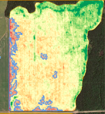
The health change notification hit the nail on the head when outlining a potential issue. The right side of the imagery showed discoloration from phosphorus deficiency in the corn. The most effected area was more noticeable in the blue boarders. Time saved. #EfficientFarming -SC
@farmers_edge VR Fungicide in this #canola field makes sense Can’t see the variability from the road, but cutworms, Flea Beetles & frost have left their mark on my 354 foot path. Why spray these areas with same rate when population & staging are so varied? #Stayonlabel
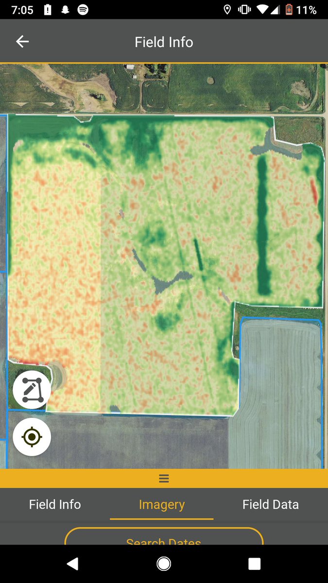
Amazing the accuracy of @farmers_edge zone maps. Currently using them for nitrogen application. This vein of better ground is hardly noticeable to the eye right now but will most likely be the only area that doesn’t drought stress all year. The tractor sure knows it’s there.
It’s always a fun day when we can use satellite imagery to find and measure an error made by the sprayer which caused herbicide damage to a potato crop here in Nebraska! #FarmCommand -RA
Do you have concerns of spray drift? Our Imagery suite can help. This Crop Health Change imagery layer notified this Farmer of a stressed area in their field, further investigation proved drift as the cause. Use the tools available to your advantage! #FarmCommand#AgTech
#FarmCommand Crop Health Change alerts show the increase of flea beetle damage from June 10 to June 12 despite getting a second pass of bug juice on the 7th. 3rd times a charm? plants still viable and can can be rescued.. hit em again! 😡 #plant19
It’s awesome how our #FarmCommand imagery can pick up a small difference in planting dates. The earlier stage soybean is the dark purple area on the variance map! #smartfarming#imagery#Different -MP
Quick detour to scout this #corn field on the way home. I'm always impressed with the @farmers_edge daily imagery. Makes scouting more efficient and purposeful! This image shows where the cover crop didnt take #scouting#different#smarternotharder
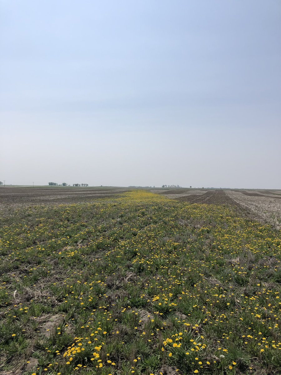
Using the scouting tool in the #FarmCommand app I noticed a odd line in our imagery. I went to check it out and it ended up being a strip of dandelion that this growers thought to be a sprayer application issue from last year! #SmartFarming -MP
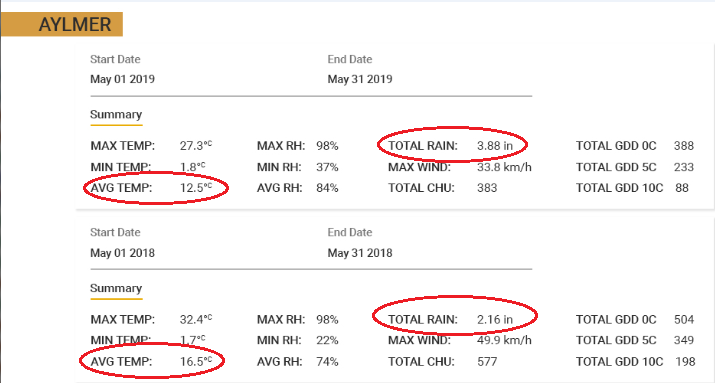
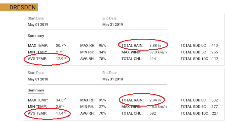
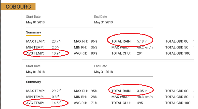
It's been a difficult #Plant19 for many areas, including Ontario Farmers. Here are 3 locations that are seeing significantly more rainfall and lower average temps in 2019 vs. 2018. #weather#FarmCommand@fe_ontario
"We're never going to replace going into your field to scout, but we can direct your feet to the spot when you get to the field to help you be more efficient."
-@FE_HeatherClair, Digital Ag Lead
See why our product experts recommend imagery for scouting https://t.co/7a8CB8Eho8