Weather forecast and info for southeast Wisconsin from the FOX6 Weather Experts: Rob Haswell, Tom Wachs, Stephanie Barichello, Lisa Michaels and Holly Baker
Woah! Who remembers this from a year ago? Exactly one year ago today (11/10/2025 - a Monday morning), we had the lake effect snow band that wouldn't end. Over a foot of snow fell in spots right along the lake in Racine and Kenosha counties. Then you'd drive a mile or two west and literally nothing. I remember a guy blowing off leaves in his driveway a few miles west while snowblowers were out in full force just east. Here is the science as to why that happened. Unusual November cold. Tell me what you remember about that day. It was a wild one!
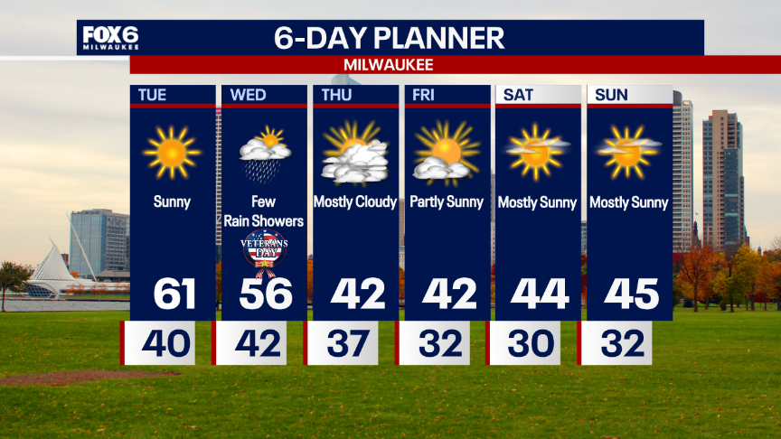
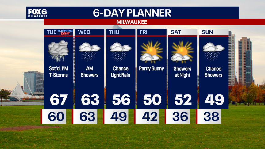
LOTS of sun on Tuesday with highs in the low 60s. Our one storm system of the week arrives on Wednesday (Veteran's Day) with less than 0.10" of rain. Just some light rain showers. The big weather story is the late week cool down. Highs in the 40s starting on Thursday! What do you think of this forecast? Posted: 10:52pm Mon. 11/9/26
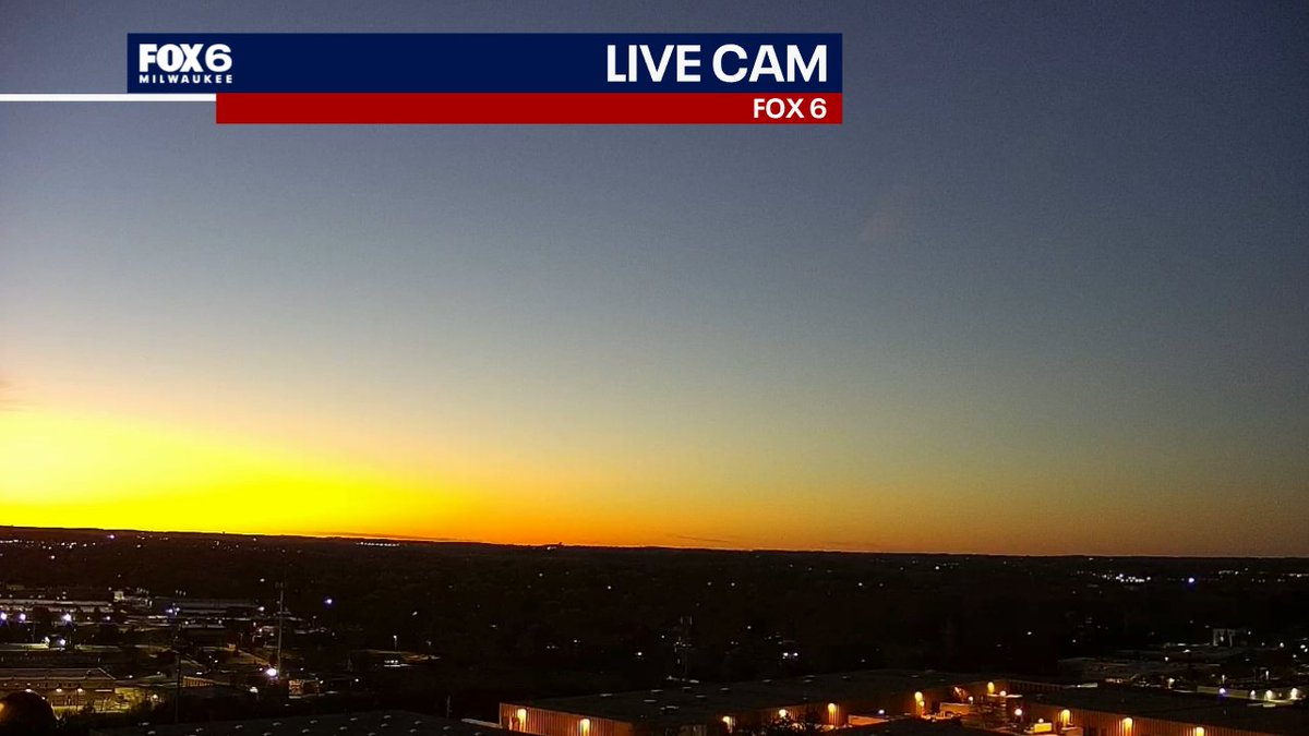
It's a "New Moon" tonight so the sky will be extra dark. You can see Saturn in the SSW sky this evening and Mars in the SSE sky early in the morning. The next International Space Station Flyover is on Friday evening. Are you enjoying this weather? Posted: Mon. 11/9/26
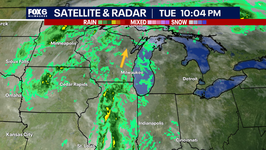
10:04pm Tuesday 11/3 Radar Update: Another push of rain is moving in from the south. Rain (and wind) will pick up overnight and continue into parts of the morning on Wednesday. Windy on Wednesday afternoon with drizzle possible. Morning temperatures in the 60s, afternoon temperatures in the 50s. Less than 0.25" of rain is expected out of this next batch.
3pm 11/3: It's a soggy Election Day in Wisconsin. Rain will continue on-and-off into Wednesday morning. It won't add up to much and will stay fairly light to moderate at times. Temperatures will hold in the 60s all night.
10:20pm Mon. 11/2: Drizzle on Election Day morning, scattered showers and a few rumbles on (non-severe) thunderstorms on Tuesday afternoon. Windy and warm with highs in the upper 60s. Morning showers on Wednesday, drying out Wednesday afternoon. Cooling down late in the week. And hey...since we are in November, I need to point out...no snow in sight! :)
The Brewers weren't the only thing HOT in October! Milwaukee saw the 6th warmest October on record going back to 1871! We went from a record high of 87 on the 12th to a low temperature 40° cooler at 37° on the 17th. It was a dry month overall, with rain just under an inch below average.
5:03pm Monday 11/2: A band of light rain just moved through Milwaukee. This will likely be the steadiest of the rain we see all night. Scattered light showers and drizzle will return on-and-off throughout the night, but it shouldn't be a big deal. Temperatures will be around 60 all night. How was your Monday? Are you handling the early sunset alright?
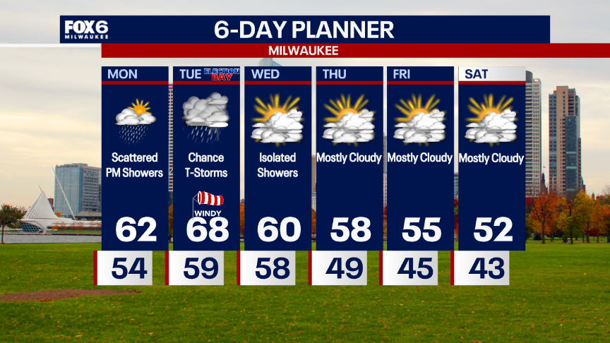
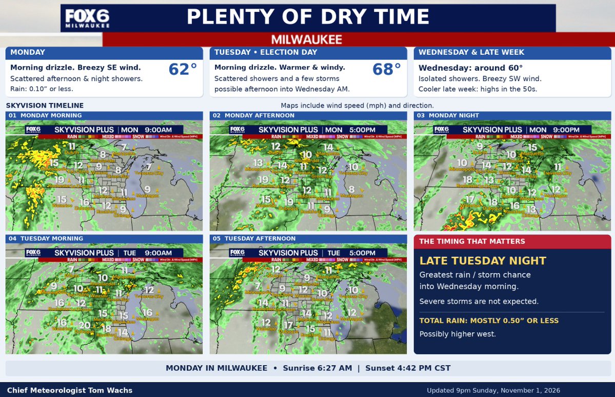
10:20pm Sun 11/1: While this forecast looks wet on Monday and Tuesday, there will be LOTS of dry time too. Scattered afternoon showers picking up at night on Monday. Highs in the low 60s. Windy on Election Day and mainly dry in the morning. Scattered showers on Tuesday afternoon with a few rumbles of thunder on Tuesday night (severe weather not expected). More seasonal weather later in the week with highs in the 50s (closer to our average high).
Weather Update. Don’t let all that green fool you! 🌧️ There’s plenty of dry time in this forecast.
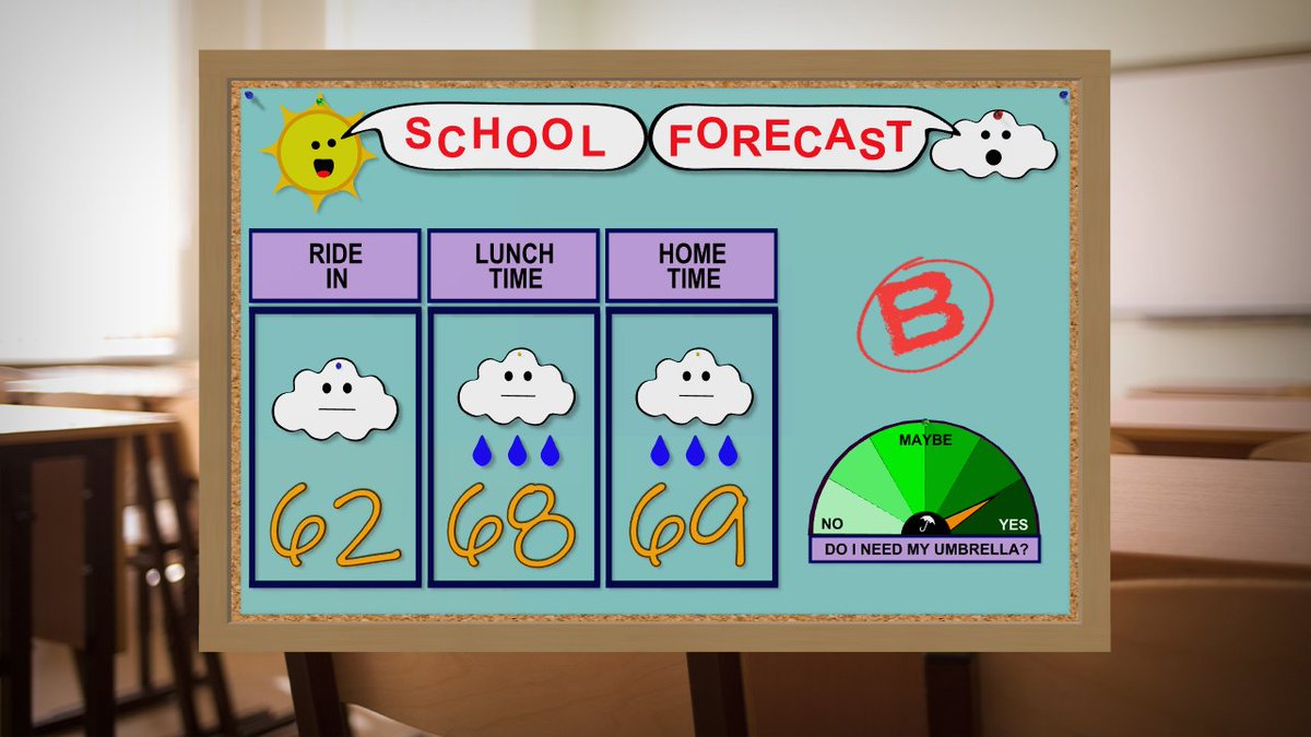
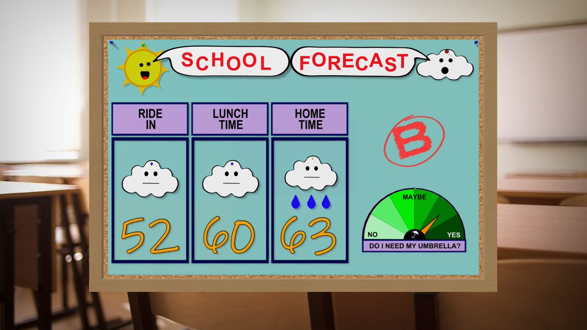
A little drizzle, scattered showers, and highs of 62° Monday and 68° on Election Day. A few storms are possible Tuesday, but the best chance holds off until late Tuesday night. Severe storms aren’t expected.
Keep the umbrella handy - but don’t cancel your plans! 👍
Posted: 9pm Sunday, November 1, 2026
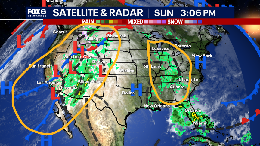
Science Lesson: I'm back with a cool science lesson on this November 1st. We have a storm system with clouds/rain to our south and a stronger storm system in the southwestern U.S. But wait...you see the fronts with that storm in the SW, not with the other storm. Now look at the visible satellite movie from this afternoon. You can see the wave of low pressure moving through the first storm, causing the showers. Translation: Not all storms produce surface fronts. Some storms stay aloft and create the lift. We think of it like a wave in the ocean that generates the lift/creates precipitation. Cool stuff! Oh...and that SW storm is heading our way for Monday afternoon through Wednesday with rain and even a few storms. Posted: 3:10pm Sun. 11/1/26