A Tornado Watch has been issued until 9 PM Local for parts of the mid-atlantic, including New York City. In addition, multiple Tornado Warnings are ongoing throughout the country.
Enhanced risk today for parts of the Ohio Valley to Mid-Atlantic states.
Today's risk is mainly centered around a 45% CIG1 wind risk, with widespread wind gusts of 60–75 mph. A few tornadoes also remain possible, along with hail up to 2 inches in diameter.
Two firefighters have died following a vegetation fire near Bordeaux–Mérignac Airport in France, which has also spread to nearby buildings, according to the Interior Minister.
The fire has grown to more than one hectare in size, and all takeoffs have so far been suspended.
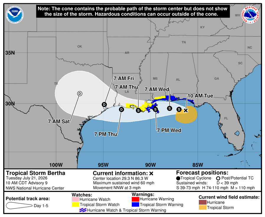
Tropical Storm Bertha is continuing on her path towards Louisiana, with tropical storm warnings being issued for the Florida Panhandle, all the way to New Orleans, where she is expected to make landfall tomorrow night. Storm surge could be 2-4ft ranging from the mouth of the Mississippi River to the Mississippi/Alabama Border.
Enhanced Risk is in place today for parts off Wisconsin, Illinois, Iowa and Minnesota. Tornado watches and warnings have already been issued.
The main threats include several tornadoes, some of them strong (EF2+), damaging wind gusts of 75 mph or greater, and hail up to 2 inches in diameter.
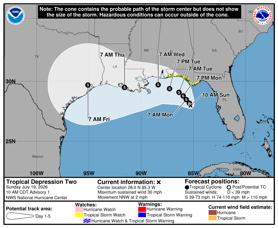
Tropical Depression Two has formed over the Gulf, with Tropical Storm watches being issued for portions of the gulf. Maximum sustained winds are at 30 mph, with strengthening expected overnight. The next advisory is expected at 4 PM CDT.
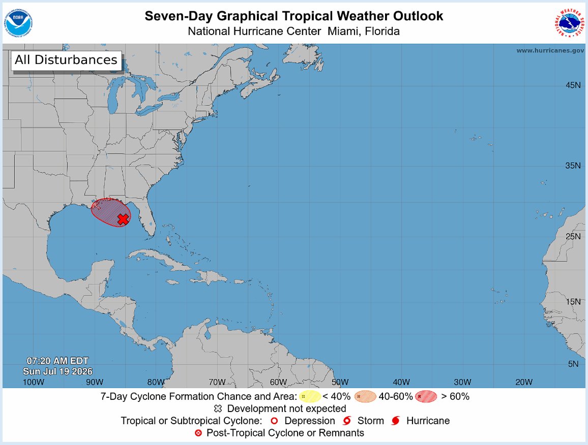
Tropical Depression 2 has formed in the Gulf, with the NHC Initiating advisories starting at 11 AM EDT. Formerly, this was an interest with 80% confidence of formation within 48 hours or 7 days. If this becomes a tropical storm, this would become Tropical Storm Bertha.
A Tornado Watch has been issued for parts of Maryland, Pennsylvania, and most of New Jersey, until 9 PM.
Along with Tornadoes, there's a good chance of severe wind gusts within the region, and isolated hail up to ping pong ball size.
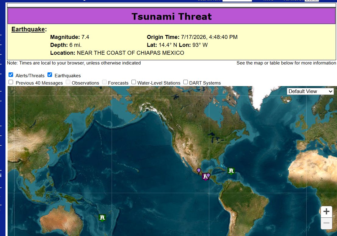
According to the U.S. Tsunami Center, a magnitude 7.4 earthquake has struck near the Chiapas region of Mexico at 10km depth, prompting a potential tsunami threat.
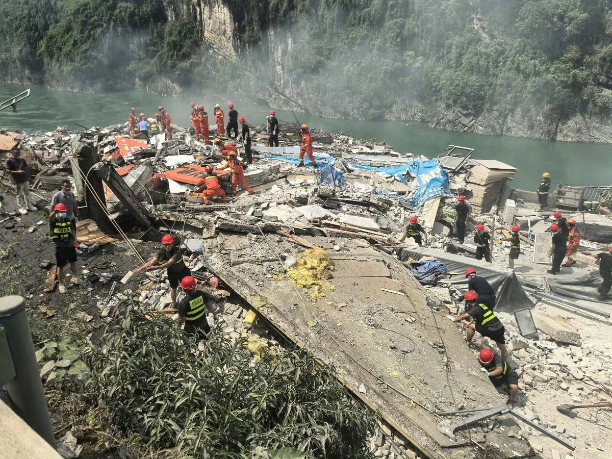
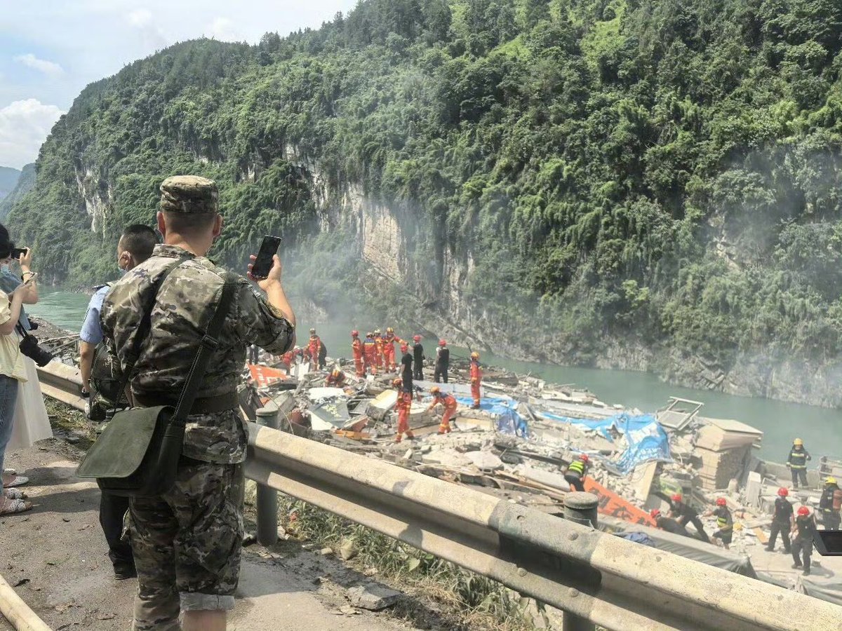
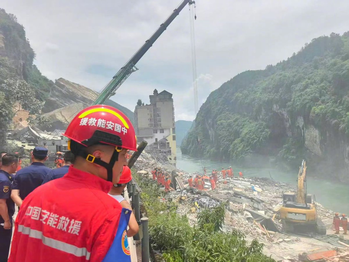
A massive landslide in Chongqing, China, has caused several buildings to collapse near the Wujiang Three Bridges in Pengshui. There are reports of people trapped, with an unknown number of casualties at this time.
Catastrophic and deadly flooding has and is currently ongoing on the Guadalupe river in Texas, with the river gauge at Center point rising 32 feet in 4 hours.
this is CRAZY wording, i dont think ive seen the NWS directly mention past historic events in a warning before
catastrophic situation unfolding right now
There have been several reports of street flooding in Ingram, and Indian Creek Road at the Guadalupe River was among the impacted areas.
Latest forecast: https://t.co/zCFr1wJyM5
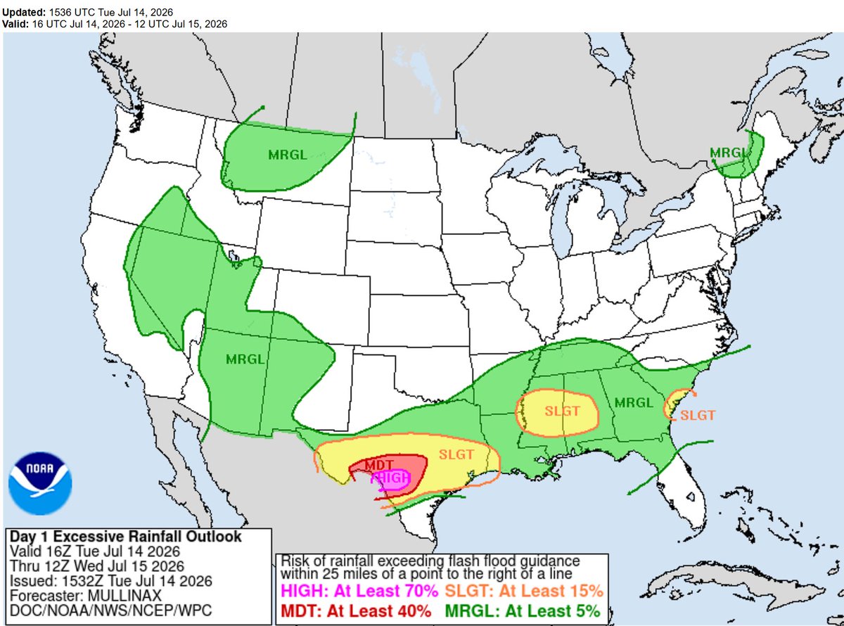
Starting today the next few days will have torrential rainfall across a large area of south Texas. with areas getting from 3-10 inches of rain possible. turn around dont drown
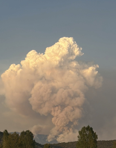
A dangerous forest fire is approaching residential areas in the Fontainebleau Forest, and evacuations have begun in nearby areas.
The fire has so far spread over 1000 hectares, or around 2500 acres, with French water bombers for the first time scooping water from the Seine River, 500+ firefighters are deployed to fight the fire