Sadly, this week the Fort Bend Star and its website are closing down. This week's edition of the paper is the final one.
It's been an honor to serve you. We'll see you around the Bend.
https://t.co/MSELyTXf3T
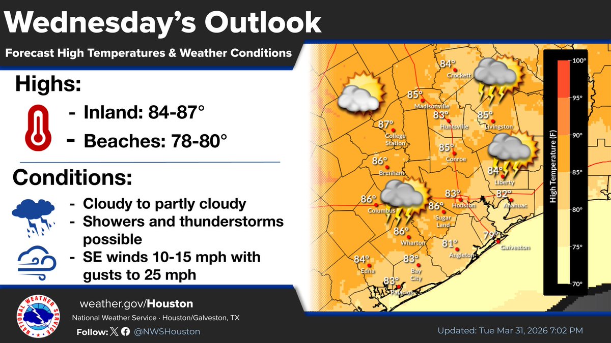
Today's highs will be in the mid to upper 80s. Winds will be out of the southeast around 10-15 mph with gusts up to 25 mph during the afternoon hours. Isolated to scattered showers and isolated thunderstorms are possible, mainly in the afternoon.
Tonight: Lows in the upper 60s-lower 70s. Skies becoming mostly cloudy skies. Patchy fog possible overnight.
Wednesday: Skies becoming partly cloudy. SE winds increasing to 15-20 mph with gusts to 25 mph in the afternoon. Isolated to scattered showers & thunderstorms possible.
A weak cold front will push through the region tonight bringing temperatures down into the mid-50s to low 60s. Some patchy fog is possible ahead of the front.
Today will see mostly sunny skies and high temperatures in the mid to upper 80s for most of the region, with slightly cooler conditions along the coast.
The quiet weather continues. Tonight will see the return of patchy fog and mostly cloudy skies with lows in the 60s. Friday will be another unseasonably warm day with highs in the mid to upper 80s. A weak cold front Friday night will cool down temperatures a few degrees. #HOUwx