7 DAY FORECAST: a few afternoon showers and storms will still remain possible to wrap up the week, with highs near 90. As an upper low moves over Saturday, that should bring us the best chance of showers and storms. Behind that, high pressure builds back in bringing mid 90s!
(9:46pm) A few storms have popped up in Ellis county and also in North Dallas. Brief heavy rain and occasional lightning will be possible as these work northwest. #TXwx
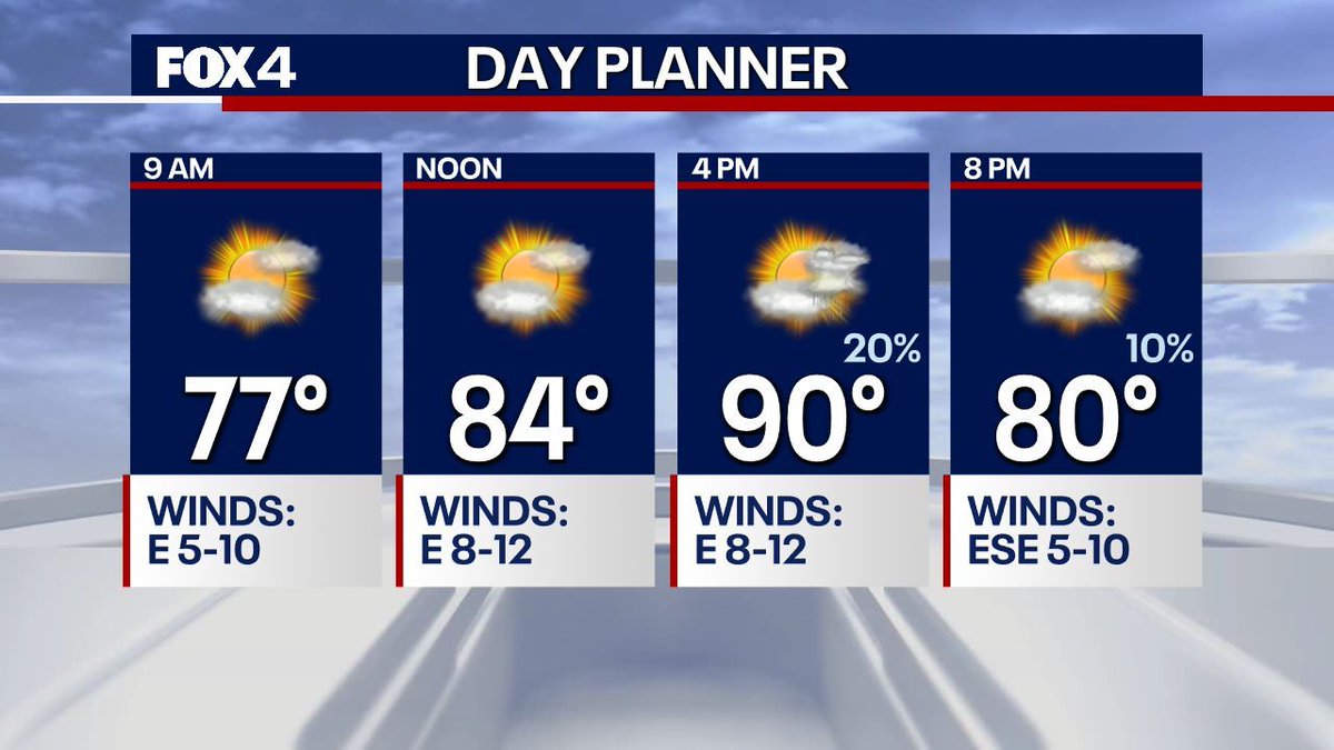
PLANNING YOUR EVENING: There's a small chance of a pop-up shower before 9pm, but most of us stay dry. Otherwise, expect a warm and muggy evening to continue. Stay hydrated if you have outdoor plans! #TXwx
Heat, humidity, and storm chances will be the norm through the weekend. Today, partly sunny skies and isolated afternoon storms are expected. Highs will reach the mid 80s to 90. Rain chances go up by the weekend, thanks to a storm system out west.
Very warm and muggy today, as highs approach 90. Just isolated storms possible for the afternoon/evening. Any storms that develop will have heavy rain, gusty winds, and lightning.
Active weather continues this week! Showers and a couple of rumbles are more isolated tomorrow afternoon, with highs still climbing to about 90°. As our next disturbance approaches late week, additional storms are possible with more of a heavy rain threat.
7:00pm- Storms have really come down in intensity. Heavy rain, lightning, and small hail continue to be the greatest threats with these lingering cells. Expect coverage to taper off after sunset!
5:08pm- A NEW Severe Thunderstorm Warning is in effect for western Dallas county into Tarrant county. Quarter sized hail and 60 mph winds are possible.
A FLASH FLOOD WARNING has been issued for portions of Hopkins, Hunt, Rains, and Van Zandt Counties until 7:45pm. Between 2 and 4 inches of rain have already fallen and additional heavy rain is moving overhead. Stay safe!
4:40pm- Storms are currently sub-severe, but pocket change sized hail remains possible within the strongest cells as they drift W/SW. Another boundary moving through Dallas county could help fire off new storms through sunset.
3:43pm- Another Severe Thunderstorm Warning is in effect for Collin county, northern Rockwall county and NW Dallas county for 60 mph winds and quarter sized hail.