Our research group covers various applications of spatial remote sensing related to environmental issues, specially regarding management of forest fires.
The propagation of estimations to the regions with lacks of GEDI data was carried using multisource data information ranging from optical satellite data, L-band SAR backscatter and other derivatives and ancillary information. 3/3.
#Paper_Alerte Elena aragoneses and her colleagues have just published an outstanding paper about the mapping of forest canopy fuel parameters at European scale. 1/3
https://t.co/6ngWFJz841
They developed a two-step, easily replicable methodology to estimate forest canopy fuel parameters, namely, canopy height (Hm), canopy cover (CC) and canopy base height (CBH), for the entire European territory, based on GEDI LiDAR. 2/3
📢🔥 Review of #wildfirerisk assessment concepts: ignition, propagation, exposure & vulnerability. Discover how they connect to #mitigation and #adaptation efforts. Learn about operational fire risk systems worldwide and the @FirEUrisk system
https://t.co/YmRGjxttwN @Fire_MDPI
@FirEUrisk 𝗦𝗵𝘂𝗵𝗮𝗻 𝗟𝗼𝘂 has presented the preliminary results of an assessment of global burned area products (FireCCI51 and MCD64A1) in the detection of small fires of China.
A rich contribution of GITA members to the #EGU23 General Assembly. The contributions encompassed different topics: #FireCCI Burned Area products and their intercomparison to other BA products, Fuel type mapping and parametrization within @FirEUrisk project, and fire emissions.
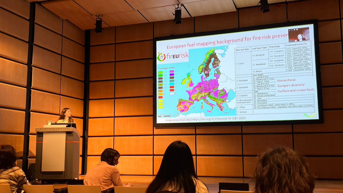
@FirEUrisk 𝗘𝗹𝗲𝗻𝗮 𝗔𝗿𝗮𝗴𝗼𝗻𝗲𝘀𝗲𝘀 has presented her current research about the estimation and mapping forest canopy fuel parameters from GEDI LiDAR data in Europe within the @FirEUrisk project.
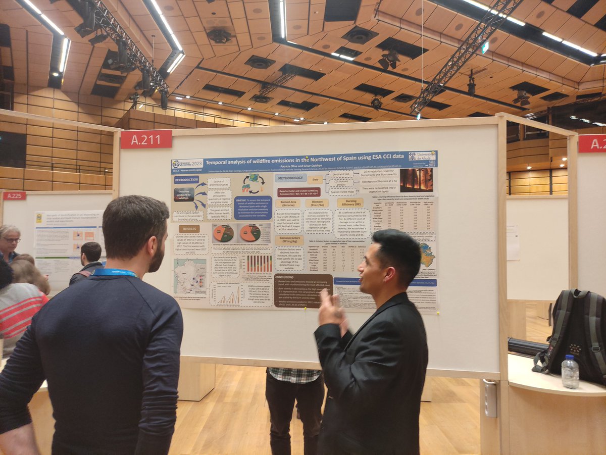
@FirEUrisk 𝗖é𝘀𝗮𝗿 𝗤𝘂𝗶𝘀𝗵𝗽𝗲 and @patriolivap have presented a poster describing the main result of their analysis of wildfire emissions in Northwestern Spain.
@FirEUrisk 𝗟𝘂𝗰𝗿𝗲𝗰𝗶𝗮 𝗣𝗲𝘁𝘁𝗶𝗻𝗮𝗿𝗶 has presented the recent advances within the #FireCCI project. She also moderated a workshop to about the use of the different products generated within the project.
@FirEUrisk The paper has been published in Earth System Science Data and can be accessed through https://t.co/XHFaxqLecM. The map layer can be downloaded through https://t.co/E3JtSq9u2L.
#Paper_Alerte Elena Aragoneses and her colleagues have just published a new fuel map for Europe based on a hierarchical and multipurpose fuel classification system as a part of the @FirEUrisk project. The map identifies 20 fuel categories at 1 km spatial resolution.
Boreal fires, typically accounting for 10% of global fire carbon dioxide emissions, contributed 23% in 2021.
Do you want to know how Zheng B., @EmilioChuvieco and other colleagues have monitored these emissions?
Then, check out their latest article!
https://t.co/sAE3Y0lIJt
Boreal fires, typically accounting for 10% of global fire carbon dioxide emissions, contributed 23% in 2021.
Do you want to know how Zheng B., @EmilioChuvieco and other colleagues have monitored these emissions?
Then, check out their latest article!
https://t.co/sAE3Y0lIJt
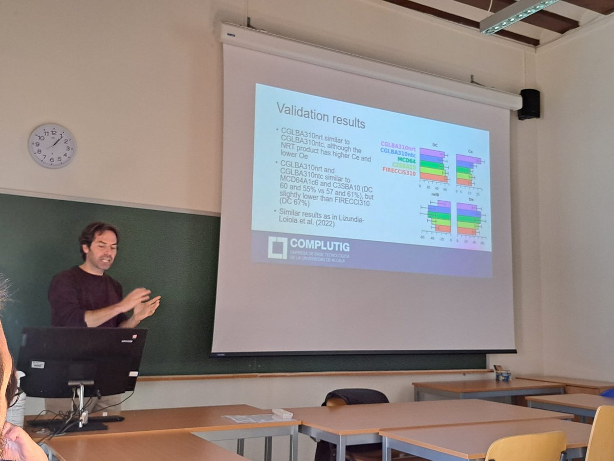
#Coming_soon The new version of CGLS near-real-time (NRT) burned area provides burn detections at high accuracy (similar to operational products: NASA's MCD64A1 and C3SBA11) with a short time latency. Congratulations to Dr. Marc Padilla for this achievement.
#CGLSBANRT
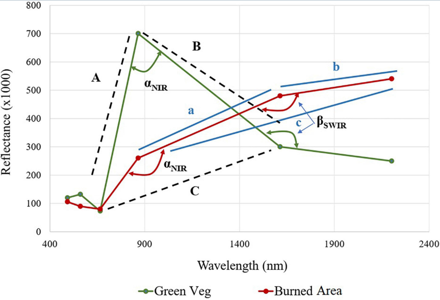
#Paper_Alert Check out the most recent research carried out by @patriolivap and her colleagues. The paper assesses the performance of band angle indices for burned area mapping in Chile.
#Google_Earth_Engine#Sentinel2
¡ALERTA DE EMPLEO!
¿Estás familiarizado con la teledetección y la programación (especialmente Python) y/o Google Earth Engine?
Estamos buscando a alguien para unirse a nuestro grupo, en un proyecto de mapeo de áreas quemadas con sensores de media resolución media.
The contract period is 15 months. However, as the topic will have funding continuity, it is very likely to be extended by 3 to 5 years. Salary is between 1400-1900 euros, depending on qualifications. Those interested should send us a DM before January 31!
JOB ALERT!
Are you highly familiar with remote sensing and programming (especially Python) and/or Google Earth Engine?
We are looking for someone to join our project on burned area mapping from medium resolution sensors.