Another step towards the cold season. Right on schedule.
The last week of August frequently brings the first notable snowfall of the season to the Alberta/British Columbia border region.
Conditions will improve tonight and a tranquil weekend is expected. In the meantime, stay weather aware today, and have multiple ways to receive warnings!
I'll have more updates tomorrow morning, but the data this afternoon is very concerning.
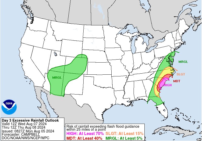
The combination of a stationary front, tropical moisture transport, and then the remnants of Debby will have the potential to produce 4" to 8" of rain throughout the region. This amount of rain alone would produce significant flooding throughout the region. However, with most of the region experiencing below-normal rainfall for much of this Summer, the potential for significant runoff of the topsoil is very high. Very poor travel conditions are likely throughout the rest of this week into Saturday. Prepare accordingly.
Tropical Storm Debby is bringing torrential record rains South Georgia to North Carolina over the next 3 days. Eventually Debby its rains will head north. We will discuss this on the Joe & Joe Weather Show Podcast LIVE tonight at 7:35pm
https://t.co/iMpaeorEKO via @YouTube
Everything still on tap as #debby rainfall event continues to unfold. Several rivers are going to rise into MAJOR flood stage across northern FL and potentially GA and SC. In Charleston, SC we usually see about 50-60" of rainfall in a year. Hard to believe we could see half that in 3 days. Be safe all. We will see you on @weatherchannel at 4pm from Charleston, SC.
RARE EVENT: with 3x consecutive days of high risk (level 4 of 4) of excessive rain, It’s hard to overstate how big of a deal this is. These events are are issued by @NWSWPC on fewer than 4% of days/year on average, but are responsible for 83% of all flood-related damage and 39% of all flood-related deaths. @cnn source: https://t.co/tiarfMogWR