Covering all weather in the Great Lakes! Our amazing forecasters X links can be found on the website! Reminder: all graphics and alerts are Unofficial!
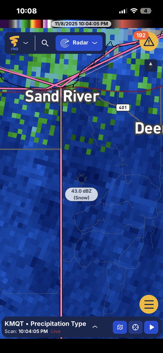
HEAVY Lake snow currently happening in the winter storm watch for the UP of MI. Exceeding 23.7 kft.
If things hold- this could translate to 1.5 to 2.5 in/hr snowfall rate
A line of low topped convective showers are moving ashore into NE OH and NW PA at this hour. Weak MUCAPE of 100 j/kg has developed and lapse rates have increased to 7°C. This should allow the mixing down of 50 mph (perhaps isolated 60) mph wind gusts through 5:00 pm!
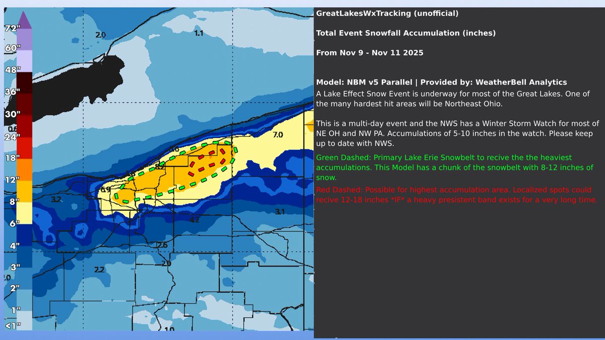
GLWXT issues unofficial Lake Effect Snow Outlook
This is unofficial; not affiliated with the NOAA/NWS
Discussion: https://t.co/YA5IEMAQxC
Read ALT
#GreatLakes#GreatLakesWX
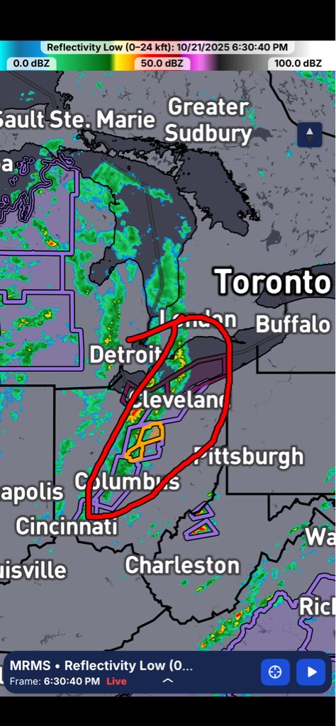
GLWXT is monitoring 3 broken up lake effect rain bands. 2 of west Lake Erie effecting Northeast Ohio. 1 band originally from lake St. Clair but mainly being reinforced over Erie effecting Northeast Ohio/Northwest Pennsylvania.
Half an inch to an inch QPF is possible.
Heavy lake effect rain happening with a band. Mainly in PA/NY. A couple thunderstorms associated with this band and a few inches of rain are likely for that area.
More accumulation possible in higher terrain areas.
(Part 3) GLWXT forecast
High terrain areas could see from 0-1.5 inches of LES; 2 in if there is a persistent band (uncertain)
Non high terrain likely will see from 0-0.5 inches. 1 in is possible if there is a persistent band.
A LES outlook won't be issued due to uncertainty
Over the course of the next 3 days. A low pressure will gradually traverse the Great Lakes, leaving long term lake effect rain bands.
There will be parts to this post in threads.
#GLWXT#greatlakes#greatlakeswx
(Part 2)
Still a lot of disagreement among models on how much or if any snow will fall... GLWXT Forecasters have looked into this and we do think it's a legit signal. We think higher terrain areas have a better chance of seeing something.
Long time no see!
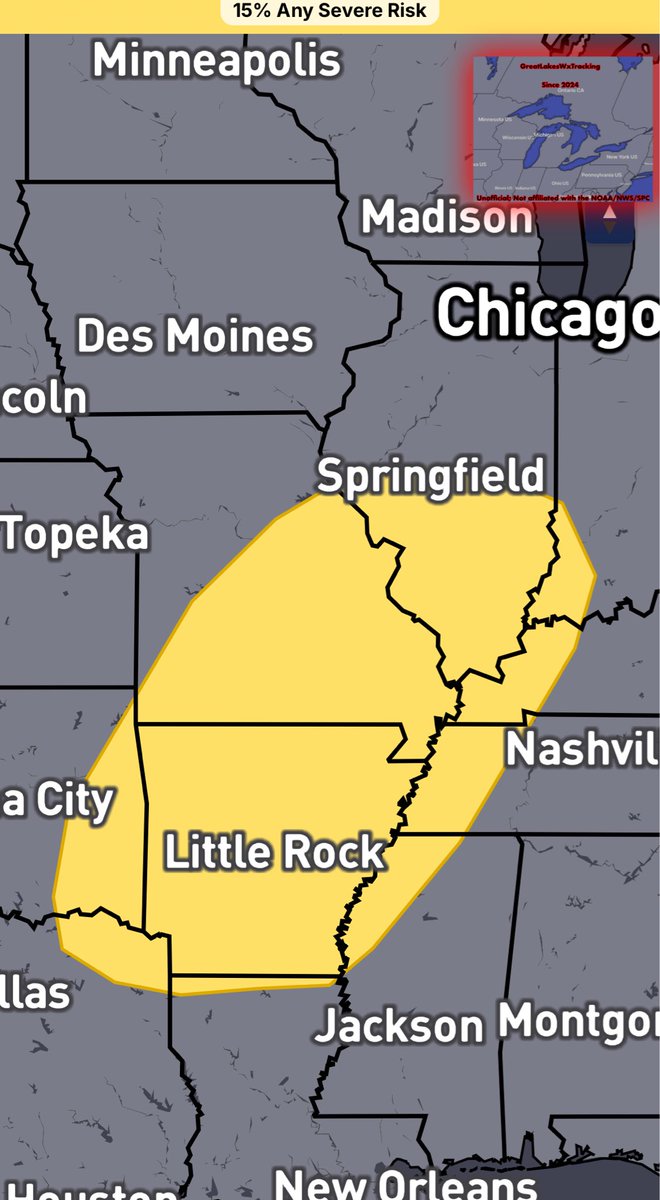
The SPC has added a Day 6 (Sunday) 15% (SLGT) risk of severe weather for the Middle Mississippi Valley/Ohio Valley/Lower Mississippi Valley/Tennessee Valley/Ohio Valley.
Some of our covering regions, like IL/IN are in this risk.
Main risk would be damaging winds.
#INWX #ILWX #wxtwitter #wxx
Summary… a complex of strong to severe wind-producing storms is located in SW OH and is bound for central and NE OH for this evening
Discussion… scattered to widespread strong wind gusts and very isolated severe wind gusts continue with a band of storms located in SW OH. 1000-1500 CAPE and 25-30 knots of shear coupled with extremely steep 8°C low level lapse rates will likely allow this to persist for the next several hours across the buckeye state. Additional strong storm development is possible ahead of this complex in central and eastern OH, with the main threat being damaging winds.
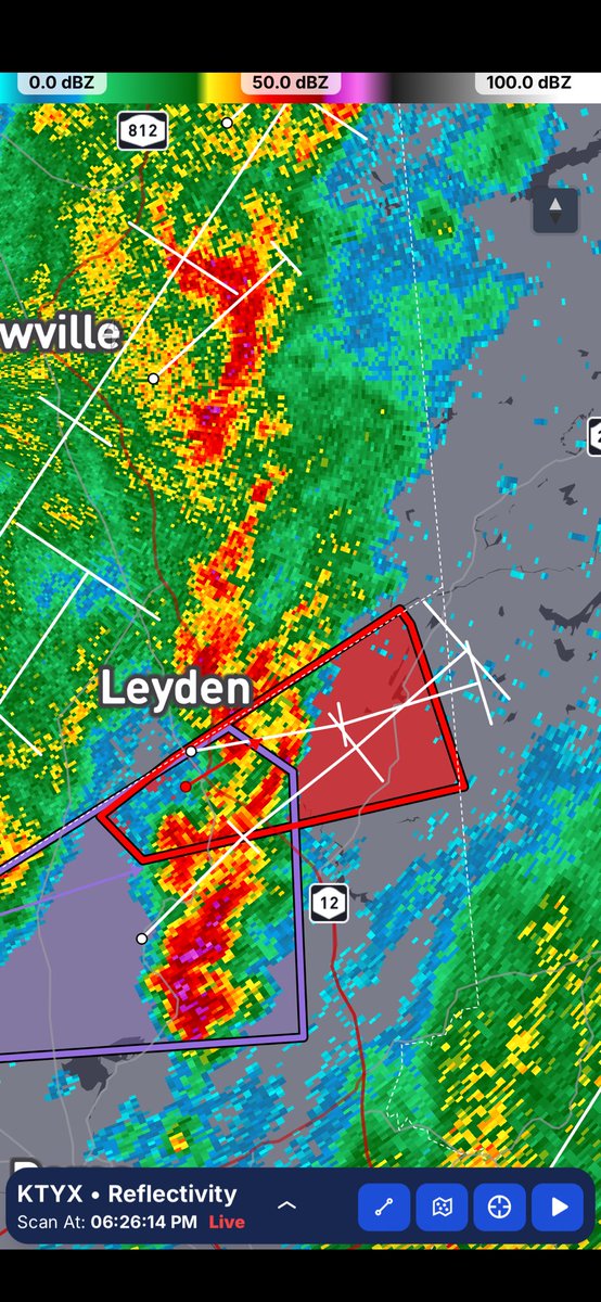
Tornado Warning for...
Northeastern Oneida County in central New York...
* Until 645 PM EDT.
* At 618 PM EDT, a severe thunderstorm capable of producing a tornado
was located over Boonville, moving northeast at 30 mph.