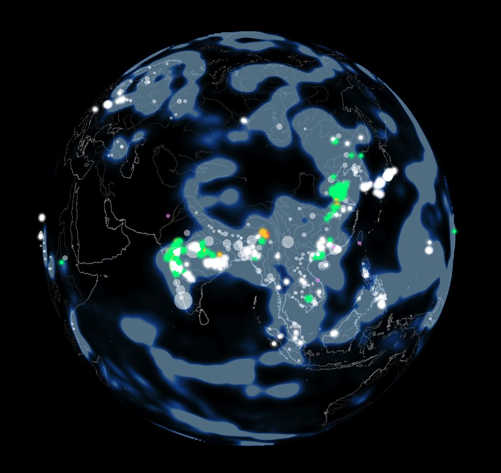
🌧️ Building a live flood risk engine that analyzes and provides coverage to +60% of the world population.
It has been on for a few days, using our own GIS data with NOAA’s and it detected several floods from heavy rain before they happen.
Stay tuned as we keep improving it.
🌧️ Flood alerts triggered yesterday in South Africa.
Several alerts around the region, hope it helped some stay safe. We keep improving to protect people from heavy rain.
⛈️ Looking forward to integrating Footing API to provide us with the safest locations that people can move towards in case of flash floods.
Worldwide geospatial analysis on steroids.
🌎 We score countries, regions, and towns. Now down to the plot.
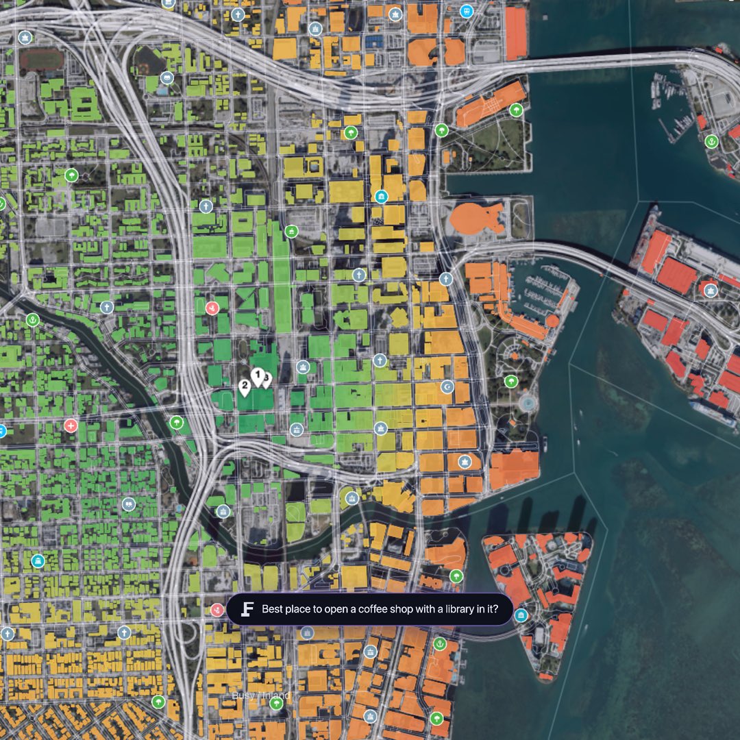
We asked: “Best place for a coffee shop with a library in Miami?”
Green good, red bad, pins mark the top plots.
Opening, moving, or expanding a business? Ask Footing.
Now you can find the best places to mine electricity, just with a prompt and a click.
“Find the best place to build a solar farm in California.”
“I’m planning to build a wind park, point me at the main distribution sites near me.”
Just ask Footing.
A new way to understand GIS, geospatial analysis, for everyone.
Up to now, these type of spatial analysis was capped to technical people or consulting firms.
AI is making things easy for everyone.
Where should you build a solar farm? Find vineyard land that still yields in 40 years? The lowest wildfire risk on Earth?
Ask Footing and it scores every place on Earth against your goal, continent down to a single plot.
Waitlist now open: https://t.co/tUYTmcNIh9
Portfolio’s take different shapes depending on which country or region are located.
https://t.co/Ulp6S5hQGt helps companies and individuals make the best decision for each territory.
Describe your goal and see the best places on Earth for it.
A new way to understand GIS, geospatial analysis, for everyone.
Up to now, these type of spatial analysis was capped to technical people or consulting firms.
AI is making things easy for everyone.
Consultant-grade land analysis is coming, for everyone.
It always existed but lived inside enterprise GIS suites most people can't afford.
Describe what you want in plain language. Footing finds the best places on Earth for it, continent down to a single plot.
Launching soon.
Our goal with FloodLink is to keep people around the world safe from storms and flash floods.
Our system is detecting heavy activity in Asia, mostly in China and India, the most populated countries.
Stay safe
Our goal with FloodLink is to keep people around the world safe from storms and flash floods.
Our system is detecting heavy activity in Asia, mostly in China and India, the most populated countries.
Stay safe
🇨🇳 Scary images coming from Hubei, China.
5 days ago an alert triggered and it was never downgraded so the storm and flood hazard is ongoing.
Stay safe people in the region.
🇨🇳 Scary images coming from Hubei, China.
5 days ago an alert triggered and it was never downgraded so the storm and flood hazard is ongoing.
Stay safe people in the region.
🇮🇳 Aftermath of the heavy rain in Mumbai, India.
🌧️ FloodLink managed to share a few alerts before the disaster happened.
Hope it helped some stay safe
🇨🇳 Unfortunate floods at Hunan, China.
Our alert triggered in advance, hope it helped some people stay safe.
Our prayers to the victims
https://t.co/VEEqvrYiKO
Cooking a global plot analyzer, for investors, real estate agents, funds and family trusts interested in purchasing land, anywhere in the world.
🏡 coming soon