JENESYS delegation from Japan visited GeoThings in Hsinchu! Students tried geoBingAn disaster coordination via LINE — AI-powered COP in Japanese.
"Why didn't we know about this tool?"
https://t.co/xbekmNGemi #geoBingAn#JENESYS#DisasterResponse
It's our pleasure to be invited for Taiwan Security Solutions Webinar. Check our @geoBingAn service as EOC (Emergency Operating Center) for local government or community.
https://t.co/yDhFpGzacm
UN Open GIS is developing UN Vector Tile Toolkit (UNVT) to provide the latest & efficient web map technology of vector tile to UN Global Service Centre, UN Agencies and National Geospatial Agencies.
Our pleasure to be invited with @audreyt for this task force, to work on the data in response to Emergency Transportation. From 119 call, ambulance dispatch, EMT actions, ER capacity, and later transferring to general nursing room. Much about data interface and ontologies!
UN-GGIM Working Group on Geospatial Information & Services for Disasters (WG-Disasters) is organizing a WG-Disasters Conference in Tokyo from 25 to 27 February 2020.
https://t.co/5EOQq0l3Pq
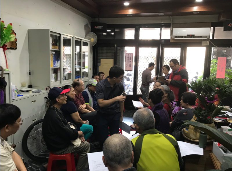
It's always fun and fruitful to have community-based training session for using @geoBingAn for disaster resilience. And it feels great to see all the survey photo uploaded by those senior volunteers (hearted)!
#HumanitarianICT
Yet another capacity building of disaster resilience for community by using @geoBingAn, we look forward to the joint drill in the near future!
#HumanitarianICT


![GeoThingsTW's tweet photo. 究平安 @geoBingAn App v2 正式上線!
我們從每一次工作坊、演習、以及志工的回饋中汲取養分,回到「離線作業」的初衷。
[Android] https://t.co/hDyrhmDrAS
[iOS] https://t.co/gK1k9znWwu
#geoBingAn #HumanitarianICT #離線作業 https://t.co/SAZsXupnw3](https://pbs.twimg.com/media/HFuNL_ZawAAAYz2.jpg)
![GeoThingsTW's tweet photo. 究平安 @geoBingAn App v2 正式上線!
我們從每一次工作坊、演習、以及志工的回饋中汲取養分,回到「離線作業」的初衷。
[Android] https://t.co/hDyrhmDrAS
[iOS] https://t.co/gK1k9znWwu
#geoBingAn #HumanitarianICT #離線作業 https://t.co/SAZsXupnw3](https://pbs.twimg.com/media/HFuNL_YaUAATyiY.jpg)
![GeoThingsTW's tweet photo. 究平安 @geoBingAn App v2 正式上線!
我們從每一次工作坊、演習、以及志工的回饋中汲取養分,回到「離線作業」的初衷。
[Android] https://t.co/hDyrhmDrAS
[iOS] https://t.co/gK1k9znWwu
#geoBingAn #HumanitarianICT #離線作業 https://t.co/SAZsXupnw3](https://pbs.twimg.com/media/HFuNL_MaoAA1BJN.jpg)





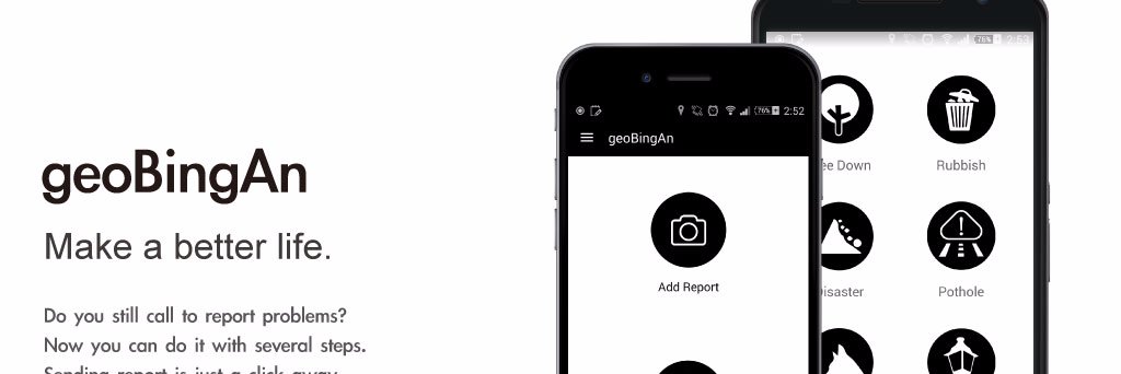

![GeoThingsTW's tweet photo. 究平安 @geoBingAn App v2 正式上線!
我們從每一次工作坊、演習、以及志工的回饋中汲取養分,回到「離線作業」的初衷。
[Android] https://t.co/hDyrhmDrAS
[iOS] https://t.co/gK1k9znWwu
#geoBingAn #HumanitarianICT #離線作業 https://t.co/SAZsXupnw3](https://pbs.twimg.com/media/HFuNL_lakAAEN2X.jpg)