Ask yourself:
>>Do we need data processing procedures to adjust our point clouds for possible misalignments?
>>Is additional software needed to make these adjustments?
Find the answers https://t.co/1vUGssSK8v
#lidar#uav#pointclouds#lidardrone#calibration
Check out this information session examining just a few of the many advanced applications utilizing our Geo-MMS product suite! Topics covered include Building Information Modeling (BIM), Security and Precision Agriculture.
YouTube link - https://t.co/pYSLZ3Bvbq
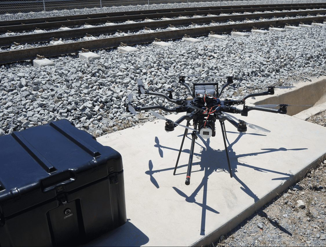
For their continued redevelopment, railway structural integrity must be assessed quantitatively. #LiDAR provides an excellent option for such assessment, due to its high scan rate, point measurement density and speed of data processing. https://t.co/HLXhhV6thP
Geodetics’ Geo-MMS product suite has applications in a wide variety of fields, including powerline inspection, Building Information Modeling (BIM) and precision agriculture. #uav#drones#lidar#georeferencing https://t.co/UXjDEF7f2k
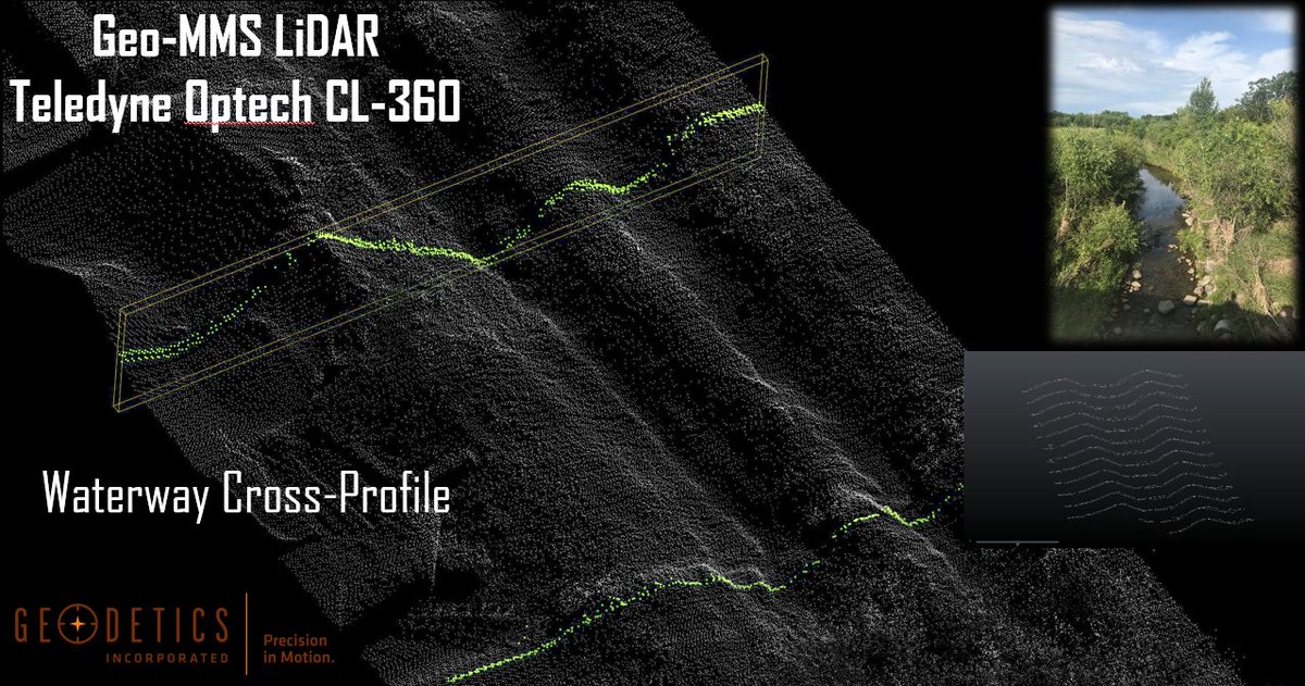
@geodetics_lidar and @VelodyneLidar share a long and fruitful partnership. Sensors such as the Velodyne VLP-16, HDL-32E and Puck 32MR are some of the most commonly implemented LiDAR sensors within the Geo-MMS product suite
https://t.co/Tup0y75c2i
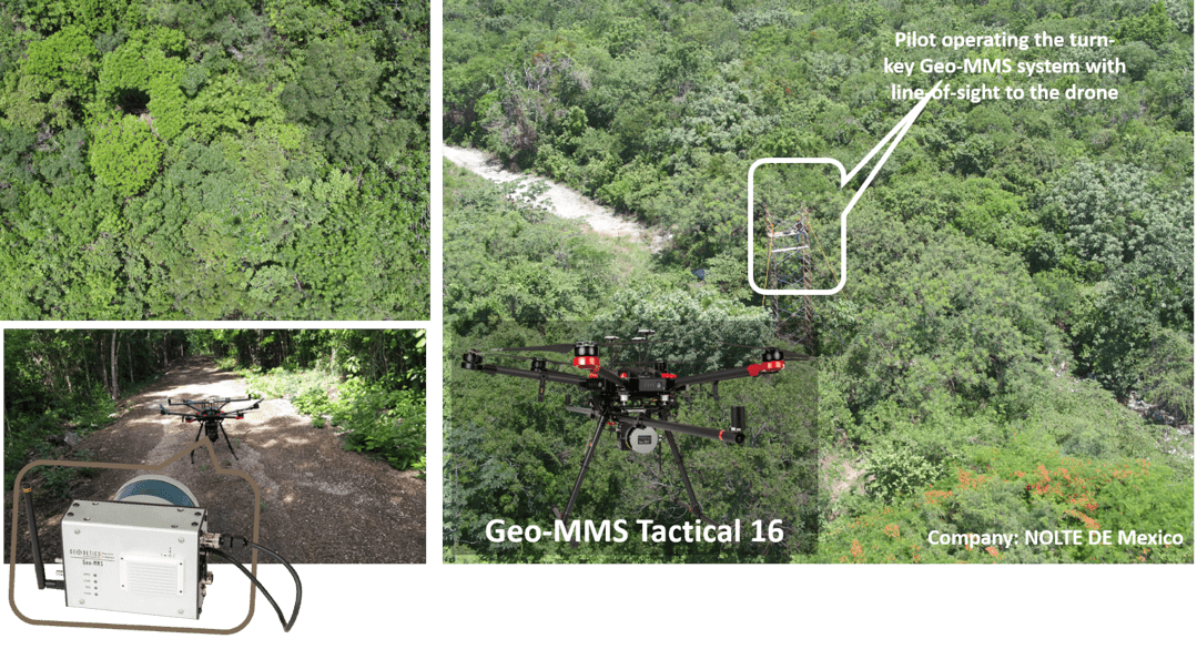
Did you know that unmanned aerial vehicles (UAV) can be used for detailed 3D mapping? @VelodyneLidar’s Puck helped @geodetics_lidar to create a high-quality and cost-effective UAV mapping solution that functions across various industries. Read more here:
https://t.co/cvG5z9yZK5
Leveraging LiDAR archaeology to see through thick, overgrown jungles in an effort to discover ancient ruins never seen by man before. The discovery possibilities are limitless. #lidar#Archaeology#lidardrone#geodetics Learn more>>> https://t.co/RUJlJ41gwc
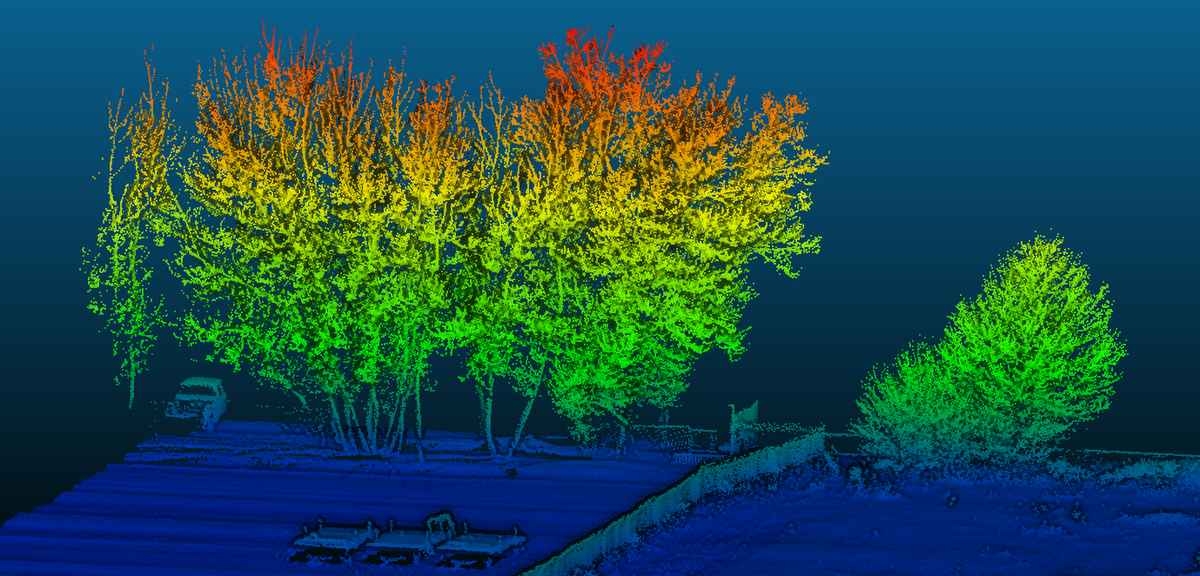
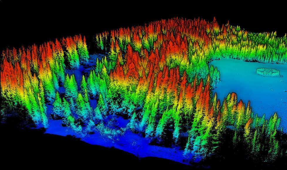
The uses and applications of classified LiDAR point clouds extends far and wide. Classified areas of forestry can be assessed over a given period of time. Learn what Geodetics products can do for your project...https://t.co/jjfIkFSCJF
#lidar#photogrammetry#drone#uavs
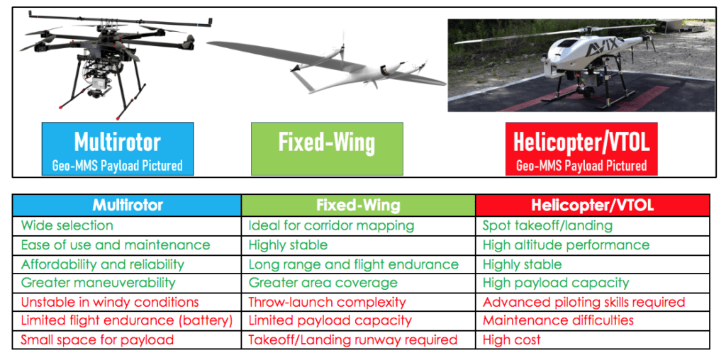
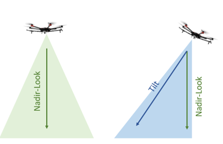
Does a dual-camera drone offer better coverage? Geodetics Geo-MMS product suite offers both options - discover what is best for your application. https://t.co/PdbVzdMNAd #lidar#uav#drone#lidardrone#dronephotography
Selecting the right digital elevation model for your project can be challenging. Geodetics offers three simplified, but common interpretations.https://t.co/ynJoGGbYuA #lidar#uav#geodetics#drone#agriculture#surveyor
With the integration of the @quanergy M8 with our Geo-MMS product line we can now offer the most advanced drone mapping systems on the market. #lidar#drones#uav https://t.co/qHywdcD9Dp
Join us September 3rd through 6th at @InterDroneExpo 2019 at the Rio in Vegas. Stop by booth #402 learn more >>>https://t.co/evoJpvXBpF #drone#lidar#uav
Going to @InterDroneExpo 2019? Stop by booth #402 or register to reserve some time to meet with our team to learn about our Geo-MMS product suite #drone#lidar technology https://t.co/jNOoUEcEtX.
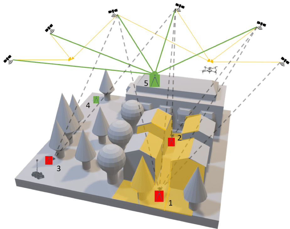
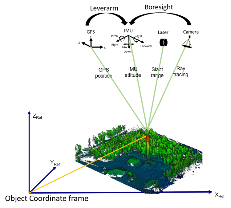
Geodetics compares image attitude estimated from both the indirect and direct approach. #lidar#geodetics#drones#droneservices#UAV Learn more>>> https://t.co/p76gq5sCiS