Hi #gischat Cannot find a way to export multiple PostgreSQL tables of a specified schema to FlatGeoBuf (or GeoJSON) with one single #ogr2ogr command as we can do for #ShapeFile export.
Detail: https://t.co/0RzntXCpBm
Any hint ?
Linux, Windows and Mac packages of point release #QGIS 3.22.8 'Białowieża' (LTR) and release candidate of new release QGIS 3.26.0 'Buenos Aires' ready on https://t.co/8GHALpmjLR. Make maps not war!
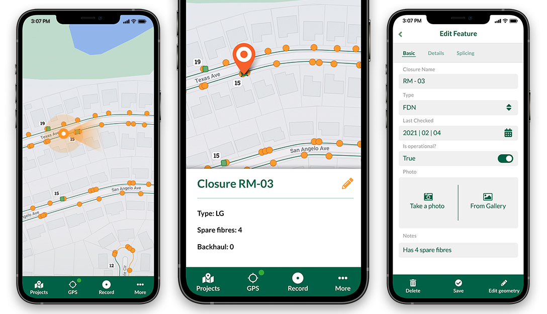
https://t.co/KXCwKEzzE3 version 1.5.1 was released earlier today with an option to resize photos and several bug fixes. With the app you can have the power of #QGIS in your pocket. Read more about the features and bug fixes here:
https://t.co/0mXrKUM4m1
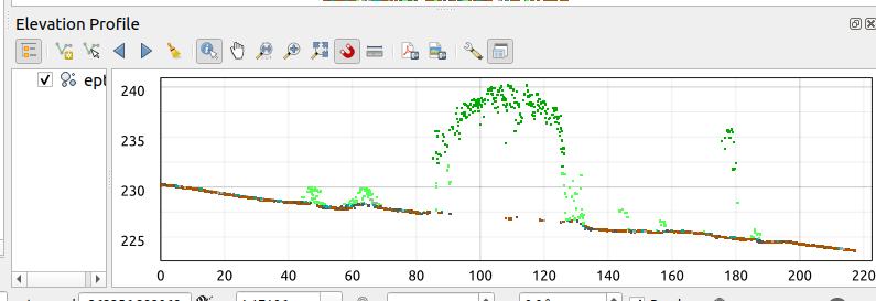
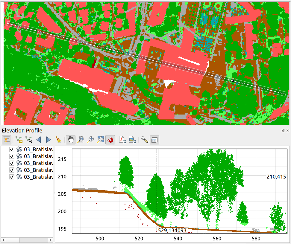
The next version of #QGIS will be packed with exciting 3D and point cloud enhancements, thanks to our crowdfunding campaign late last year. The excellent new elevation profile tool by @northroadgeo can generate plots from mesh, raster, vector and point cloud data.
We are improving point clouds and 3D in #QGIS in collaboration with @northroadgeo and @howardbutler Read our latest progress report on several exciting new features which will greatly improve #QGIS usability:
https://t.co/q4CRLSIa9X