I’m pleased to share my latest article in @WarOnTheRocks , co-authored with @KellyAGrieco and @HunterSlingbaum.
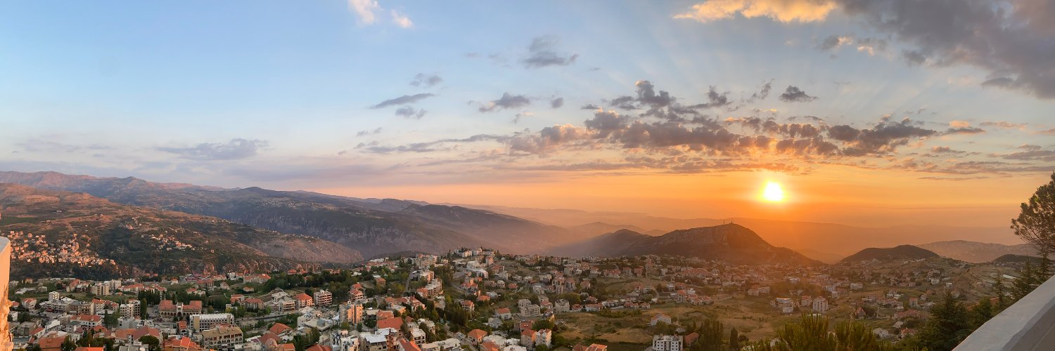
We examine how Hizballah’s risk strategy during the conflict helped make Lebanon impossible to ignore in broader US-Iran negotiations.
https://t.co/c6X7A8pNXh
🇲🇱 #Mali: FAMa/Russian Africa Corps launched drone strikes against FLA positions in I-n-Afarak (Inafarak), Kidal Region, on July 12.
Low-resolution satellite imagery via @CopernicusEU shows the aftermath of the strike.
📌 Geolocation: (21.323244, 0.729990) https://t.co/MLnX3ibAe7
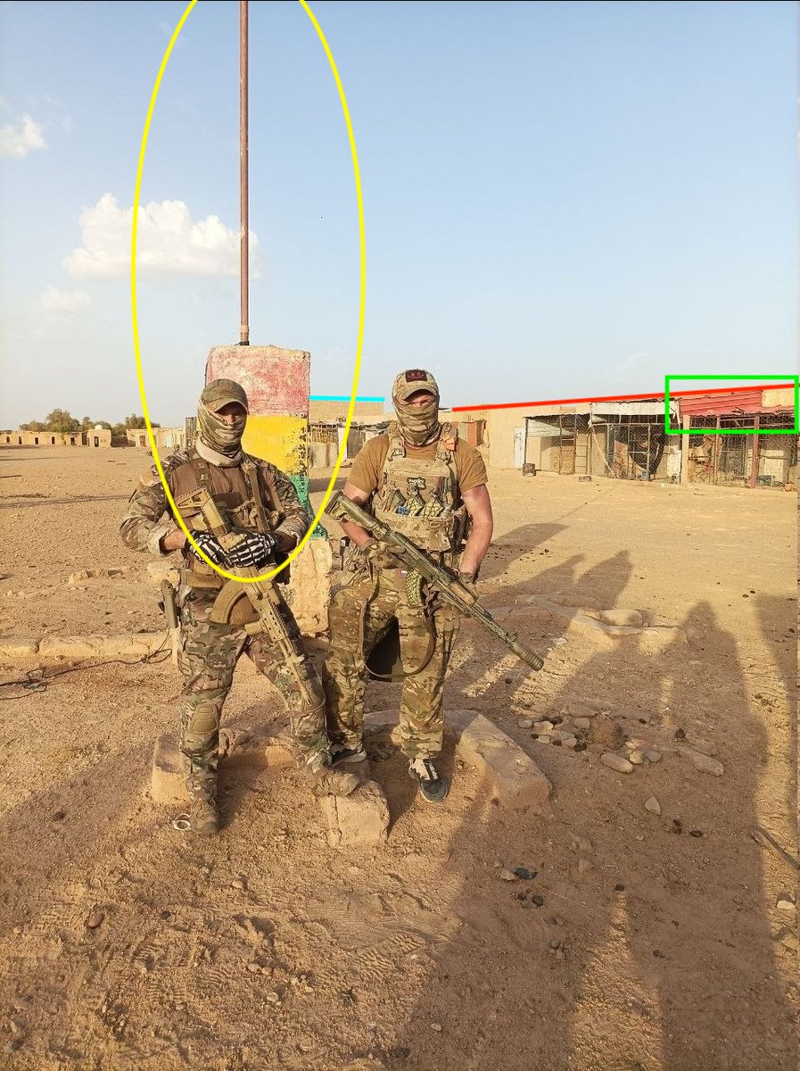
🇲🇱 #Mali: Russian Africa Corps fighters have reportedly recaptured Anéfis from the FLA. The group shared a photo of their fighters in the town center.
📌 Geolocation: (18.043020, 0.602018) https://t.co/mY96AZJ8Jg
🇳🇬 #Nigeria: Islamic State - West Africa Province (ISWAP) claimed two attacks on Nigerian Army Camps in Logomani and Mairari, Borno State.
According to the group's statement, these raids are a part of a "new wave of attacks" since the US strikes in May.
🇲🇱 #Mali: Russian Africa Corps launched strikes against Azawad Liberation Front (FLA) targets in Anéfis, Kidal Region.
📌 Geolocation: (18.045997, 0.603228) https://t.co/1j7V2InoCT
🇲🇱 #Mali: Russian Africa Corps launched an FPV-drone strike against an FLA vehicle in Anéfis, Kidal Region.
📌 Geolocation: (18.038581, 0.602403) https://t.co/TvfeRgi2SW
🇲🇱 #Mali: Russian Africa Corps launched an FPV-drone strike against #JNIM fighters near the Gao airport, Gao Region on July 04.
📌 Geolocation: (16.259511, -0.020935) https://t.co/aDIUbtaOaa
🇳🇬 #Nigeria: Low-resolution satellite imagery via
@CopernicusEU shows the before and after of the strike.
This is the first visual confirmation of a second ISSP camp being targeted in the Christmas strikes.
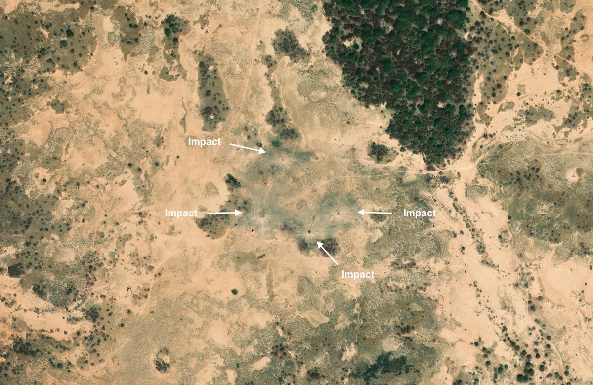
🇳🇬 #Nigeria: More high-resolution satellite imagery shows the exact location of four more impacts from the US airstrikes targeting Islamic State - Sahel Province (ISSP) in Tangaza, Sokoto State on Christmas.
This is the second ISSP camp targeted in the strikes.
📌 Geolocation: (13.582980, 5.032310) https://t.co/nNMfnzBuh1
🇲🇱 #Mali: Russian Africa Corps launched a FPV-drone strikes against a JNIM "fuel depot" in Ndoukala, Ségou Region. The date(s) of the strikes is unclear.
📌 Geolocation: (14.791352, -5.998116) https://t.co/ENiqwbz84E
🇲🇱 #Mali: Russian Africa Corps launched an airstrike against JNIM fighters in Kirnya, Mopti Region on June 15.
📌 Geolocation: (15.051110, -1.546111) https://t.co/i2eBVkwKi6
🇳🇬 #Nigeria: New high-resolution satellite imagery available via Apple Maps shows the aftermath of the US airstrikes targeting Islamic State - Sahel Province (ISSP) in Tangaza, Sokoto State on Christmas. Four distinct craters can be seen in the image.
🇳🇬 #Nigeria: "Lakurawa" fighters on motorbikes were filmed in Zugurma, Niger State.
This incident indicates a significant geographic expansion of jihadist activity into Nigeria's North-Central region.
📌 Geolocation: (9.451370, 4.970316) https://t.co/vyiGUIyyEQ
🇳🇬 #Nigeria: A Pro-IS channel claimed Islamic State - Sahel Province (ISSP) targeted JNIM camps “along the border between Kebbi and Niger states” on June 14.
The account shared a map with a marker placed east of the Illoka Oje Forest in Kebbi State, where JNIM and ISSP have recently clashed. Below is our visualization of recent ISSP-JNIM clashes in Nigeria.
📌 Marker from Pro-IS map: (11.2302382, 4.0216257) https://t.co/RdozsmMjpK
🇳🇪#Niger: Terrorists launched an attack on Niamey Airport in Niger. The attack was successfully repelled and the vehicle used was found. This is the second attack on the airport this year, with the first occurring in January.
📌Geolocation: (13.4735768, 2.1791092)
https://t.co/nC4eqXnRak
🇳🇬 #Nigeria: The Nigerian Armed Forces launch Operation Clean Sweep III in the aftermath of the killing of Ret. General Abubakar.
The coordinates shown in one image from the operation match the location of recent ISR flights over Matazu LGA in Katsina State.
📌 Geolocation: (12.242809, 7.676797) https://t.co/Gi1V60mLVC