A global 6M dataset built specifically for the UAS/UAV/UTM/BVLOS industry for the growth of your organization!
EASA Certified. Fully certified to relevant industry standards and regulation for integration with flight safety systems.
https://t.co/T8dqVrTWwy
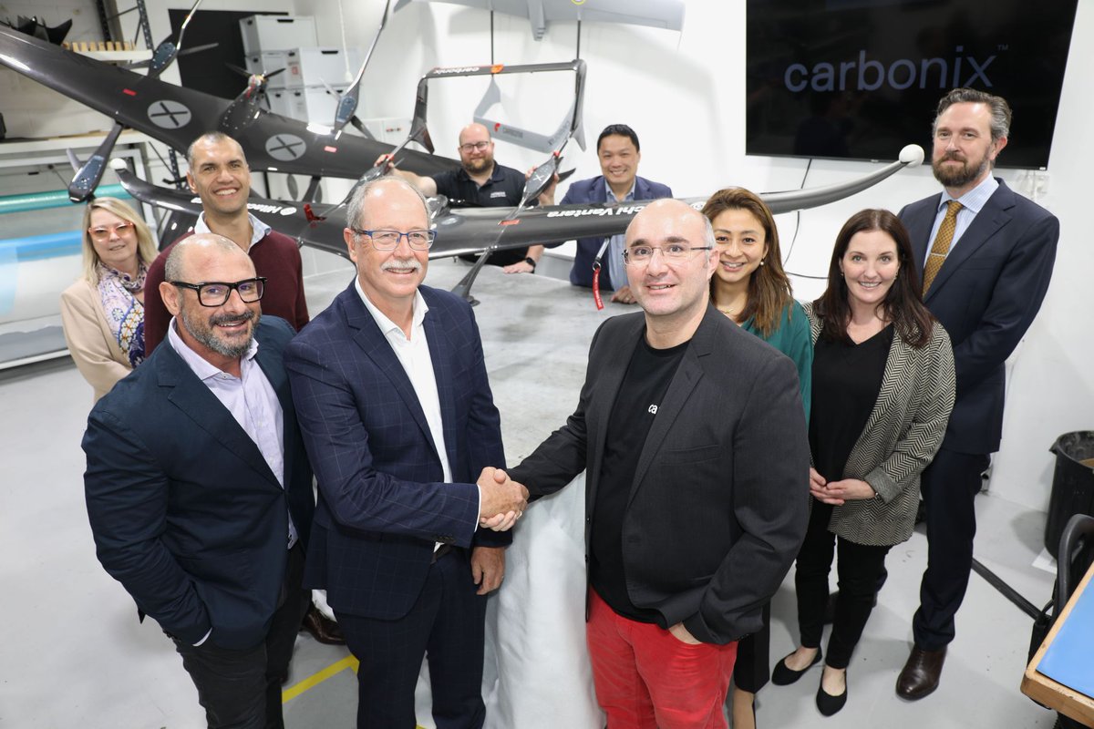
New partnership milestone! We hosted a delegation from @HitachiVantara , who collected their Volanti aircraft. 🚀 Signing the MOU sealed our strategic partnership and commitment to our shared key values: reducing environmental impact and enabling cost-effective data acquisition.
Patrick A. Blott, #Intermap Chairman and CEO. “Our elevation data provides accurate, location-specific details to increase the level of confidence for accurate property valuation and help investors make smarter decisions.”
A global 6M dataset built specifically for the UAS/UAV/UTM/BVLOS industry for the growth of your organization!
EASA Certified. Fully certified to relevant industry standards and regulation for integration with flight safety systems.
https://t.co/T8dqVrTWwy
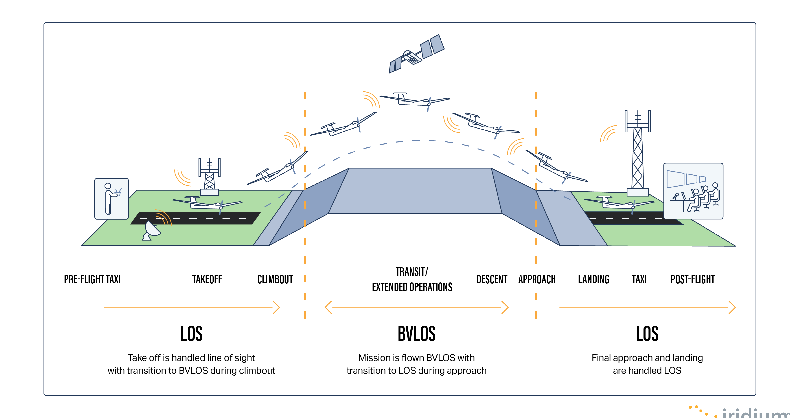
We are super pumped about Australia's @CASABriefing announcing the launch of a new beyond visual line-of-sight (BVLOS) outside of controlled airspace (OCTA) exam for remote pilots.
Want to know more?
Read our opinion piece here: https://t.co/ljLbsviqYo
A global 6M dataset built specifically for the UAS/UAV/UTM/BVLOS industry for the growth of your organization!
EASA Certified. Fully certified to relevant industry standards and regulation for integration with flight safety systems.
https://t.co/T8dqVrTWwy
Better elevation data creates an address specific risk score. Plus we customize your risk scoring analytic for your particular organization that incorporates into your work flow! Good work #Intermap