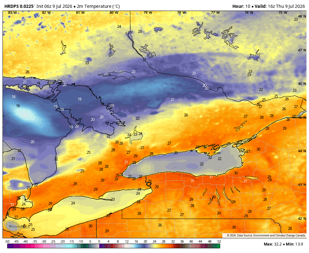
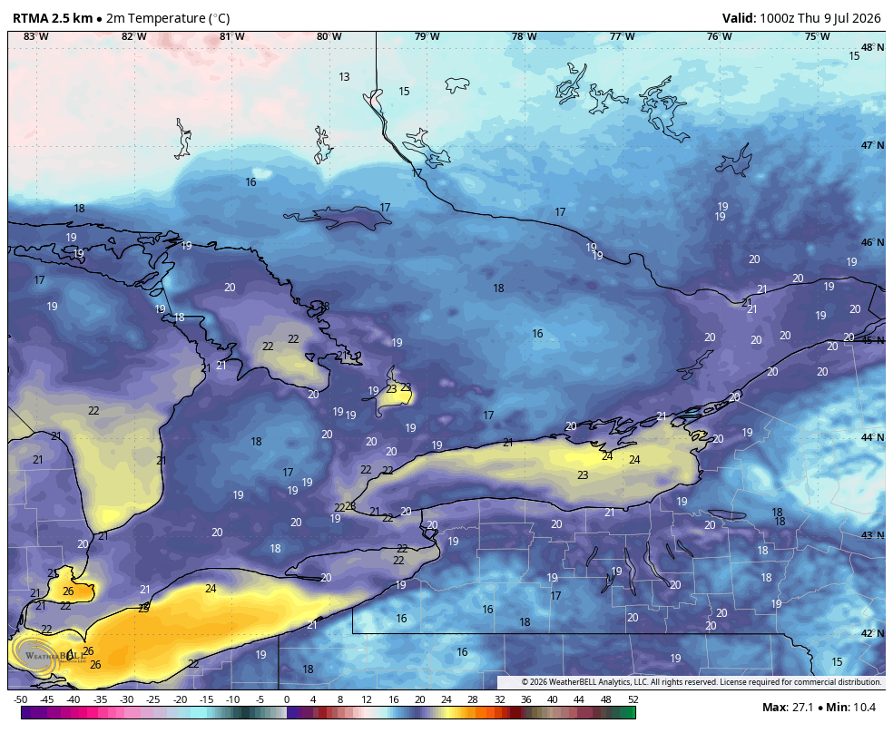
In just a short 6 months, this same pattern would be a full Hwy 21 closure from Goderich to Port Elgin with people stuck in snowbanks by Mitchell on 23. ❄️🫠
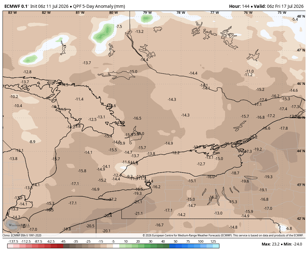
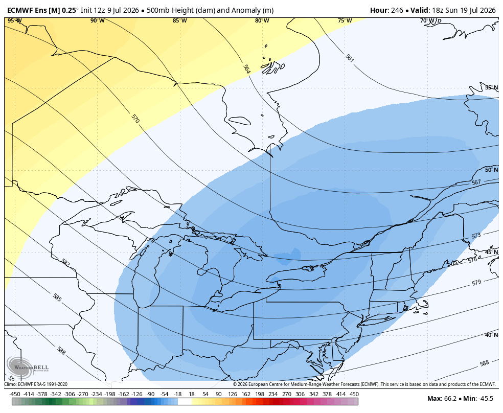
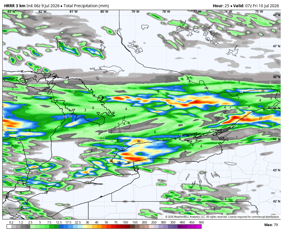
Sneak peak of fall is on the way to parts of Southern #Ontario tomorrow!
As mentioned yesterday, bands of Lake Effect showers/ rain are expected to develop overnight across areas east of Lake #Huron
It will also be a chilly day with temps struggling reach the upper teens (average highs this time of year are around +27C)
Similar to Monday AM, morning temps will likely be in the upper single digits across parts of SW and Central Ont and towards Cottage Country
Looking at the long range data, not seeing any multi day heat events until at least the second week of August
#OnWX #ONStorm
Update on tomorrows Severe Storm potential 👇
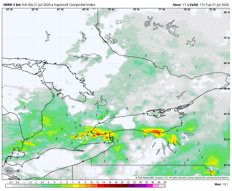
Models continue to show several rounds of storms tomorrow across Southern #Ontario
The atmosphere looks to recover after the eaely morning storms leading to significant CAPE (fuel) for the afternoon across SW/ Central Ont and the #GTA
At this point, the severe risk is looking isolated rather than widespread
The #Kincardine to #Cornwall and south has the best chance at seeing severe storms
Main risks: torrential rain (20-40+mm), strong wind gusts (90+km/hr) and large hail (2+cm). A brief tornado cannot be rulled out
Will have another update in the morning
#OnWX #ONStorm
Parts of SW #Ontario could be in store for an early morning lightshow tomorrow 🌩 ⚡️
Line of storms is expected to track through east of Lake #Huron between 3am and 6am
Torrential rain likely, strong winds and hail possible
#OnWX#ONStorm
Update on tomorrows Severe Storm potential 👇
Several rounds of storms expected tomorrow across Southern #Ontario
First round looks to be early morning followed by a stronger line for the afternoon
Main risks- torrential rainfall, strong winds, hail
Slight risk of a brief tornado
Rainfall amounts will vary with locally heavy rainfall (20-40+mm) within the strongest storms
Will update this evening
#OnWX #ONStlrm
A look at the week ahead 👇
Overall, a cooler and drier than normal week
Temps will range from near 20C to the mid 20s Monday to Friday (temps may struggle to reach 20C Wednesday), things may warm up for the weekend with temps in the upper 20s
Tuesday is the only day that offers widespread rain chances, mostly dry the rest of the week
#OnWX #ONStorm
Chilly morning on tap tomorrow across parts of SW #Ontario 🥶
Temps are expected to drop down below 10C overnight
With dewpoints near 5C, the air will be cool and crisp
#OnWX#ONStorm
Update on the severe storm potential for tomorrow 👇
Models continue to show a line of storms moving through the region tomorrow afternoon ahead of a cold front
We'll have to watch the showers/ storms during the morning that may hinder storm development as well as any lingering wildfire smoke
Greatest risk of severe storms looks to be from #Kincardine towards #Cornwall and south
Main risks- damaging winds, large hail, torrential rain. Slight risk of an isolated tornado
Will update layer this evening
#OnWX #ONStorm
The latest HRRR model continues to show a massive plume of wildfire smoke making its way into Southern #Ontario tomorrow
Some areas could be in the thick of it for over 48hrs
Expecting to see similar if not worse conditions compared to 2023
#OnWX#ONStorm
#NorfolkOPP is on scene of a structure fire on #Highway3, just outside of #Simcoe. Details are limited at this time.
Highway 3 is now closed between Charlotteville East Quarter Line and Windham East Quarter Line Road. Please avoid the area and watch for emergency services vehicles responding to and working at the scene.
Updates will be provided when available.
#RoadClosure #OPP @NorfolkCountyCA. ^ag
Very warm start to the day across Southern #Ontario
Temps range from the low to mid 20s, humidex values near 30
Sweltering afternoon with temps in the mid 30s, upper 30s across the #GTA and #Toronto. Humidex values in the mid/ upper 40s
Watch for a line of severe storms to develop across Eastern Ont after 7pm (will have an update shortly on storm potential)
#OnWX #ONStorm
Our multi day heat event has begun across Southern #Ontario! 🔥
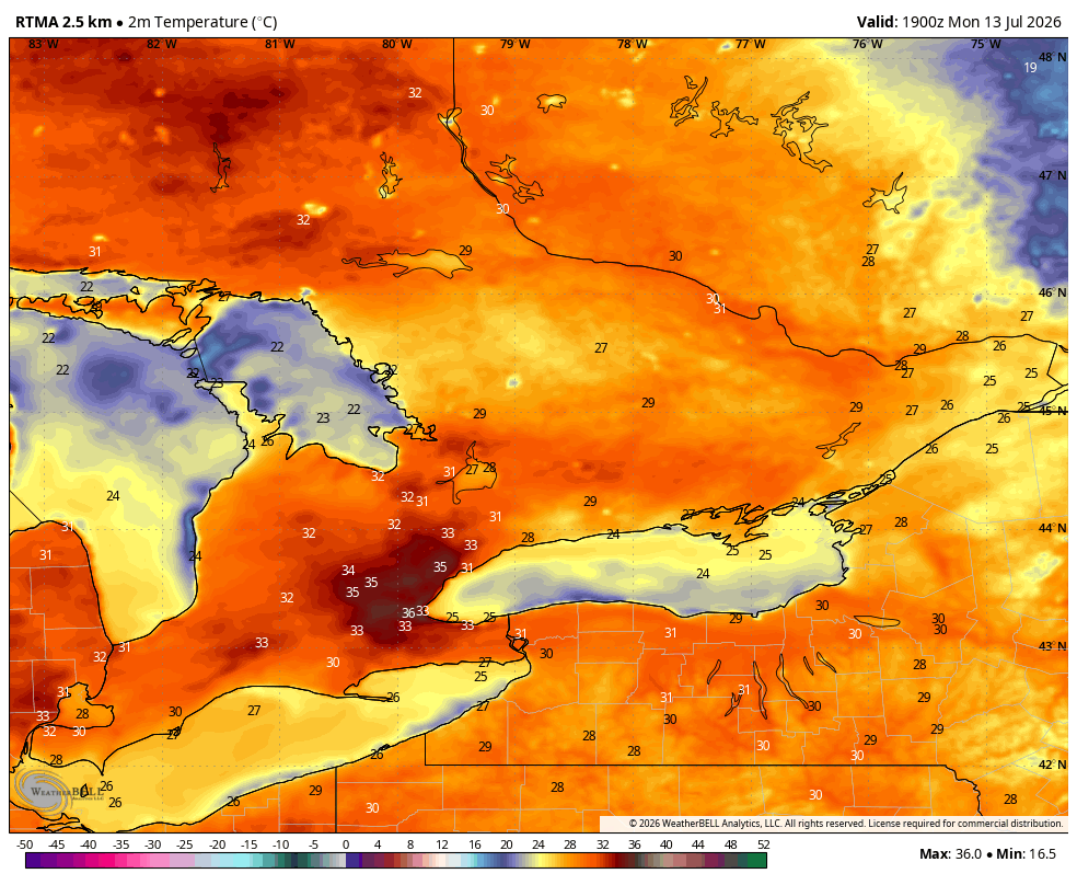
Widespread temps in the 30s across most of Southern Ont this afternoon
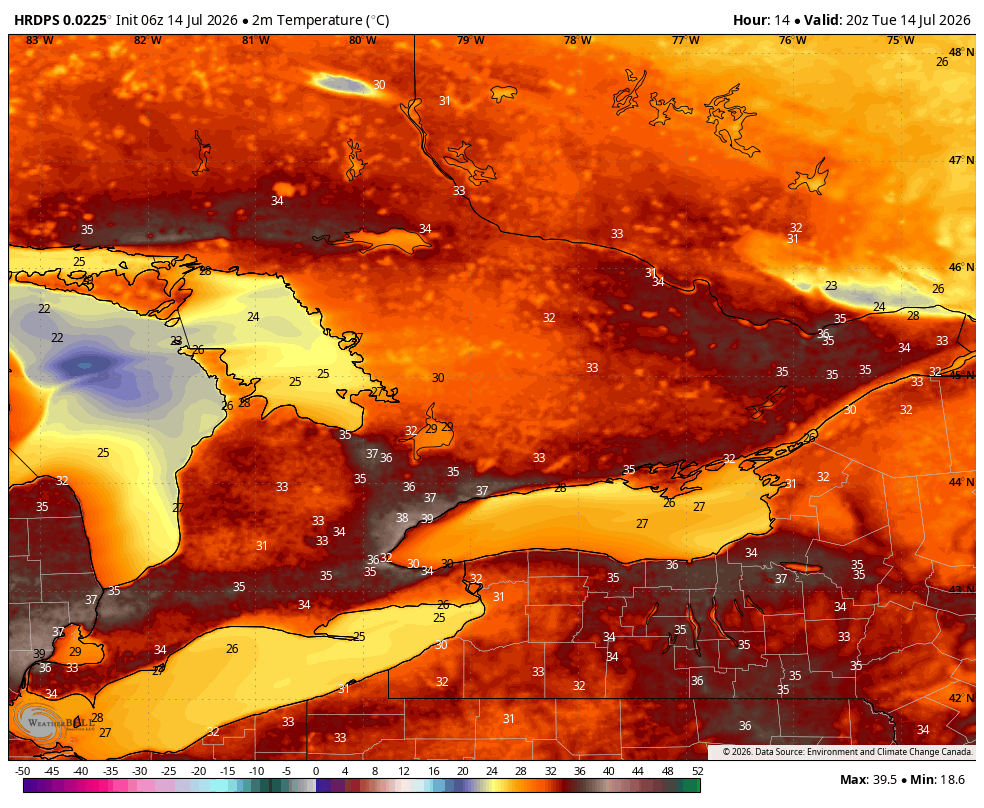
As mentioned last week, Tuesday (tomorrow) continues to be the hottest day of the week
Temps in the mid 30s expected across most of the region of the region with temps nearing 40C (without the humidex) possible across #Toronto and the #GTA 🥵
Heat event continues into Wednesday, possibly into Thursday but with temps in the low 30s
#OnWX #ONStorm
Lake Breeze Boundaries are setting up across parts of Southern #Ontario
Circled areas have the best chance at seeing isolated showers/ storms later this afternoon/ evening
#OnWX#ONStorm
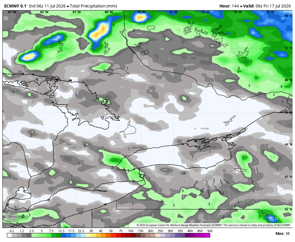
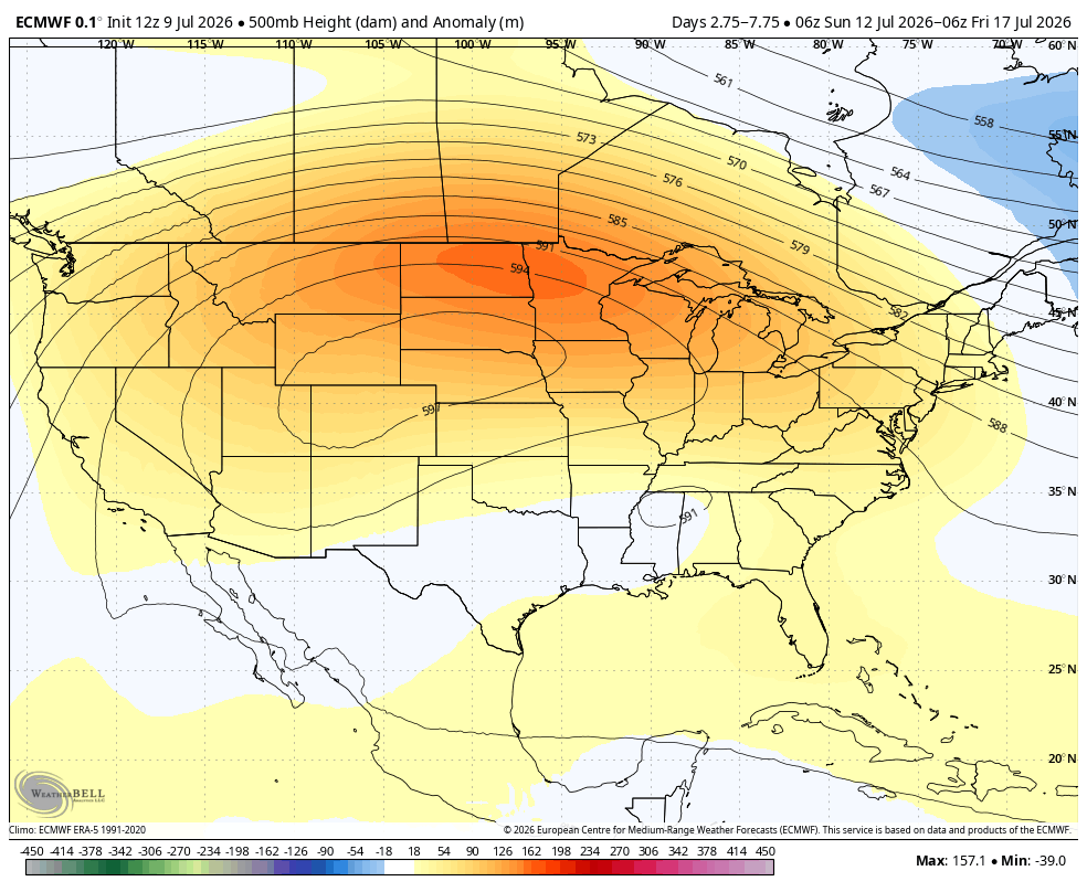
Another dry stretch of weather is on the way to Southern #Ontario
As the heat dome/ ridge out west shifts eastward, it will block any chances at rain/ storms across the region
The next 7 days look very dry with little to no rainfall expected for most
#OnWX#ONStorm#OntAg
After a bit of a break from the heat, looks like another multi day heat event may be on the way to Southern #Ontario next week
The ridge/ heat dome out west appears to flex/ shift eastward, pushing heat into the region
Doesn't look anywhere near as hot as last week and not as long duration
Several days (Monday to Wednesday) of temps in the low/ mid 30s, humidex values upper 30s/ near 40
Big cool down possible by the weekend!
#OnWX #ONStorm
Very warm start to the day across Southern #Ontario
Temps range from the upper teens to low 20s
Temps peak in the upper 20s/ near 30C before the line of showers/ storms move through
Still looks like a broken line of storms will track through the region early afternoon
Could see scattered storms develop out ahead of the line- those could become severe
#OnWX #ONStorm