Good Tuesday morning! Some showers and a t-storm around through this morning, with more widespread storms later this afternoon and this evening. Severe thunderstorms and flash flooding possible mainly this afternoon and evening. Stay weather aware today! #pawx#njwx#dewx#mdwx
Hurricane hunters have found Depression TWO has strengthening into Tropical Storm Bertha in the Gulf off the coast of Florida and is the second named storm of the season. This is expected to remain a low-end tropical storm and make landfall near New Orleans Wednesday
Southeastern PA is in the Conditional Intensity Group #1 (CIG 1) for tornadoes today (hatching/stripes on the map). What does it mean? It means that if tornadoes develop, some tornadoes could be stronger than just weak EF0/EF1-strength tornadoes.
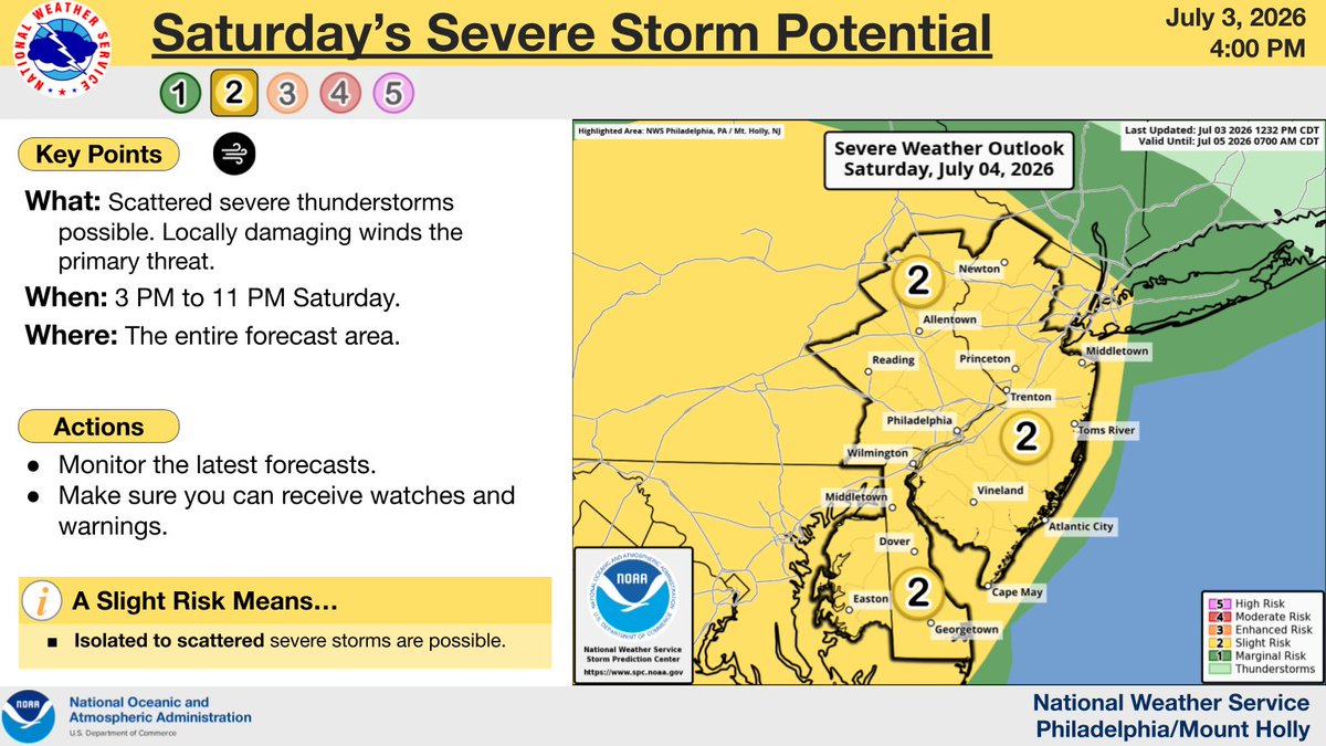
⚠️⛈️ The risk of severe thunderstorms and flash flooding for Saturday has increased. Scattered to numerous thunderstorms will be capable of producing damaging winds, tornadoes, flash flooding, and large hail. Multiple rounds of storms expected. (1/2) #PAwx#NJwx#DEwx#MDwx
A significant event is looking more likely Saturday. Multiple rounds of storms expected, which may begin before noon and extend after sunset. There is a significant risk of wind damage, w/ a notable risk of flooding & potential for tornadoes. See reply post for larger graphics.
No words. Here is a peak at one of our most incredible drone flights around a #tornado to date near Tulliby Lake, AB.
The odds were completely stacked against us on this one, but thanks to some determination to make the 18 hour drive up here pulling an all-nighter, and brilliant forecasting by Nelson Tucker we were able to see this beauty.
This will likely be one of our last intercepts of the season, thank you so much to everyone for following along as we press on to properly measure tornadoes to push weather science forward!
#stormchasing #nature #weather
The most important video we’ve ever made just released on YouTube, covering the 2025 Camp Mystic Flood Disaster. Please like, share, and hype it so more people can become aware of the inaction and ignorance that enabled the disaster to happen:
https://t.co/UYXJsz3XYr
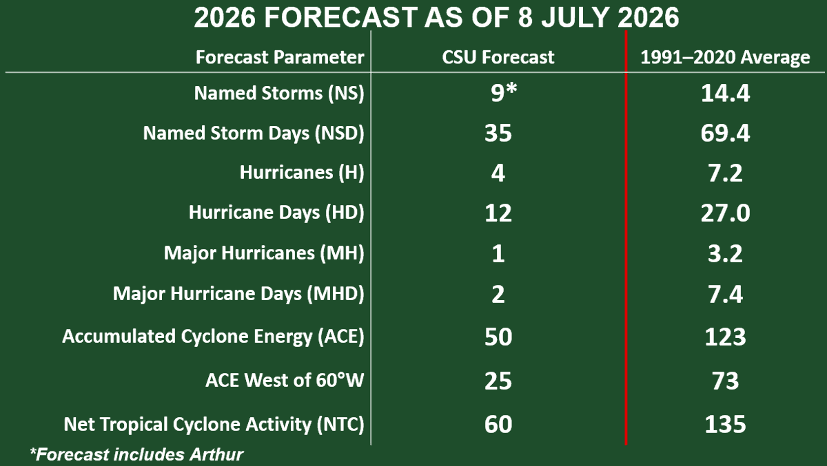
CSU reduces forecast for 2026 Atlantic #hurricane season and now calls for well below-normal activity: 9 named storms, 4 hurricanes & 1 major hurricane. High likelihood of strong #ElNino and associated increase in vertical wind shear the primary factor:
https://t.co/fAwk9hWVVK
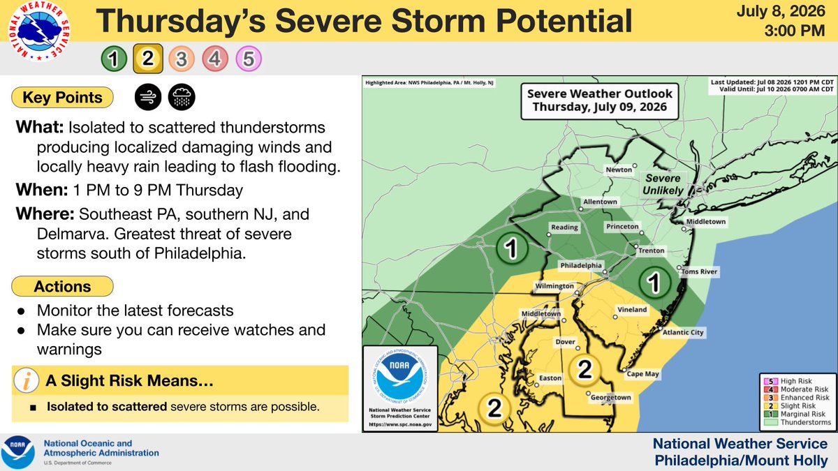
⚠️⛈️ Isolated to scattered storms are forecast to develop on Thurs, especially across SE PA, S NJ, & Delmarva. The greatest risk of severe storms with damaging winds will be mainly near and south of Philly. There is also a risk of localized flash flooding. #PAwx#NJwx#DEwx#MDwx
With Philadelphia hitting 101° today, that marks three straight days of 101° or higher. That is the first time that has ever happened with records going back to 1873. #PAwx
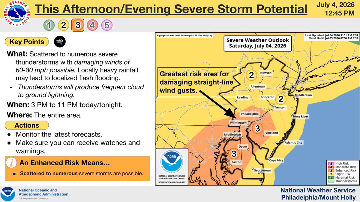
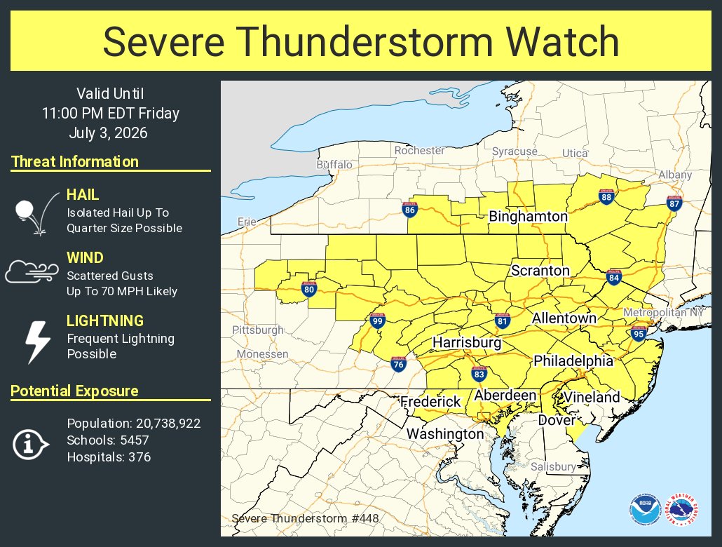
Good afternoon! The severe thunderstorm risk has increased for some areas later this afternoon & evening. Damaging straight-line winds are the main threat, however frequent cloud to ground lightning will occur with any stronger storms. Stay weather aware! #mdwx#dewx#njwx#pawx
Dangerous heat continues through the 4th of July, then cooling takes place Sunday and especially early next week. As this change in the pattern occurs, some severe t-storms are possible through this evening and then again this weekend. Stay cool and safe! #pawx#njwx#dewx#mdwx