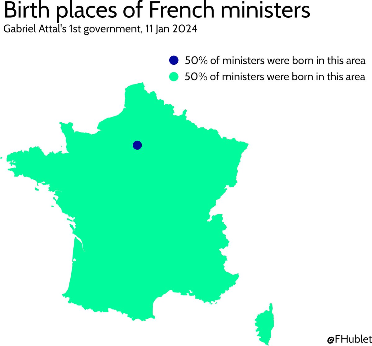
🗺️ French centralization is not just about institutions.
In the new French government the median distance from ministers' birth place to Paris is... 17 km 👇
#remaniement#gouvernement
Et avec deux souches différentes et un départ de Paris. Voici les résultats à 24h. Une souche semblerait être une sudiste, l’autre une bretonne avant tout (elle a été jusqu’à Brest !)…
Tout cela permis par le projet de @Docteur_Drey #derrierelebloblarecherche#blob [3/3]
Très beau travail cartographique d'@EU_Eurostat sur la population européenne en 2021. L'échelle est très fine avec une analyse par grille de points. C'est développé sur un site très simple d'accès et qui en un coup d'œil permet de voir plusieurs dynamiques. 1/n
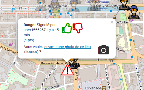
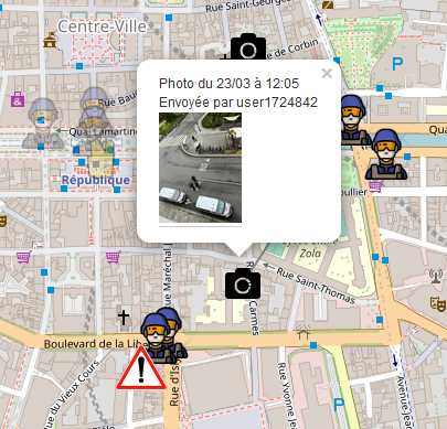
Le "Waze" des #Manifestations, un usage original de cartographie participative en temps réel (suivi des cortèges, dangers, positions des forces de l'odre, photos...)
➡ https://t.co/kqTYS8DWP8
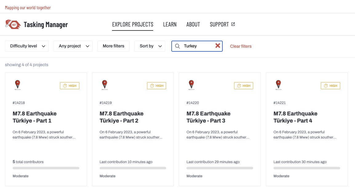
Mapping Damaged Buildings on OpenStreetMap
Now, we created new MapRoulette tasks to map damaged buildings on @OpenStreetMap. Damaged building data source came from different resources including @CopernicusEMS, manual digitisation by volunteers and field data. #TurkeyEarthquake
Call to Action: Map Southern Turkey
Dear @openstreetmap community,
We’re asking your help to support mapping the areas which have been terribly affected by the powerful earthquake (7.8 magnitude) in Southern Turkey. #TurkeyEarthquake
Mapping Tasks:
https://t.co/tJAi2r8OCq
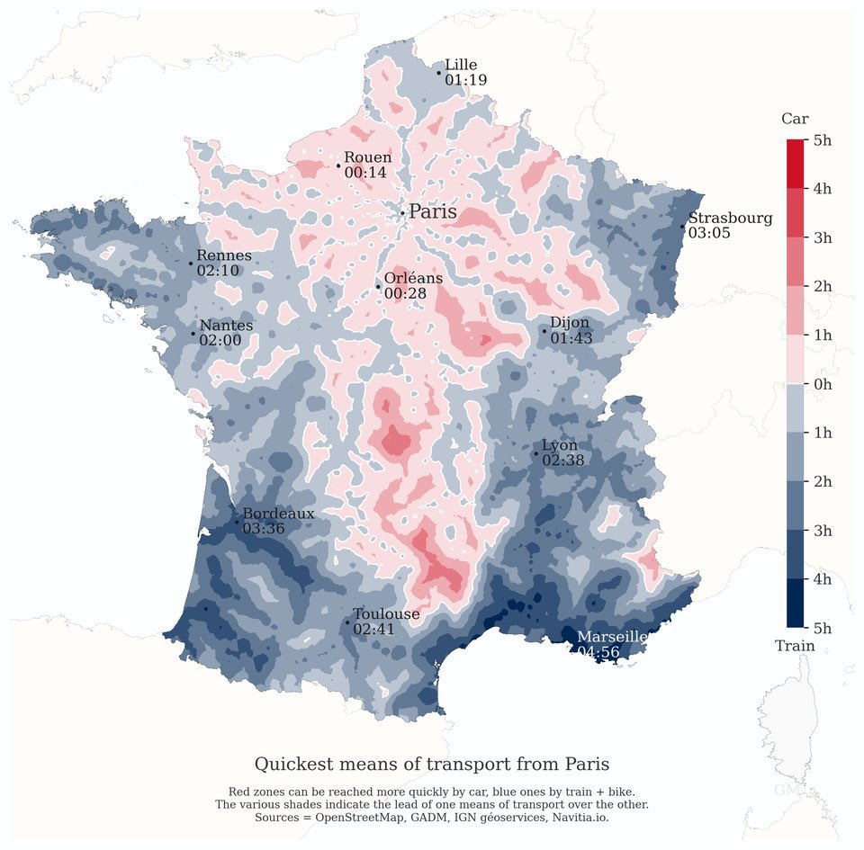
Travelling from Paris 🇫🇷 to the rest of France?!
🔴Red zones can be reached more quickly by car 🚗
🔵Blue zones by train 🚆 + Bike 🚲
Great comparative data visualization. 👇👇
HT https://t.co/hg30tXW729
Quelques mots français dans les langues étrangères ! Mon préféré ? "Alain Delon" en roumain pour parler d'une veste en daim fourrée. Carte tirée de mon "Atlas de la France Incroyable" (@EdAutrement) toujours réalisée par la non moins incroyable @AbCarto.
#30DayMapChallenge 🗺️, jour 30 : last but not least, un "remix" que vous reconnaîtrez aisément. Un parcours reliant uniquement une sélection de 21 villes de plus de 20.000 hab. n'ayant jamais été villes étapes ! 🚴🇫🇷
#30daymapchallenge day 27.
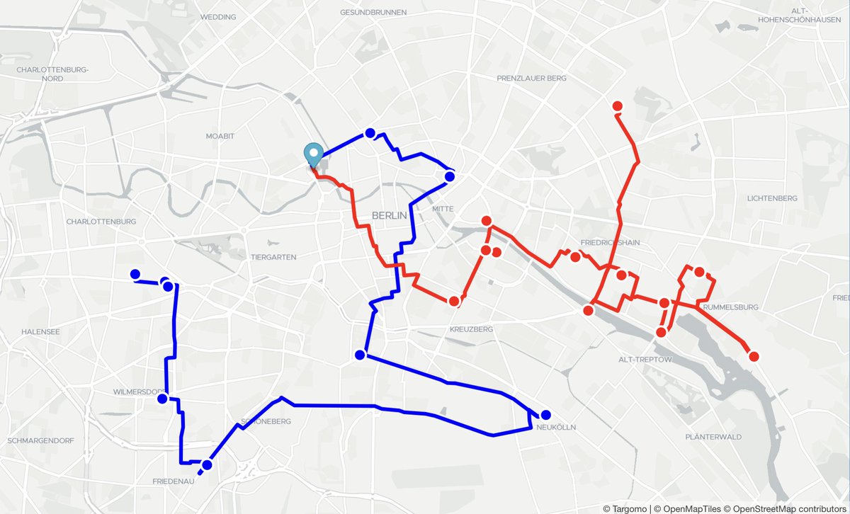
🎶 Music-themed!
You want to go to a club on Friday night, but your friend doesn't like the same music as you do.
Targomo's fleet API helps solves this, by providing the best 🚴🏼 route based on your different tastes in 🎶. ⬇️
https://t.co/5dauZ43gfk
The theme for Day 23 of the #30DayMapChallenge is 🚶🏻♂️Movement .
Using our foot traffic data, we can now examine how people spend their time during the day and night.
Below, we see how London's 🇬🇧 foot traffic data reveals the city's dynamism.
🚀 Deuxième ville de France avec plus de 870 000 habitants, @marseille a publié sa #BaseAdresseLocale, certifiée à près de 100 % 🟢 dans la #BaseAdresseNationale. Un très bel exemple d’utilisation de l’API de dépôt. Témoignage à venir... https://t.co/lGtJmmE8G7
La productivité est tombée à 0, on vient de découvrir https://t.co/zNKiJ7mOjz où tous les noms de villes (et notamment de rues autour de la gare Montparnasse par exemple) sont traduits en breton... #bretagne
(vous connaissez la ville de Pontwaz ? 😅)
Day 15 of this years #30daymapchallenge ☄
Food & drink being the topic, we decided to highlight our Location Scoring API. We defined a set of criteria that can make a location attractive when you talk about foods or drinks.
Test it out for yourself ⬇️.
https://t.co/8olrAhTTwS
Today is Hexagon day according to the #30DayMapChallenge! I took the time to generate a POI density map thanks to the @targomo's Places Layer API, which uses the @openstreetmap's POIs.
I chose to represent the density of kebab restaurant in Paris.


![AnneChaChouille's tweet photo. Et avec deux souches différentes et un départ de Paris. Voici les résultats à 24h. Une souche semblerait être une sudiste, l’autre une bretonne avant tout (elle a été jusqu’à Brest !)…
Tout cela permis par le projet de @Docteur_Drey #derrierelebloblarecherche #blob [3/3] https://t.co/YBVU2v0TbI](https://pbs.twimg.com/media/Fv1eixIWIAIlnCc.jpg)


![AnneChaChouille's tweet photo. Et avec deux souches différentes et un départ de Paris. Voici les résultats à 24h. Une souche semblerait être une sudiste, l’autre une bretonne avant tout (elle a été jusqu’à Brest !)…
Tout cela permis par le projet de @Docteur_Drey #derrierelebloblarecherche #blob [3/3] https://t.co/YBVU2v0TbI](https://pbs.twimg.com/media/Fv1eixNXwAEGMzm.jpg)