🚨🚨🚨 Tornado spotted in New Jersey tonight, with storms also tracking through Delaware. If you're in the area, get to the lowest floor, away from windows, and keep alerts on.
Tornado-warned storms moved through Delaware and New Jersey today. Posts show a tornado near Newark and west of Wilmington, DE, and one reported confirmed near Bordentown, NJ.
South Florida just got soaked. A gauge near Riviera Beach reported 23.19 inches of rain in 72 hours, and West Palm Beach set a daily record of 7.39 inches on Monday, smashing the old mark of 2.52 inches from 1925. More downpours are possible through Wednesday, so never drive through flooded roads.
🌀 New area to watch in the tropics:
The National Hurricane Center will be monitoring an area of low pressure that should be forming to the northeast of the Bahamas this week for the potential of it acquiring subtropical characteristics. Currently has a 30% chance of doing so. Next name on the list is Kyle.
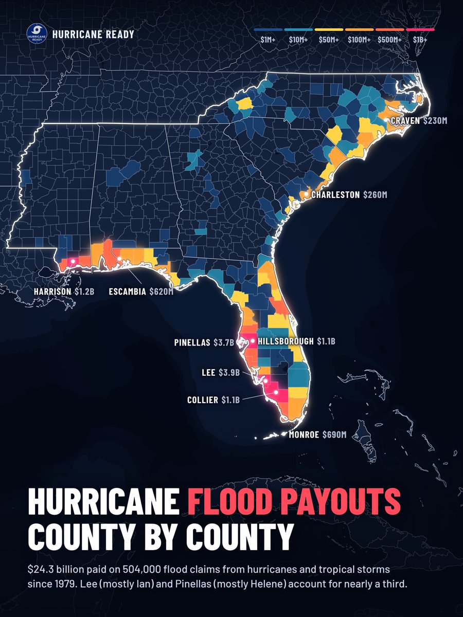
5 maps that explain hurricanes in the Southeast, from Mississippi to North Carolina. Since 1851, 245 hurricanes have come within 60 miles of this coast, and since 1980 these storms have caused more than $500 billion in damage.
Swipe to see which power companies leave customers without power the longest, the evacuation routes and the highways that flip lanes, where $24.3 billion in flood insurance has been paid out, and how far storm surge could reach in a worst-case Category 5. Save this post and check your own area before the next storm.
🚨 BREAKING: Subtropical Storm #Josephine, the eleventh named storm of the 2026 Atlantic hurricane season, has formed off the east coast of the U.S. National Hurricane Center will issue its first full advisory on the system at 5PM ET.
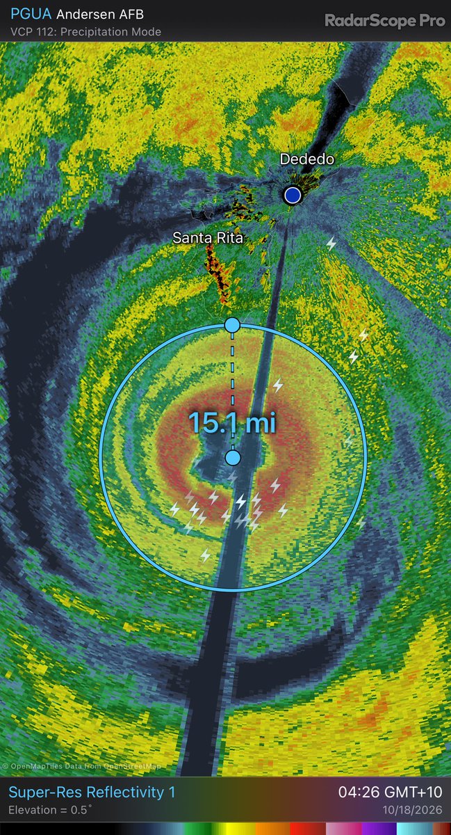
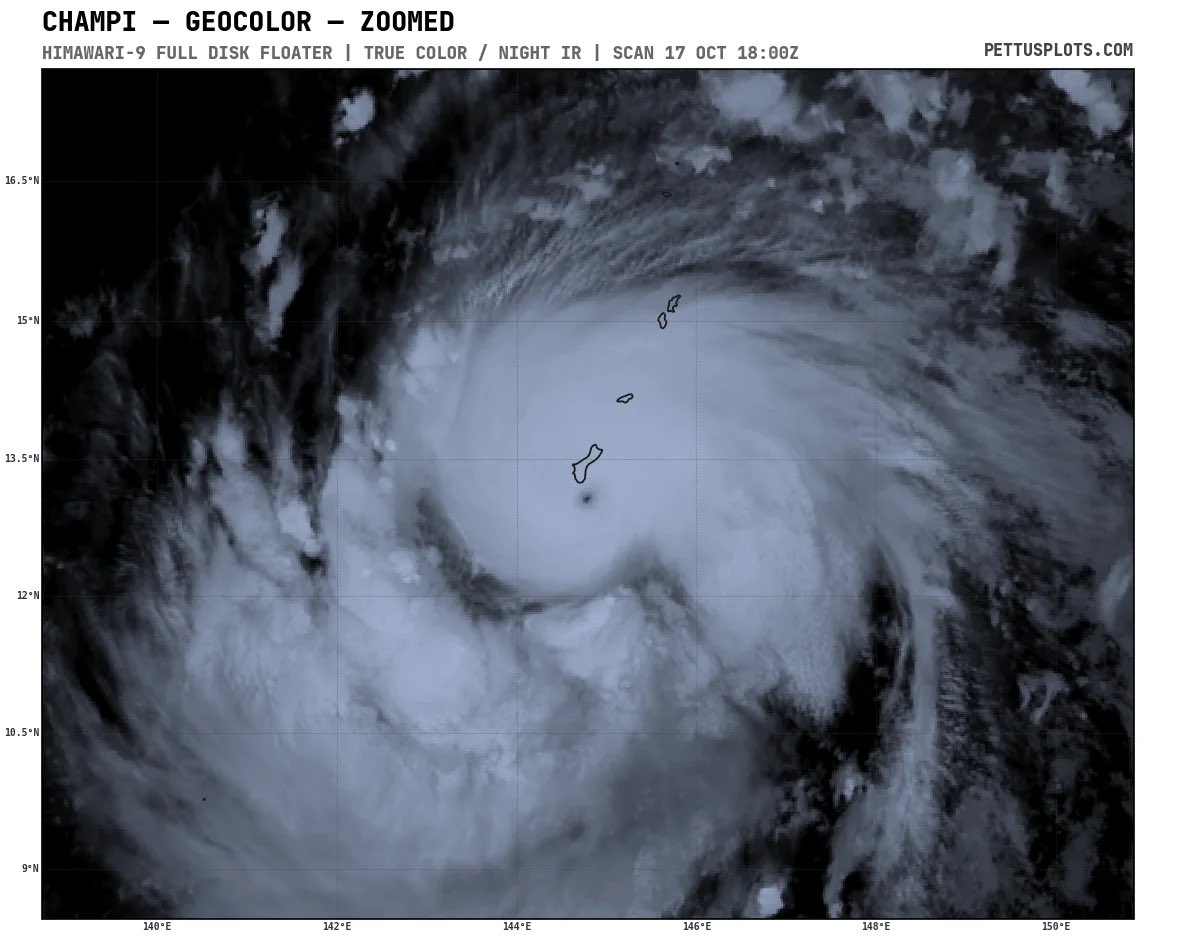
Out over the West Pacific, #Guam is bracing for yet another impact from a tropical cyclone as Typhoon #Champi is quickly baring down on the island region with maximum sustained winds of 130 mph (equivalent to a category 4 hurricane). It is forecast to continue strengthening and possibly reach Super Typhoon status (winds of >150 mph) as it comes dangerously close to a landfall later this afternoon ET time or early Sunday morning in Guam’s local time.
AI is currently giving Tropical Storm #Trudy a higher probability of undergoing rapid intensification (RI), which is defined as an increase in a tropical cyclone’s maximum sustained winds by at least 30 kts / 35 mph in a span of 24 hours.
When coming into consensus with the SHIPS (Statistical Hurricane Intensity Prediction Scheme) forecast, there is a 21% chance that the RI threshold is met, which is triple (3.2x to be exact) the climatological mean.
SHIPS is a statistical-dynamical computer model very commonly used by hurricane forecasters that combines climatological statistics with real-time global dynamical model data to produce a precise 5-day forecast for a tropical cyclone.
The 2026 East Pacific hurricane season continues to overachieve as we now have another new tropical storm: #Trudy. It is forecast to rapidly intensify into a major hurricane by the end of the week as it approaches the same areas in #Mexico that were just recently impacted by Hurricane Simon.
Most deterministic forecasts models have the storm peaking as a category 3, while the median amongst the 50 members of Google DeepMind top it off at a category 4. NHC is currently leaning towards the AI guidance, showing Trudy peaking as a category 4.
Mexico should be closely monitoring for potential impacts from yet another powerful hurricane this weekend. There is a 58% and 44% chance of the storm center being within 100 nautical miles of Manzanillo, Michoacán and Puerto Vallarta, Jalisco; respectively.
🗓️ Oct 13th 2PM update on the tropics:
The National Hurricane Center is no longer monitoring the area of low pressure by the Cabo Verde Islands for tropical development and we are back to being all quiet in the Atlantic over at least the next 7 days. 😴
How accurate were the models with #Isaias? Guidance verification indicates that AI was at the helm, with Google DeepMind leading the way in terms of smallest mean track error (in nautical miles) and mean absolute VMAX error (in kts).
What is coming after Isaias? The National Hurricane Center is monitoring an area of low pressure to the west of the Cabo Verde Islands that has a low chance (20%) of becoming a tropical cyclone over the next day or two. Regardless, heavy rainfall is expected over portions of the islands. Aside from that, no imminent threat to the Caribbean or US over the next 7 days.
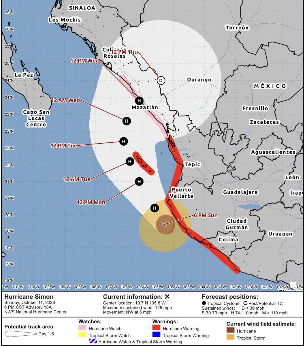
Hurricane #Simon continues on its slow north-northwestward crawl roughly paralleling the coast of #Jalisco this evening while progressively trending down in intensity due to land interaction with the mountainous terrain of west-central #Mexico.
Simon is currently a category 3 hurricane with max sustained winds of 125 mph, but the good news for coastal Jalisco is that Simon’s RMW (radius of maximum wind) has continued to shrink in size with this continual land interaction, with hurricane-force winds only extending about 30 nautical miles from the center and limiting the amount of overlap with the coast.
NHC has Simon continuing to weaken through midweek as it skirts up the coast of Jalisco and moves towards Las Islas Marias and eventually into Sinaloa. Hurricane warnings remain in effect for Jalisco, Nayarit, and Las Islas Marias with a hurricane watch posted for Sinaloa.
Here is a live look at Playa Las Gemelas in Puerto Vallarta, #Mexico with Category 4 Hurricane #Simon currently lurking around 85 miles to the southwest. Expect conditions to continue to deteriorate into tonight as the core of the major hurricane inches closer.
The remnants of #Rachel are bringing a plethora of impacts to the western U.S. today, with coastal flood and high surf advisories posted along the California coast from the Bay Area down through SoCal. Wind advisories, high wind warnings, and flood watches are also encompassing much of the Desert Southwest, the Great Basin, and parts of the Snake River Basin.
Oct. 11th- The tornado threat continues with the remnants of #Isaias today, with a tornado watch recently being issued for parts of North and South Carolina including major population centers such as those in the research triangle (Raleigh, Durham, Chapel Hill).
A tornado watch means that conditions are favorable for tornadoes to develop within a specific time range and in this instance, until 5PM ET this afternoon. Have a reliable way to receive warnings so immediate action can be taken in such event!