Just released! New interactive map features and two new migrations in the GIUM Atlas of Ungulate Migration: the white-eared kob and tiang in South Sudan and Ethiopia!
This is an ongoing collaboration with @migratinghooves and @gageCarto. https://t.co/4mDKnfeXcE
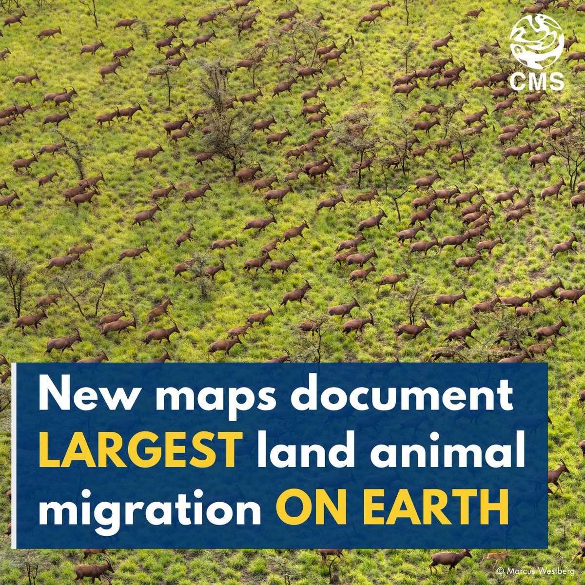
🚨 Just launched: new @migratinghooves maps of the Great Nile Migration, the biggest land-animal trek on Earth!
Over 5 million white-eared kob + 400K tiang roam 100,000 km² between South Sudan & Ethiopia. 🐾
View the maps and discover how they can steer wildlife-friendly development: https://t.co/bbcT9xN9Hv
We are excited to announce the newest maps in the Atlas of Ungulate Migration: the white-eared kob and tiang in South Sudan and Ethiopia! These maps will serve as tools in balancing the needs of both people and wildlife in this incredible region. https://t.co/v2N3liVPzV
Join us in one week for our online event launching the Atlas of Ungulate Migration! Time: Sept. 4th at 16:00–17:00 CEST | Beijing 22:00–23:00 CST.
Zoom link: https://t.co/G81KkRF151
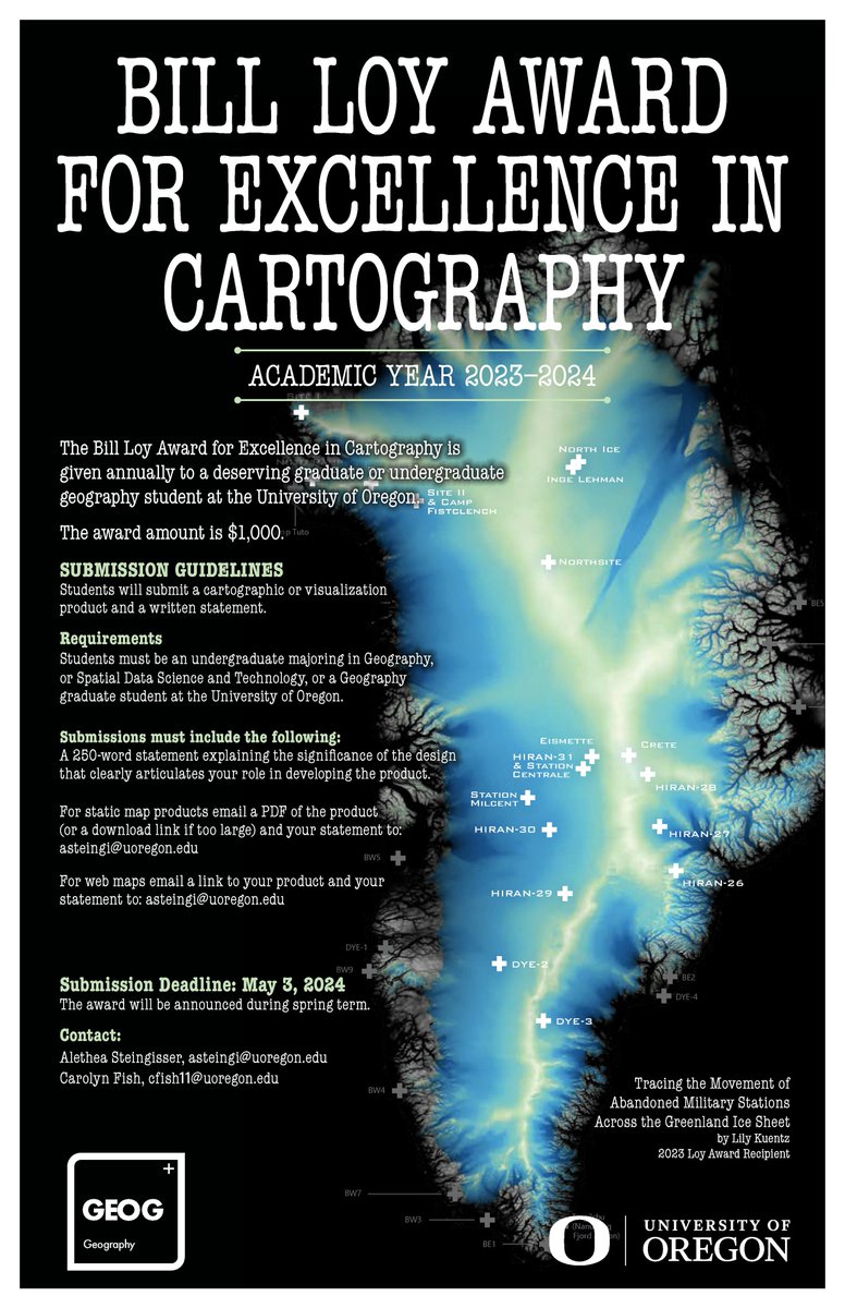
And in the cartographic design category, the 2023-24 Bill Loy Award for Excellence in Cartography recipients are Aidan Clark, with honorable mentions to Bran Blundell and Isaac Bell.
Beautiful work, all! Bill would be very proud. 🌎🌍
@uogeog@uocas
Announcing the 2023-24 Bill Loy Award for Excellence in Cartography recipients in the cartographic research category: Lauren Nguyen, Anneke Brouwer, and honorable mention to Juliette Setudeh Nejad.
Wonderful, engaging work! Congratulations, all!
@uogeog@uocas
We are happy to share that Volume 4 is out! This annual publication is one of the big cartographic efforts that the @InfoGraphicsLab collaborates on.
🦌 #migration@uoregon@uocas
The 4th @USGS report on #ungulate migrations is LIVE! I am so proud to have contributed to this huge collaborative effort featuring 33 herds of deer, elk, & pronghorn migrating across the Western US! 🙌
Report: https://t.co/AgRP86Gnuq
Press Release: https://t.co/n2BFVdwOqF
The 4th @USGS report on #ungulate migrations is LIVE! I am so proud to have contributed to this huge collaborative effort featuring 33 herds of deer, elk, & pronghorn migrating across the Western US! 🙌
Report: https://t.co/AgRP86Gnuq
Press Release: https://t.co/n2BFVdwOqF
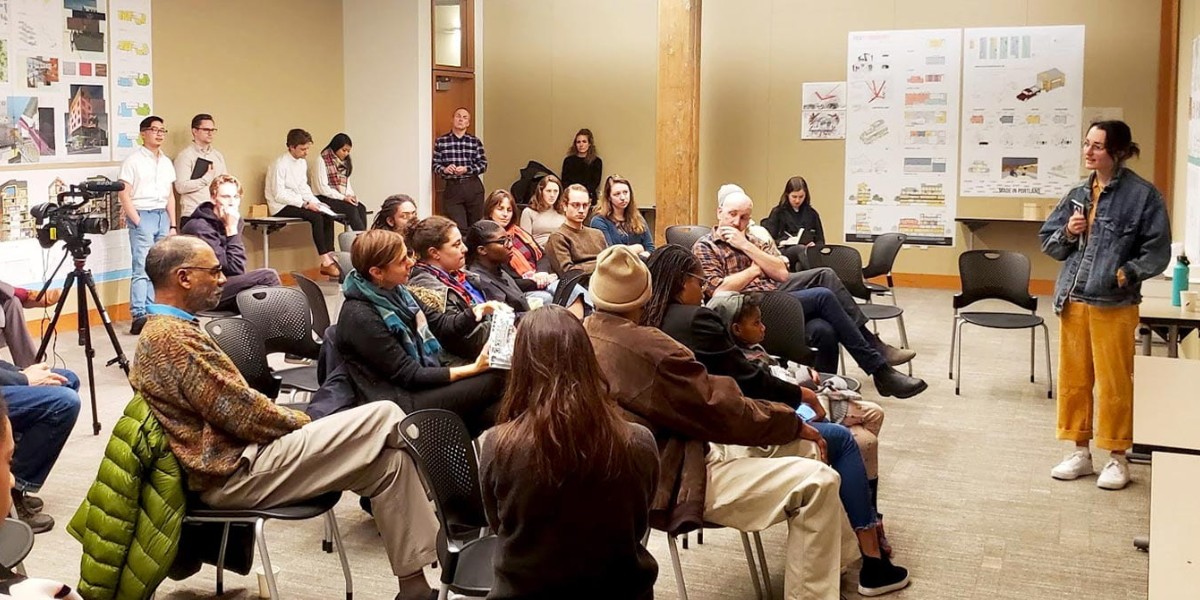
This work seeks record and reimagine how we confront and transcend barriers that restrict our movement, agency, and freedom. We invite participants to borrow from the cartography to represent these barriers through geographic and conceptual mappings. https://t.co/LcCGinUlMt
On now, April 4 -7! Cartographies of Belonging: Visualizing Agency in a Fractured World in the @UO_EMU. This participatory mapping exhibit engages symposium attendees in creative visual arts exercises to explore their experiences of threat and freedom as writers and journalists.
📢Submissions for the Bill Loy Award for Excellence in Carto are open! It is granted annually to a @uoregon grad or undergrad in @uogeog or Spatial Data Science and Technology whose work demonstrates excellence in cartographic design and/or geographic vis. https://t.co/c0RHhBEgUU
The School of Architecture & Environment has opened applications for Visiting Faculty Fellowships in Design for Spatial Justice at the rank of assistant, associate, full professor, or professor of practice.
https://t.co/6BqTKslJTR
📢 @NACIS is seeking a social media volunteer to boost outreach and connect better with our awesome members! Check out details here: https://t.co/wHAGiG2qYp. Contact [email protected] if you're interested in being our social media guru 🙌
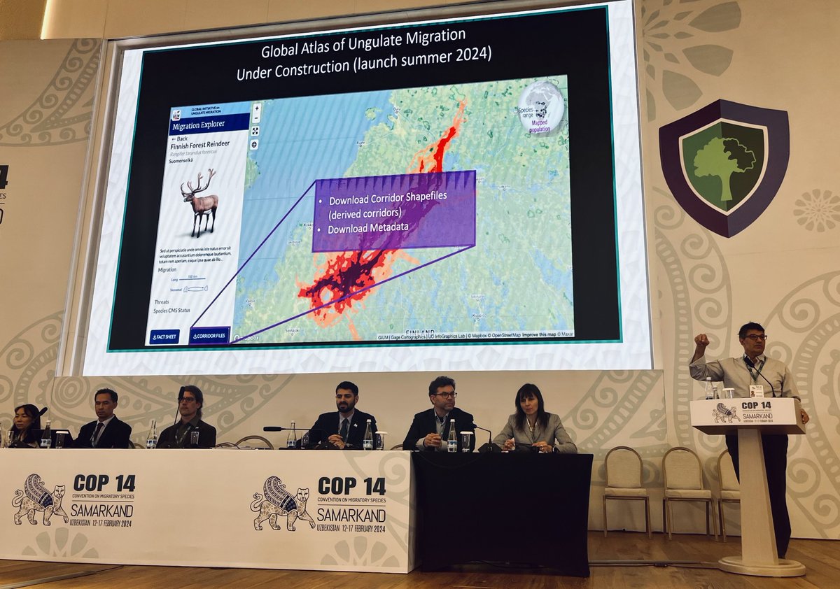
"Tracking data allows us to literally ask the animals: where do you go and how do you get there?" @wyokauffman at #CMSCOP14. We believe data driven maps are a powerful tool for conserving wild migrations. Learn more here: https://t.co/pBZtPZopeo @BonnConvention