*10:30 EDT Radar Update*
Storms across NE Tennessee Continue to produce large hail (around the size of a quarter).
ANOTHER line of storms is moving eastward across the Cumberland Plateau. This will also bring the threat of hail, and we've seen reports of 40+ mph winds as well.
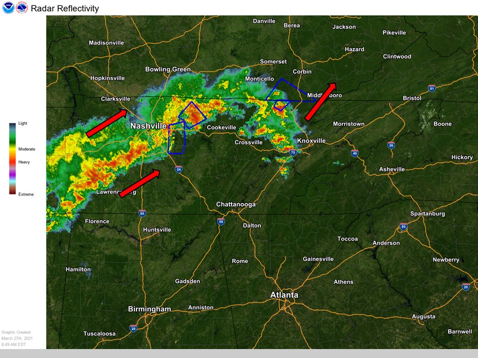
*9am Eastern Radar Update*
Severe thunderstorms (blue boxes) continue to move across middle and eastern TN up into KY. Expect these storms to remain around the area most of the day today.
The greenhouse continues to fill up with more color and varieties. These Senetti Pericallis add vibrant color to both containers and garden beds in early Spring through Summer. These plants thrive in full to partial sun and can tolerate cooler temperatures. #countdowntospring
In meteorology we define winter as the months of Dec, Jan, and Feb. Are you curious as to how much snow fell across the region during this timeframe? Check out this map, OR use our GIS Dashboard for a more interactive experience! https://t.co/R52oAKp8qt #tnwx#vawx#ncwx#mrxwx