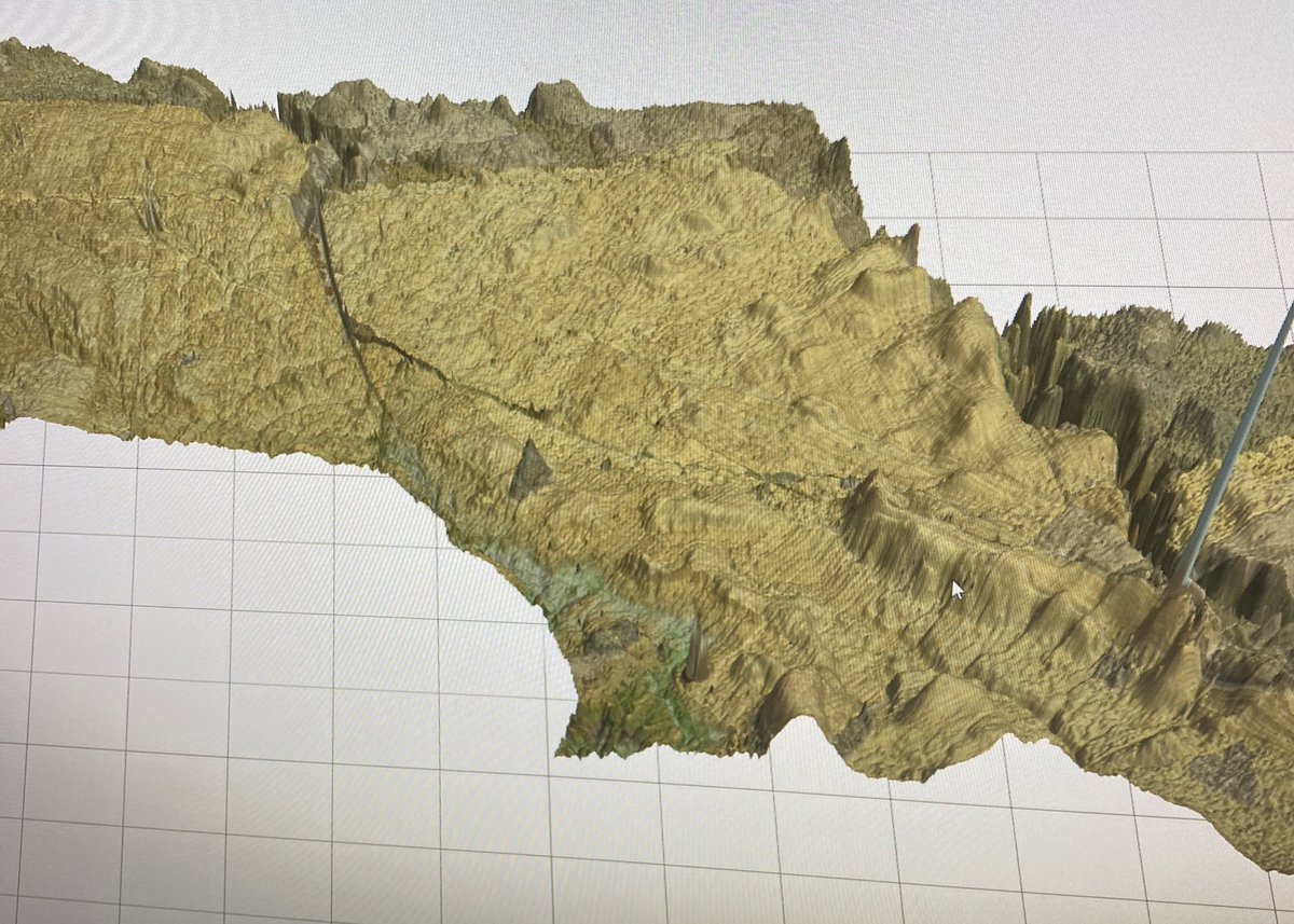
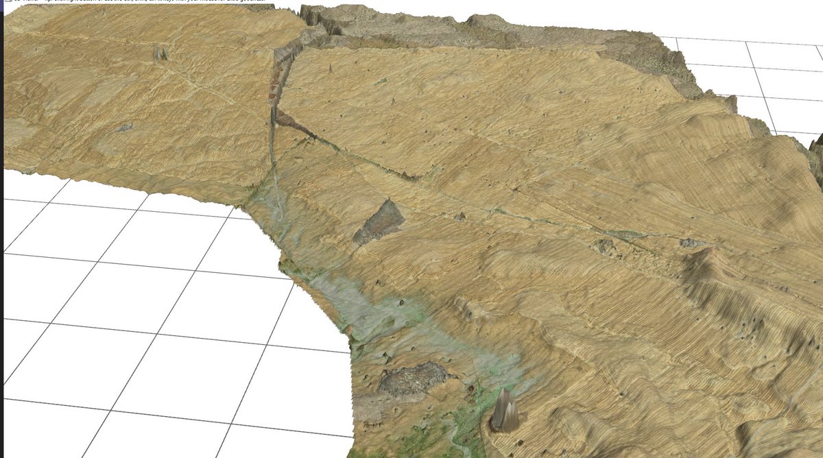
We have been playing around with getting LiDAR captured images into a 3d view over our elevation data set. Looking good! A 5000ha farm on a 1m data set. @timrichards_tim now we just need to get the 0.25m data set in 🧐
@markt8040@cleton_paul@Collier_Samual@Jeremy_Morton_@CKMonty The closer the swaths the better, but you can get away with 12-16m for a good result. Not so long ago surveyors would do 50m swaths. Definitely start on a known point you can come back to, for best results and record data from that point, through the field and back to it.
@cleton_paul@markt8040@Jeremy_Morton_@CKMonty If the volume of material@is very low, sometimes a little more dirt to move (for a better design) doesn’t cost more to shift. I would suggest you get it designed and most surveyors/designers would charge by the ha. You could use tractor data if you have it and it is RTK?
@cleton_paul@markt8040@Jeremy_Morton_@CKMonty If it is not going to be irrigated the volumes can differ depending on design. We would normally look at a multi grade design and then from there say if a contractor would quote for cube or by the hour.
"Talking Dirt" with Gwen and James this month!
REGISTER NOW!
Next up 'Pad building' & 'Dam building' in T3RRA Design with guest Jay Carroll North America - September 15 @ 4pm central Australia - September 16 @ 7am AEST
Click here https://t.co/BOckYjxfPf
@HAC_Qld @walfarms@t3rradesign So are you turning a 1m every 454m slope (0.22%) into a 1m every 2000m slope (0.05%) in the paddock? Or are you putting a variable design slope between 0.022% to 0.05% over the whole area so it can be any slope in that range?
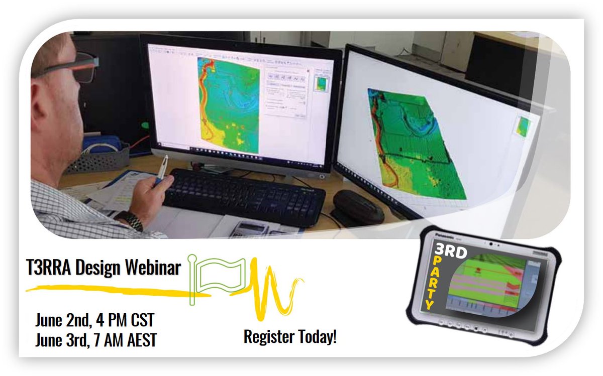
Have you registered for this week's @t3rradesign class?
#T3RRA Design contains a number of tools that enable sophisticated earthwork design combined with CAD drawing capabilities 👨💻
Can't make the class? No problem, register and receive a link to the recording @pts_ag@t3rratech