God-fearing, patriotic American conservative serving as a county commissioner in Putnam County, TN and in the credit union arena. Tennessee Tech and Philly fan
I don't want a gov't shutdown, but all those who are fretting better start getting serious about pressuring #Washington to get their fiscal house in order. A gov't #shutdown is nothing compared to the pain a #debt#crisis would bring. Both parties have a role in this.
Sometimes, people want to change things just to put their own personality on things. At CB, their goal is to just delete the personality altogether. Hence, the elimination of the "old-timer" from the signage. Heritage is what got Cracker Barrel this far, and now the CEO wants to just scrape it all away.
At Steak n Shake, we take pride in our history, our families, and American values. All are welcome. We will never market ourselves away from our past in a cheap effort to gain the approval of trend seekers.
"We have completed our very successful attack on the three Nuclear sites in Iran, including Fordow, Natanz, and Esfahan. All planes are now outside of Iran air space. A full payload of BOMBS was dropped on the primary site, Fordow. All planes are safely on their way home. Congratulations to our great American Warriors. There is not another military in the World that could have done this. NOW IS THE TIME FOR PEACE! Thank you for your attention to this matter." –President Donald J. Trump
Good morning, Tennessee.
🧵 The potential for a busy Tuesday is ahead, so please stay weather aware. Here's what you need to know.
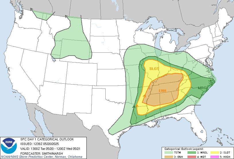
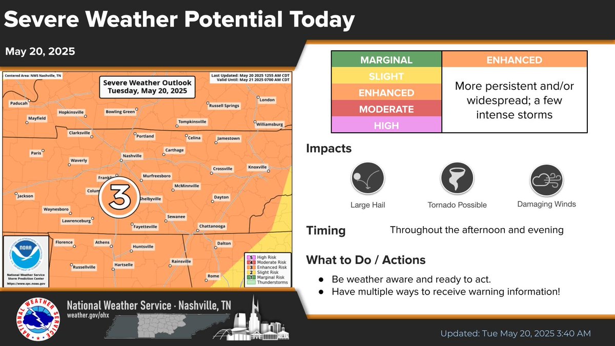
Just about all of us are under an Enhanced Risk (level 3 out of 5) for strong to severe storms today. National Weather Service forecasts damaging winds, large hail, and tornadoes will all be possible.
Much of our action after this morning's active storms (which should continue right up the OH River) develops into the Mid MS, TN Valleys including northern AL and northern GA as atmosphere resets quickly with very unstable and ready to ignite airmass.
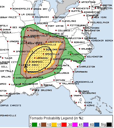
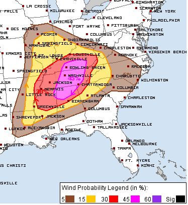
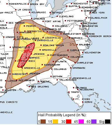
I led off with the 06z HRRR from @weathermodels_ to give you an idea of how this evolves. Remember this model can change details and will even though the general atmospheric output for the day is captured nicely. Discrete supercells and clusters appear to be the modes on what looks like a very active day and early night here. Once again today, ALL hazards are in play as you can see below with the early day SPC hazard probabilities.
2am SPC UPDATE maintains the Enhanced risk for tomorrow. No Moderate risk upgrade, still a potent setup.
Tired. Streamed today for over 10 hours. Back at it tomorrow.
See you on the next one 😼
Mid TN remains under an Enhanced Risk (level 3 out of 5) for severe storms today. There will be periods of storms through the day with the main severe risk throughout this afternoon and evening. Damaging winds, large hail, and tornadoes will all be possible.
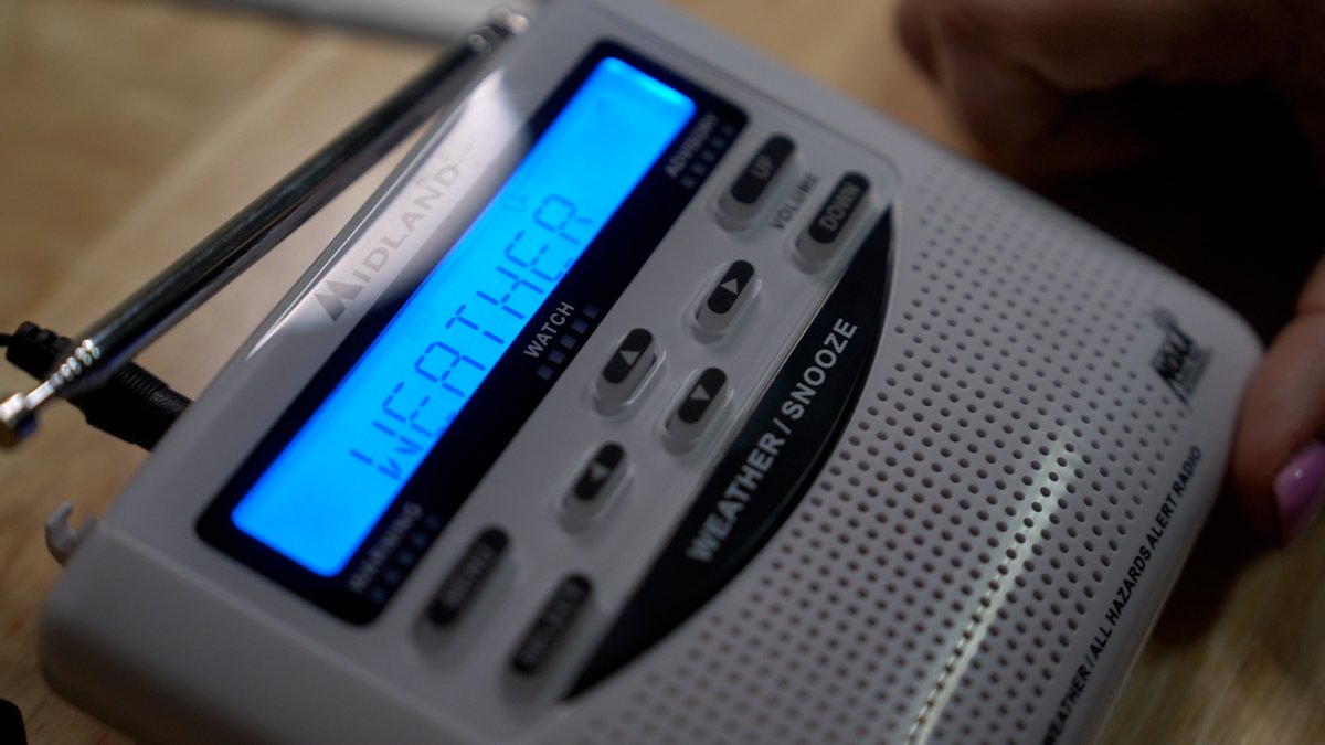
Heads up, Middle Tennessee! All NOAA Weather Radio Transmitters serviced by @NWSNashville will be down today (May 19) through Wednesday evening (May 21).
This includes the following transmitters in: Clarksville, Waverly, Nashville, Centerville, Lobelville, Clifton, Lawrenceburg, Hickman, LaFayette, Cookeville, and Spencer.
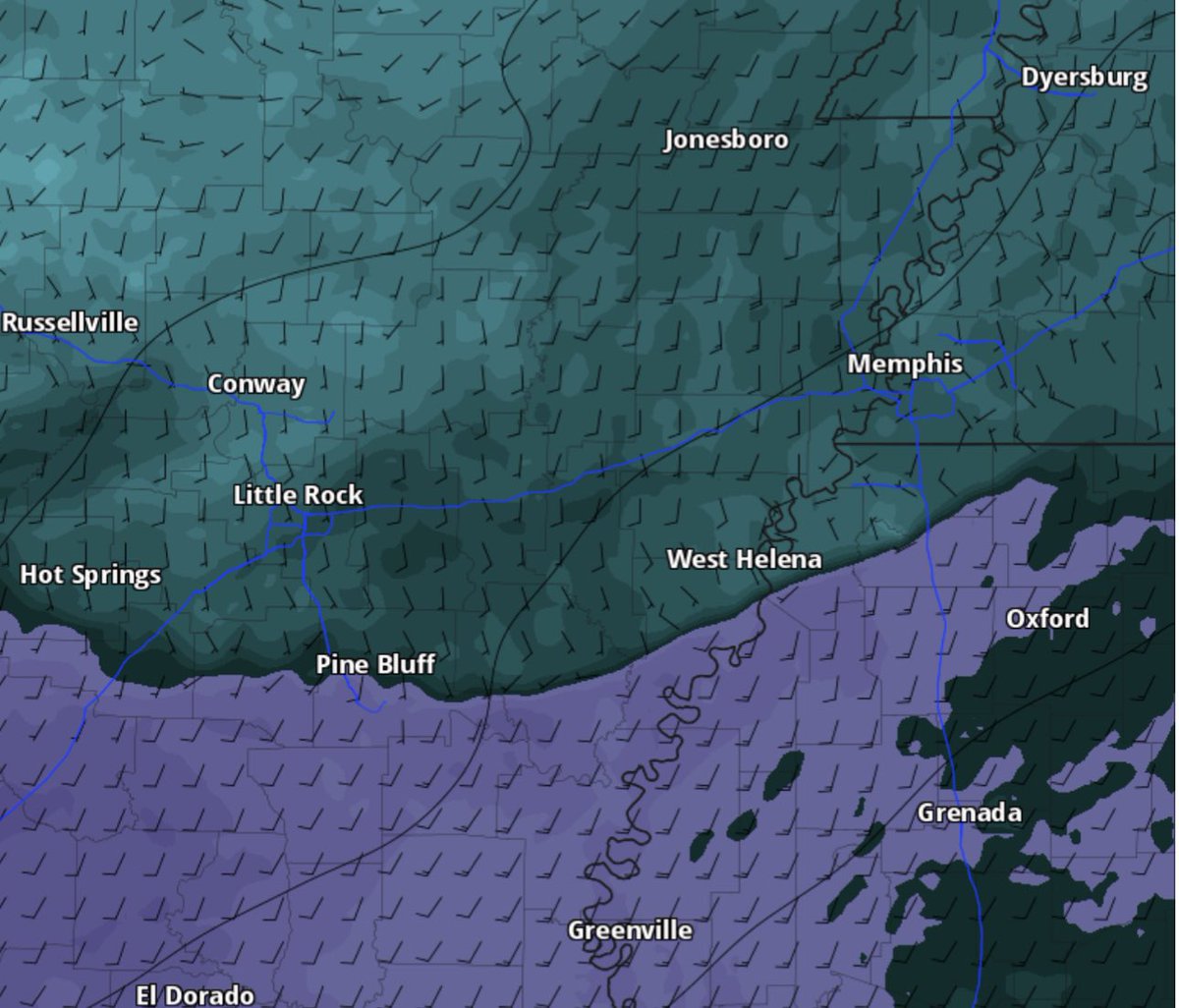
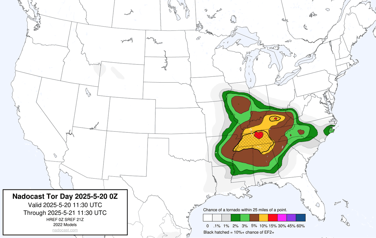
Given this clear trend for tomorrow with a chunky OFB, and shear vectors promoting easterly storm motions, I will not be shocked, at all, for a Mod Risk tomorrow with a 15% hatch for tornadoes. I honestly will be more surprised if it doesn’t happen.
Confined area from the Arkansas Delta across the river and along the MS/AL/TN border or wherever this OFB sets up.
#tnwx
#mswx
#arwx
🌪️ Stay Safe, Stay Informed! 🌪️
After a series of deadly and damaging tornadoes, we’re bracing for another challenging couple of days. Today and tomorrow, all threats are in play, including strong tornadoes. The TorCon is already at a 7, so remember: if there’s a number, there’s a risk. Make sure you have multiple ways to receive warnings and stay tuned to @weatherchannel for the latest updates. Stay safe, everyone! 🌧️📱