@austinreforms@DFWPol@jamestalarico They’re already panicking, scrambling, and talking out of both sides of their mouth. Can’t wait for a debate. Will be 🤌 😘
@MattMackowiak The whole don’t California my Texas cliche is a tired and lazy take. It’s been said since I was a kid in the 80’s. These are the same people that complain old Austin is dead… for the last 40 years. Enjoy your echo chamber.
John Cornyn has been in public office longer than I’ve been alive.
He’s had 40 years to lower the cost of housing, healthcare, groceries, utilities, and gas.
What’s the hold up?
It feels purposeless to spend time and resources analyzing and discussing a basketball team for a year, just for the entire roster to leave and reset every April. Year after year.
I have no idea how you fix it, but college sports is broken. This much turnover is unsustainable.
Trails predict where land will reprice. Years before the cranes show up.
New York saw it. Chicago saw it. Atlanta saw it.
Dallas is next. And it's running the largest version of this experiment any American city has ever attempted.
Here's the pattern:
Every major American city is fighting the same battle. The suburbs keep growing. The urban core fights to hold its tax base. People say they want walkability and community. Then they leave for places that feel safer and easier to navigate.
Cities have big ambitions. Dallas. Chicago. Atlanta. They want to attract people, businesses, and jobs. That takes money. Aging infrastructure needs replacing. New amenities need building.
The tax base isn't shrinking. But it's not growing fast enough to fund those ambitions without raising rates. And raising rates pushes more people out.
There's another approach.
Build infrastructure that makes land more valuable. Not highways. Not stadiums.
Trails.
It sounds too simple.
When you build a connected trail network, you create the walkability people crave. Neighborhoods that were cut off become accessible. Land values rise. Tax revenue grows without raising anyone's rate.
The evidence is hard to argue with.
New York built the High Line. Property values jumped 35%. Chicago built The 606. Home prices spiked 48%. Atlanta built the BeltLine. Developers have poured more than $9 billion into land along it.
The pattern holds whether the city runs red, blue, or purple. Build the connection. Land reprices.
Dallas is now running this experiment at the largest scale any American city has attempted.
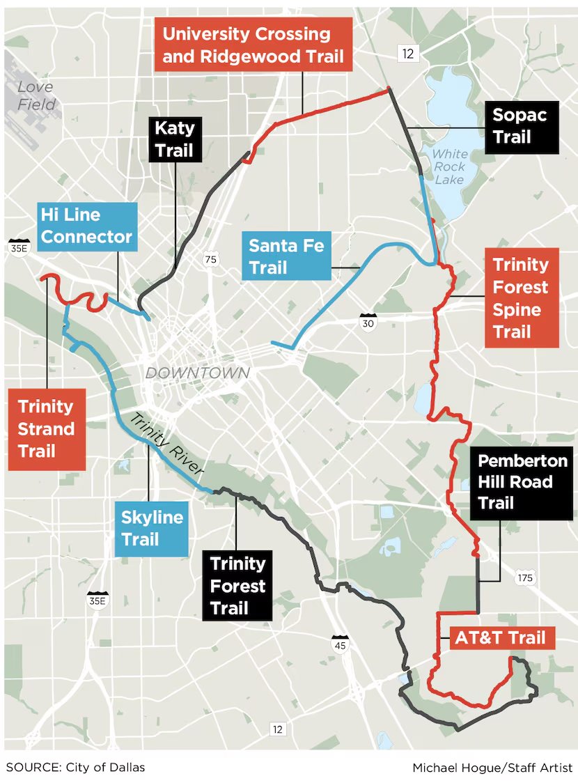
The Loop Dallas is a 50-mile trail circuit. It connects the Katy Trail, White Rock Lake, the Trinity Forest, Fair Park, the Design District, and Pleasant Grove. Every quadrant of the city.
The Design District already proves the thesis.
The city built a short connector to plug the area into the Uptown trail network. Before, it was an isolated pocket of warehouses. After, it became part of the Uptown ecosystem. Taxable value climbed 383%. Developers flipped their blueprints. Buildings now face the trail, not the street.
South Dallas is next.
A 1,200-foot bridge is opening the Trinity Forest Spine Trail. Neighborhoods cut off for decades by the river, the railroad, and the highways are about to become connected.
Every city that built a loop trail system saw the same result. Remove the barriers. Capital follows.
Trails aren't expenses.
They're leading indicators. They tell you where land is about to reprice, years before the cranes arrive.
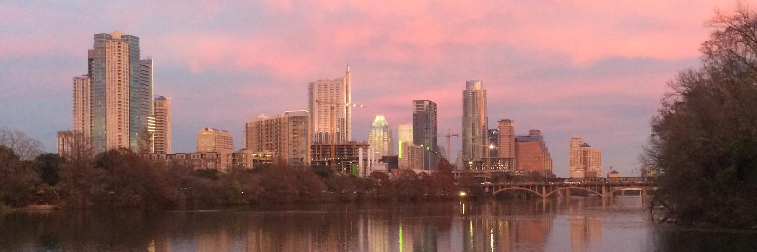
If you want to understand where Dallas is heading, don't watch the skyline.
Follow the trail.
Trails predict where land will reprice. Years before the cranes show up.
New York saw it. Chicago saw it. Atlanta saw it.
Dallas is next. And it's running the largest version of this experiment any American city has ever attempted.
Here's the pattern:
Every major American city is fighting the same battle. The suburbs keep growing. The urban core fights to hold its tax base. People say they want walkability and community. Then they leave for places that feel safer and easier to navigate.
Cities have big ambitions. Dallas. Chicago. Atlanta. They want to attract people, businesses, and jobs. That takes money. Aging infrastructure needs replacing. New amenities need building.
The tax base isn't shrinking. But it's not growing fast enough to fund those ambitions without raising rates. And raising rates pushes more people out.
There's another approach.
Build infrastructure that makes land more valuable. Not highways. Not stadiums.
Trails.
It sounds too simple.
When you build a connected trail network, you create the walkability people crave. Neighborhoods that were cut off become accessible. Land values rise. Tax revenue grows without raising anyone's rate.
The evidence is hard to argue with.
New York built the High Line. Property values jumped 35%. Chicago built The 606. Home prices spiked 48%. Atlanta built the BeltLine. Developers have poured more than $9 billion into land along it.
The pattern holds whether the city runs red, blue, or purple. Build the connection. Land reprices.
Dallas is now running this experiment at the largest scale any American city has attempted.
The Loop Dallas is a 50-mile trail circuit. It connects the Katy Trail, White Rock Lake, the Trinity Forest, Fair Park, the Design District, and Pleasant Grove. Every quadrant of the city.
The Design District already proves the thesis.
The city built a short connector to plug the area into the Uptown trail network. Before, it was an isolated pocket of warehouses. After, it became part of the Uptown ecosystem. Taxable value climbed 383%. Developers flipped their blueprints. Buildings now face the trail, not the street.
South Dallas is next.
A 1,200-foot bridge is opening the Trinity Forest Spine Trail. Neighborhoods cut off for decades by the river, the railroad, and the highways are about to become connected.
Every city that built a loop trail system saw the same result. Remove the barriers. Capital follows.
Trails aren't expenses.
They're leading indicators. They tell you where land is about to reprice, years before the cranes arrive.
If you want to understand where Dallas is heading, don't watch the skyline.
Follow the trail.