Prof. of Meteorology @CMUniversity Severe Weather & Climate, Hail, Tornadoes, Extreme Weather Resilience, Storm Chaser, Personal Account, Opinions my own
New paper published today in @Nature explores how climate change will affect hailstorm intensity globally, led by Shiyi Zhang in collaboration with Qinghong Zhang, myself and Xiangyu Lin https://t.co/dHTikBh1zZ
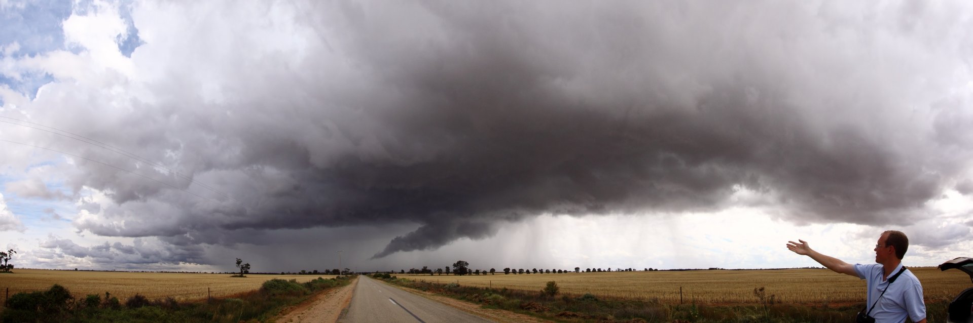
@CameronJNixon Lot of these were landspouts. Probably only one mesocyclonic shortly after the collison. We launched a couple of windsondes into the environment.
@wxkylegillett More than 2 hours later when we were able to get in to collect there was accumulating hail to several inches, in almost strata of sizes. Largest measured 64.9mm.
@wxkylegillett Was sitting under it: A left mover collides with a right mover, goes tornadic as it maximizes its inflow along with crazy volume of hail production, followed by a collision from the rear along with some sort of fujiwara-like resolution of the collisions and rotation centers.
Correlation coefficients are everywhere and they can seriously mislead you. Beware!
They’re extremely sensitive to outliers.
In my #DataAnalytics and #MachineLearning courses, I use this interactive #Python dashboard to demonstrate just how dangerous correlation can be.
Add a single outlier, and suddenly you can manufacture “strong correlation” out of random! #DataScience
@wxkylegillett Looked like the primary right actually choked out after a cycle of the mesocyclone. Still will likely be an expensive event given overlap of hail with several urban areas. There was quite a few impressive sig-severe hail swaths yesterday.
Now up to 5 tornadoes in Michigan from the surveys following the activity last night, with likely one or two more to come Takes us to 9 statewide so far this year, against an average of around 15. Active start to the season, and compounded by the flooding seen in the state.
@NWSDetroit@NWSGrandRapids With the flooding conditions across the northern LP, I don't think we'll see a survey being possible on that warning due either access or time, as @NWSGaylord has more important tasks to handle as yet more rain shows up late night tonight.
@NWSDetroit@NWSGrandRapids Yet to see a report from the one warning further north, or the warnings closer to Wolf Lake/Ravenna, or southeast of GRR, but there are wind reports that probably still are on the list to look into.
@alluringstorms@BigSloppyWX Sarnia area may see heavily rainfall and or wind. I've been a little surprised how persistent the northern booked has been even though its choked in pre-MCS precipitation.
Nasty situation evolving across Central Michigan, tornadoes developing along the line as individual supercells embedded become dominant. Looks like a fairly strong circulation near Perrinton, MI tracking eastwards.
@alluringstorms@BigSloppyWX Windsor area may see potential for impacts, just depending on how this evolves over the next hour or so, instability should be diminishing with the diurnal cycle, but shear profiles overall remain favorable provided the line doesn't collapse or full surge.