NEW: Since October 2023, the IDF Spokesperson's Unit has released dozens of 3D animations illustrating alleged Hamas, Hezbollah, and Iranian sites
The style is unmistakable: satellite zoom-ins, black & white wireframes, and red-textured houses - a new visual language of war
We found US-supplied munitions at the site of an airstrike in Yemen in mid October – for the first time since hostilities escalated earlier this year. w/ @viviannereim + @Shuaibalmosawa https://t.co/Jo9sWlHfLA
We believe that the ICE Air flight set to carry out deportations to Afghanistan and Iran, via a removal-transfer stop in Pakistan, will likely take place on a large Eastern Air carrier. There are 3 Eastern planes currently in El Paso, TX. We’ll be monitoring their activity.
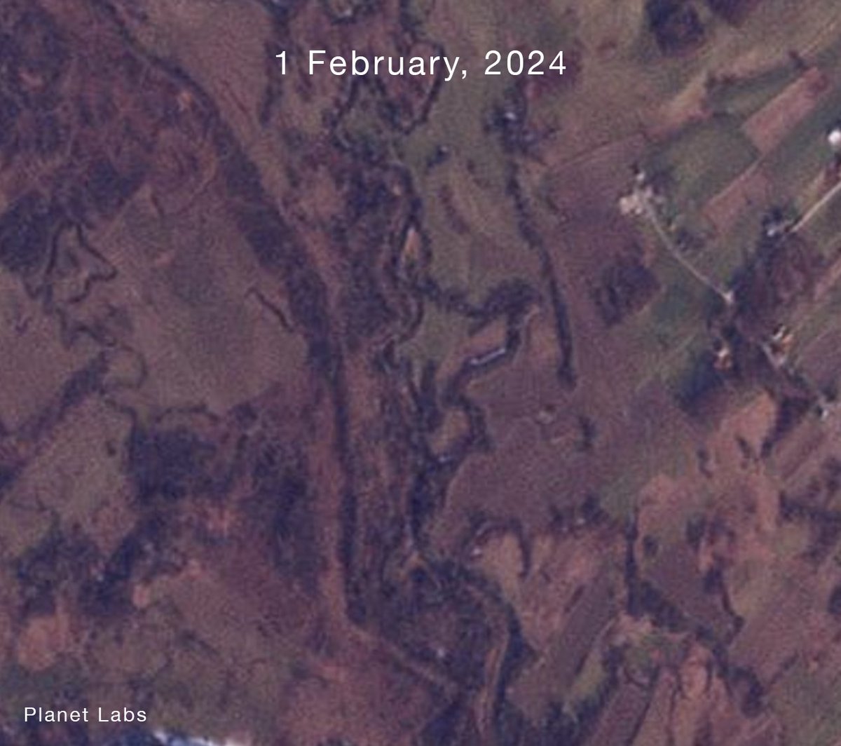
Research on other international river borders has shown that, over time, border infrastructure and the removal of riverside vegetation can affect bank erosion and the way river channels and floodplains behave during high water.
https://t.co/bgd1iLhhG7
A border patrol route cleared by Croatian authorities along the Korana River, on a stretch of the EU-external border with Bosnia and Herzegovina that has seen some of the most violent pushbacks of the past decade.
NEW: Trump’s proposed arch would cast a shadow over Arlington Cemetery graves on 284 days, our analysis found. It would darken over 75,000 graves, the JFK Memorial with its Eternal Flame and the Military Women's Memorial. With @washingtonpost team @ddiamond@asteckelberg
I’m in LA for @USCAnnenberg’s Open Source Journalism Conference the next couple days.
If anyone’s around and wants to catch up or talk open source journalism / or @LHreports work, give me a shout!
Really nice to be included in this @CJR piece on the future of visual investigations, alongside a great group of people from across the field.
I spoke a bit about how the online environment has changed as a space for open-source work and discussion.
https://t.co/ZtQrYMJQ3j
New collaborative investigation from @LHreports + @FT: we mapped how Israel has demolished village after village across southern Lebanon - much of it after a ceasefire.
A thread on the remote sensing damage analysis workflow we built to measure it 🧵
https://t.co/lHqsN2NAkz
Analysis of satellite imagery, open-source data and verified footage shows that Israeli forces have systematically destroyed homes, roads, farmland and forests despite a ceasefire with Hizbollah. https://t.co/NFukdFjbjw
An FT visual investigation found systematic destruction across Israeli-occupied southern Lebanon, crippling systems essential to civilian life, from water and energy infrastructure to medical care. Raya Jalabi reports on the scale of the devastation. https://t.co/BcUPUBtpGz
This is just an overview of a specific corner of the larger effort, which pieces together the different effects of this damage. Find the full investigation below.
Appreciative to work on this w/ @rayajalabi@AditiHBhandari@samjoiner + @LHreports team
https://t.co/JpzniO4Vvm
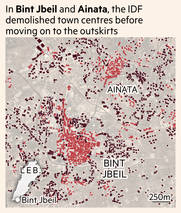
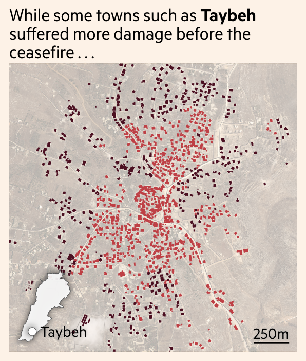
In some of the worst-hit villages, destruction started at the village centre and radiates outward over weeks
We cross-referenced these observations by conducting manual annotation of changes on s2 + high res imagery on building polygons in certain villages (see attached)