Emmy winning meteorologist @wafb from Long Island, NY. Met degree from Penn State. AMS/NWA seals. Happily married and proud father. Worked in SATX, HOU.
No...this isn't somewhere up north! This is Lafayette, Louisiana, getting near blizzard conditions as they are under a Blizzard Warning! Baton Rouge NOT under that warning, but still a Winter Storm Warning. 4-8 inches expected. https://t.co/At5R7ie6se
Good Tuesday morning...Expect scattered, non-severe storms to develop later today across the Baton Rouge area. Peak timing looks to be late afternoon into early evening. A cool front will stall across our area the next couple of days, keeping in rain chances.
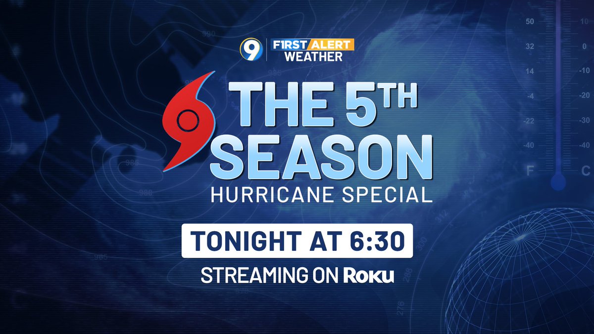
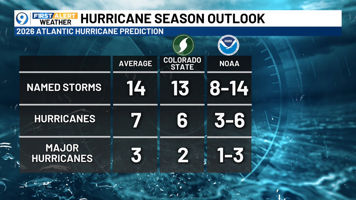
Good Monday morning. Welcome to June, welcome to the start of Meteorological Summer, and welcome to the 2026 Atlantic Hurricane Season! It's forecast to be a quieter than normal season, but it's always good to be storm-ready. Check out our "5th Season" hurricane special tonight.
How bout some good news from the weather department...Friday and Saturday are shaping up to be a bit drier with only a 20% chance later today, down to 10% Saturday. You have a few chances to mow the lawn or wash the car...FINALLY!!! Have a great weekend!
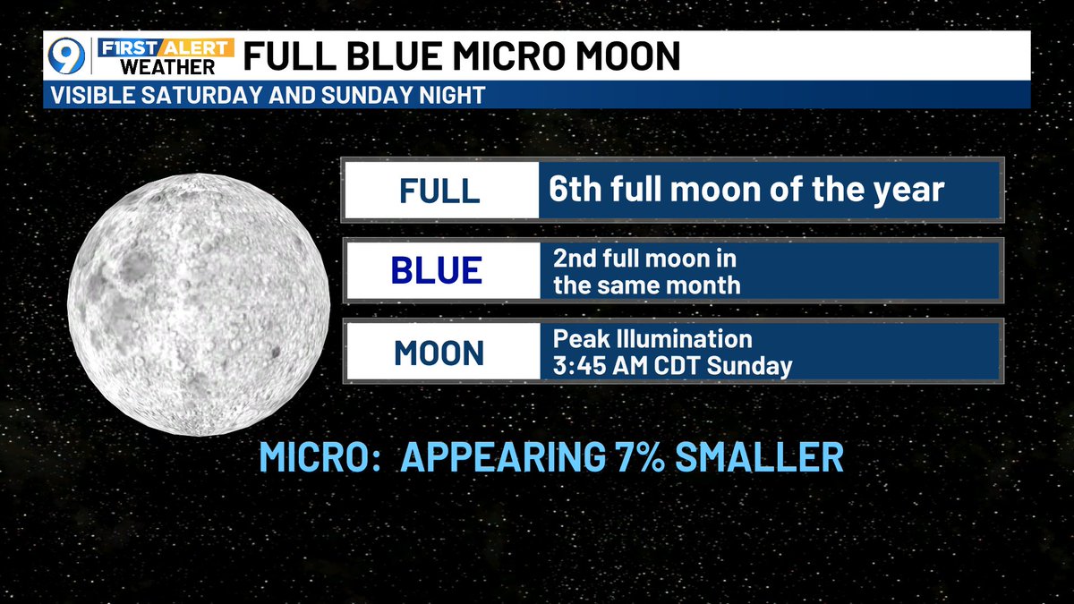
ONCE IN A BLUE MOON...A rare moon event is coming to a theatre near you this weekend with the FULL BLUE MICRO MOON. This moon will be the opposite of a supermoon, appearing 7% smaller than normal. The combo of a blue and micro moon is actually rare...won't see it again till 2053!
NOW FOR THE GOOD NEWS...The drought monitor update today shows huge signs of improvement! The red area that used to be between New Orleans and the coast is gone! At least something good comes from the dreary weather.
IT'S BACK! AFRICAN DUST...Hurricane season kicks off in four days, and right on cue, a few thick African dust plumes will migrate across the Atlantic. This, along with a strong El Nino, could put a lid on the hurricane season...WE HOPE! Previous El Nino seasons have been quiet!
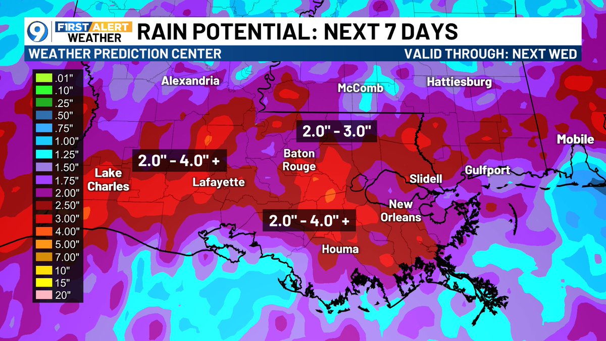
TOP FIVE, HERE WE COME?? Welp, it's certainly possible. This May is officially the 6th wettest on record for Baton Rouge with around 11 and a half inches, notwithstanding the rain we just had overnight into early this Thursday morning. We have 4 more days, with more rain otw!
WET WEATHER WEDNESDAY...Here comes the rain...After taking a day or two off from wet weather, it will move back in later this morning into the afternoon. A FLOOD WATCH remains in effect through 7AM for locally heavy downpours. Today should be our highest rain chance of the week.
Good Tuesday morning...A bit drier for your Tuesday with only a 10% chance of a shower in the morning, then 40-50% in the afternoon. Bigger and better rain chances return Wednesday and Thursday, so don't put away the rain gear just yet!
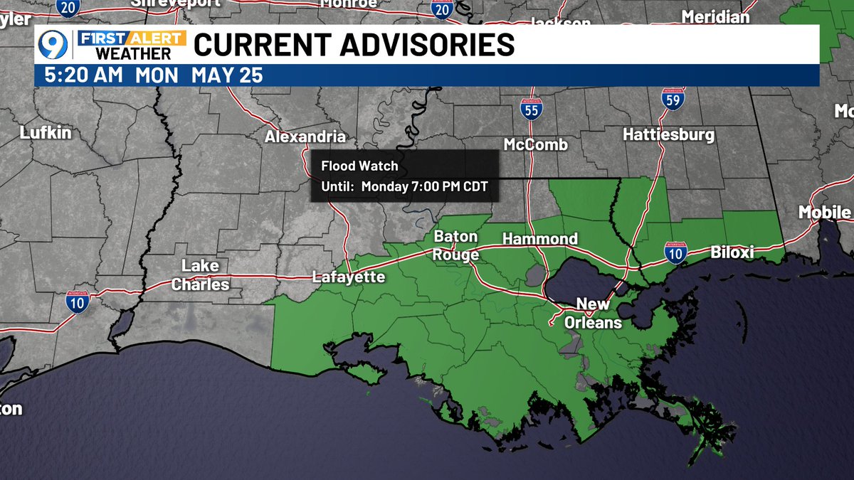
Here's a look at Memorial Day....Flood Watch remains in effect through 7PM Monday evening for rain. The HRRR model shows the timing of rain/storms, a slightly higher chance in the afternoon. There will be a better chance of wet weather east of Baton Rouge, up the I-55 corridor.
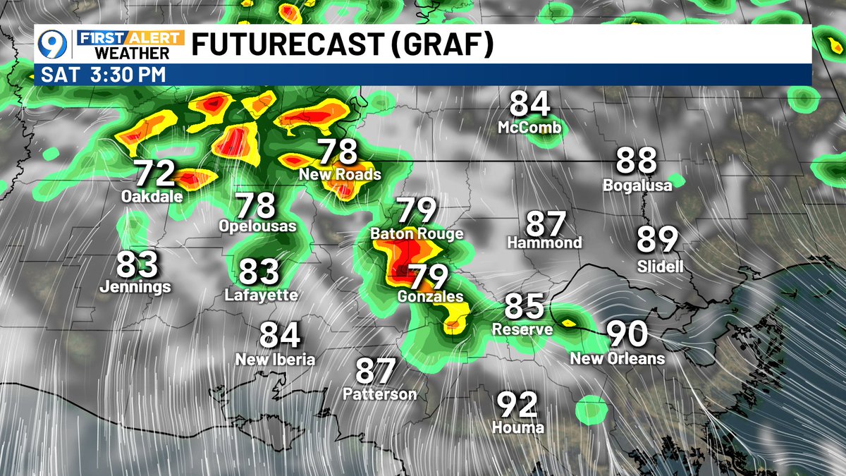
TGIF! Friday is trending a bit drier (yay) with a 40%-50% chance of afternoon showers/storms, but don't put away the rain gear. Live After Five should be able to happen tonight. GRAF shows the timing of showers later today and Saturday. Sunday and Memorial Day both look wet.